Tropical depression likely to turn into storm, bring rains to the north

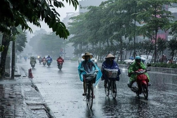
A tropical depression is expected to travel into the East Sea region and develop into a storm on Wednesday and Thursday. Photo courtesy of the National Centre for Hydro-meteorological Forecasting
The tropical depression is currently near the eastern central coast of the Philippines. Its eye is located about 800km east and southeast Luzon Island (Philippines) with wind speeds hitting 39km per hour, ranking at level six out of 12.
In the next 24 hours, the depression is predicted to move quickly in the west-northwest direction at a speed of 25-30km per hour and is likely to turn into a storm.
By the evening, the tropical depression’s eye is forecasted to be on the east coast of Luzon Island with the wind speed at level seven (50km to 61km per hour) according to National Centre for Hydro-meteorological Forecasting.
By Thursday evening, the eye is likely to be about 530km east of the Hoàng Sa (Paracel) archipelago with the wind speed at level seven.
Shortly after, the tropical depression will move at a reduced speed of 20km per hour and is likely to develop into a storm.
The storm’s eye is forecasted to sit in the sea of the Hoàng Sa archipelago with the wind speeds at level eight (62 to 74km per hour).
The National Centre for Hydro-meteorological Forecasting warned that due to the impact of the tropical depression, localities from the northern region to the central province of Thanh Hóa, especially highland areas, will have showers and thunderstorms. Heavy rains will occur in the northeast and northern mountainous regions from August 28 to 30.
In addition, the southwest monsoon continues to operate strongly, so the southern seas are experiencing wind speeds at levels six to seven.
The Tây Nguyên (Central Highlands) and the southern regions will likely receive heavy rain and lightning storms in the coming days.
The Central Steering Committee for Disaster Prevention and Control has urgently requested localities to closely monitor weather changes during the National Day holidays (September 2-3) to take proactive steps to keep people safe.
Measures should focus on ensuring safety for people and property in high-risk areas, especially for boats, resorts, amusement parks and entertainment areas on the coast and islands.
With the lessons learned from the strong southwest monsoon on August 3, authorities need to review protection plans for sea dikes and coastal residential areas
VNF ( VNS )


Most read


Recommended
 National
Vietnam News Today (Apr. 25): Vietnam Emerges As Fastest Growing Digital Economy in ASEAN
 National
ASEAN's Robust Youth - The Key to the Region's Future Success
 Focus
Focus
Foreign Minister Highlights Significance of Geneva Accords
 National
Deputy Prime Minister Tran Luu Quang's Visit to Cuba And Venezuela Deepens Relations
Popular article
 National
Vietnam News Today (Apr. 24): Vietnamese And Chinese Localities Seek Stronger Cooperation
 National
Dien Bien Phu Victory - A Proud Example of Vietnam's Military Might
 National
Vietnam News Today (Apr. 23): HCM City Travel Firms Gear Up For Summer Peak
 National