Eleven Biosphere Reserves in Vietnam Recognised by UNESCO
1. Can Gio Mangrove Biosphere Reserve
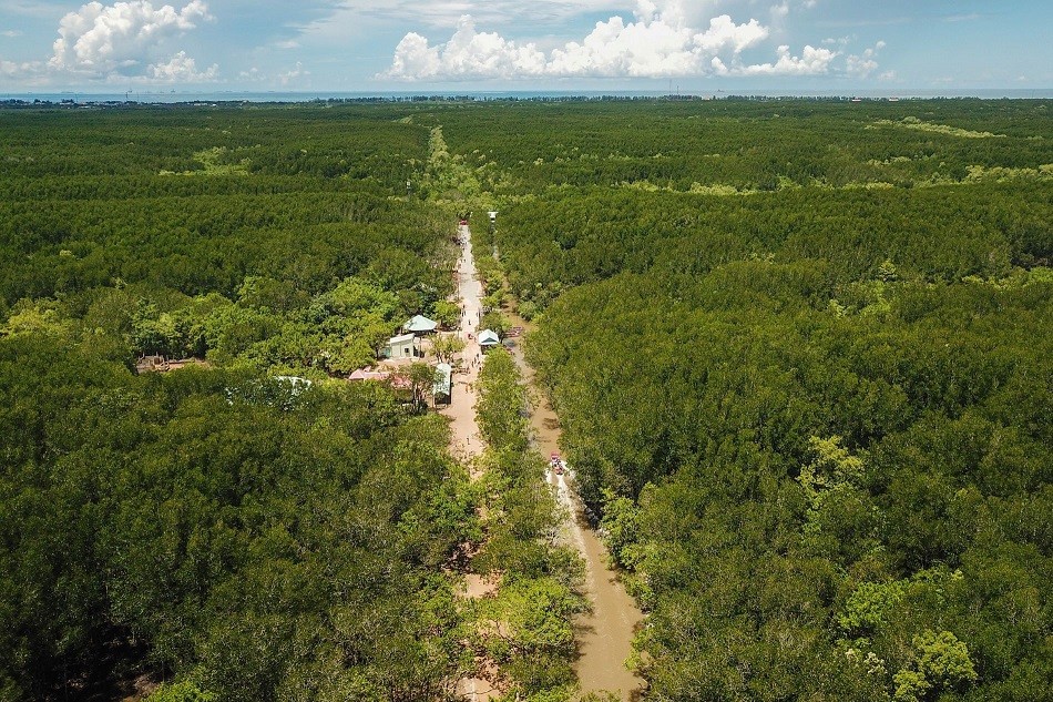 |
Can Gio Mangrove Forest. Photo: VnExpress |
The Can Gio Mangrove Biosphere Reserve is located in the coastal district southeast of Ho Chi Minh City. The reserve provides opportunities to advance environmental protection across a continuum of habitats, ranging from coastal areas to the boundaries of Ho Chi Minh City, the biggest industrial city in Viet Nam. The mangrove forest hosts the highest diversity of mangrove plant species, mangrove-dwelling invertebrates and mangrove-associated fish and shellfish species in the sub-region, and is regarded as the ‘green lungs’ of the city.
Designation date: 2000
Ecosystem-based network: Tropical Forest and Mangroves
Surface : 75,740 ha
- Core area(s): 4,721 ha
- Buffer zone(s): 41,139 ha (terrestrial: 37,339 ha; marine: 3,800 ha)
- Transition zone(s): 29,880 ha (terrestrial: 29,310 ha; marine: 570 ha)
Location: 10°31’12”N – 106°53’35”E
Ecological Characteristics
The Can Gio mangrove forest grew out of a comparatively recent brackish swamp with soil foundations created by the Saigon and Dong Nai Rivers. The development of the mangrove forest is dependent on high precipitation and a high density of rivers interweaving the area, which provide a rich and plentiful supply of alluvium in the estuarine regions. The soil formed in Can Gio has been created by a combination of clay alluvial depositions, vitriolic processes and a brackish water table.
Can Gio encompasses diverse habitats including mangroves, wetlands, salt marshes, mud flats and sea grasses. The ecosystem functions as the ‘green lungs’ of Ho Chi Minh City absorbing carbon dioxide and other polluting agents on a daily basis.
The mangroves contain a high diversity of floral and faunal species. These include mangrove species such as Rhizophora apiculate, Thespesia populnea and Acanthus ebracteatus. A high number of faunal species appear in the biosphere reserve including king cobra (Ophiophagus Hannah), saltwater crocodile (Crocodilus porosus), spot-billed pelican (Pelecanus philippensis) and fishing cat (Felis viverrina).
Socio-Economic Characteristics
There are no communities living in the core area and buffer zone with the exception of forest protectors and their households, forestry staff and a few fishermen who operate traditional shrimp-trappers in some canals within the mangrove forest. A permanent population of almost 70,000 inhabitants lives in the transition zone of the biosphere reserve. These include groups of non-indigenous local people, the majority of whom are Vietnamese. Minorities located in the reserve include Chinese and Khmer communities living together in concentrated communes and towns in the transition zone.
The main economic activities are agriculture, aquaculture, fishing, salt-pan, trading and tourism. Revolutionary forces made active use of the region during the wars against France and the United States of America in the nineteenth and twentieth centuries.
2. Dong Nai Biosphere Reserve
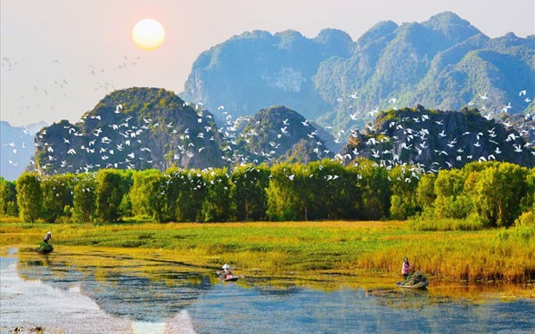 |
| Dong Nai Biosphere Reserve. Photo: Quehuongonline |
Dong Nai is the new name of the former Cat Tien Biosphere Reserve, which was designated in 2001. It is located in the Dong Nai province in the south-east of Viet Nam. In this region the plateaux of the central Vietnamese highlands give way to the Nam Bo Delta. The area includes typical landforms of the Truong Son Mountain range and the lowland rivers, streams, semi-plains, medium hills, relatively flat lands and scattered lakes, ponds and wetlands of the eastern Nam Bo Delta.
Designation date: 2001
Ecosystem-based network: Tropical Forest and Wetlands
Surface : 969,781 ha
- Core area(s): 172,223 ha
- Buffer zone(s): 346,844 ha
- Transition zone(s): 450,714 ha
Location: 11°35’35”N – 107°22’12”E
Ecological Characteristics
The Cat Tien tropical forest ecosystem forms part of the Indo-Pacific Biogeographical Region. Typical forest types include evergreen broad leaves forest, bamboo forest and other mixed forest. Cat Tien National Park provides protection for this continuous mosaic of forests. Within the park there is great variation in topography from steep hill areas in the north to large lowland areas, wetlands, riverine areas and cultivated fields in the south.
The area has been able to retain much of its original diversity due to the survival of areas of unmodified habitat and the suppression of hunting and other forms of disturbance. There are seven different habitat types and a total of 1,610 botanical species on five geographical landscapes. Of the known species 31 are listed as rare and 23 are endemic to Cat Tien.
The forest types and geographical sites function as habitats for the unique tropical fauna which include 6,085 species of mammals, 259 bird species, 64 reptile species, 33 amphibian species and 99 fish species. These include endangered species such as white-shouldered ibis (Pseudibis davisoni), Indochinese tiger (Panthera tigris corbetti), Asian elephant (Elephas maximus) and the critically endangered Javan Rhinoceros (Rhinoceros sondaicus annamiticus), one of the world’s rarest large mammals.
Socio-Economic Characteristics
There are 11 different ethnic groups living within the biosphere reserve. They can be divided into three main groups, which have different histories in the area and differ in land use strategies. These groups include recently migrated minorities from Northern provinces (such as Tay, Nung, Dao and H’mong), the Kinh or lowland Vietnamese, and the S’Tieng, Chau Ma and Chau Ro indigenous ethnic minorities that have lived in the region for several centuries.
Agriculture is the key production sector accounting for the livelihoods of about 90% to 95% of local people. Other main economic activities include tourism, aquaculture and fishing.
3. Cat Ba Biosphere Reserve
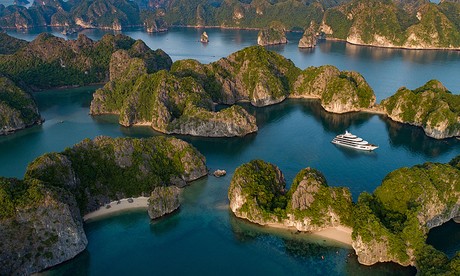 |
| Cat Ba Biosphere Reserve. Photo: VnExpress |
Cat Ba Biosphere Reserve is an archipelago located in northern Viet Nam adjacent to the Ha Long Bay World Heritage site. It is internationally renowned for its limestone karst geomorphology and provides one of the best examples in the world of a fengcong and fenglin karst landscape invaded by the sea. The 366 limestone islands include landforms, caves and cave deposits that provide evidence of a long history of erosion and landscape evolution.
Designation date: 2004
Ecosystem-based network: Tropical Forest and Marine, Coastal & Island Area
Surface : 26,241 ha
- Core area(s): 8,500 ha (terrestrial: 6,500 ha; marine: 2,000 ha)
- Buffer zone(s): 7,741 ha (terrestrial: 4,941 ha; marine: 2,800 ha)
- Transition zone(s): 10,000 ha (terrestrial: 5,600 ha; marine: 4,400 ha)
Location: 20°47’42”N – 107°00’38”E
Ecological Characteristics
The Cat Ba Biosphere Reserve is considered part of the Indochinese rainforest biogeographical province. It includes tropical humid forests, wetlands, mangroves and coral reef ecosystem types. The northern coastal region of Viet Nam has a humid, tropical monsoon climate with distinct wet and dry seasons. The area suffers from a high frequency of typhoons with 28% of all typhoons impacting the Vietnamese coastline appearing in this area.
There are 2,026 species found in the biosphere reserve including 199 phytoplankton, 89 zooplankton, 75 forms of seaweed, 23 types of mangrove, 160 corals, 475 zoobenthonic organisms, 119 fish, three seagrasses, 142 species of terrestrial fauna and 741 plants.
Many species are endemic and rare, the most significant being the globally important Golden-headed langur (Trachypithecus poliocephalus), restricted in range to Cat Ba Island, the largest of the 366 islands, and found nowhere else in the world.
The Hawksbill turtle (Eretmochelys imbricata) found in the Cat Ba region is inscribed on the IUCN Red List, while the seahorse (Hippocampus spp.) is also rare and threatened. Mangroves and seagrasses on Cat Ba function as nurseries for life in the bay and as protective buffers for local inhabitants from storm surges and typhoons driven by climate change and sea level rise.
Socio-Economic Characteristics
Cat Ba Island and its marine waters have a long history of human utilization for subsistence and cash crop agriculture, fishing, aquaculture and mariculture. Based on the evidence of archaeological remains, people have inhabited the Cat Ba area for at least 6,000 years ago. Two ethnic groups currently live in the area: the Kinh and Chinese-born Vietnamese. These ethnic groups are intermingled and not separated into different areas or communities.
The main economic activities are agriculture, fishing and hunting, with tourism also functioning as a key industry. The biosphere reserve has 42 archaeological sites containing prehistoric relics with traces from the Pleistocene era. Cultural artefacts and monuments on the island of Cat Ba include the remains of the temples Cac Ba and Cac Ong, while ancient citadels of the Mac dynasty are found on Xuan Dam. A number of festivals are celebrated including the dragon-shaped boat race, the Sea God ceremony and several fishery festivals all of which constitute popular tourist attractions.
4. Red River Delta Biosphere Reserve
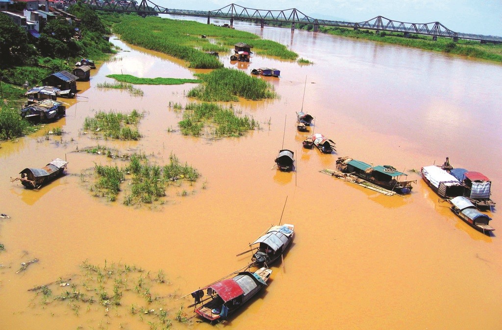 |
| Red River Delta Region. Photo: Lotussia Travel |
The Red River Delta Biosphere Reserve is located in the coastal region of northern Viet Nam. Mangroves and intertidal habitats of the Red River Delta form wetlands of high biodiversity, especially in the Xuan Thuy and Tien Hai districts. These wetlands are of global importance as migratory sites for several bird species.
Designation date: 2004
Ecosystem-based network: Tropical Forest, Marine, Coastal & Island Areas and Mangroves
Surface : 137,261 ha
- Core area(s): 14,842 ha (terrestrial: 6,278 ha; marine: 8,564 ha)
- Buffer zone(s): 36,951 ha (terrestrial: 18,457 ha; marine: 18,494 ha)
- Transition zone(s): 85,468 ha (terrestrial: 35,447 ha; marine: 50,021 ha)
Location: 20°32’11”N – 106°34’48”E
Ecological Characteristics
The Red River basin is shared by China, Laos and Viet Nam. The main Red River is approximately 1,140 km in length and covers over 500 km in Viet Nam. The coastal areas of the Red River Delta support a complex system of natural, semi-natural and agricultural vegetation types. The natural vegetation consists mainly of salt tolerant species and plant communities, including mangrove, salt marsh and dune vegetation.
The mangrove ecosystem comprises the mangrove forest and the adjacent intertidal area, which represent a transitional zone between the marine and terrestrial environments. There are 26 mangrove species found in the coastal zones of which the most dominant are Kandelia candel and Sonneratia caseolaris.
During spring and autumn migrations, huge numbers of birds stop on route from their breeding grounds in northern Asia to their wintering sites in the Indo-Malaysian and Australian regions. A total of 78 species of water birds have been recorded in the Red River Delta including 38 species of shorebirds. Eleven of these birds fall under the category of threatened or near-threatened species, including spoonbill sandpiper (Calidris pygmaea), black-headed ibis (Threskiornis melanocephalus) and Japanese paradise flycatcher (Terpsiphone atrocaudata).
Other animal species found in the reserve include the saltwater crocodile (Crocodylus porosus) and the seacow or Dugong (Dugong dugon).
In recognition of the fundamental ecological functions performed by its wetlands, Xuan Thuy was declared the first Vietnamese Ramsar Site in 1982.
Socio-Economic Characteristics
The Red River Delta consists of several ethnic groups resulting in a diverse culture. Families inhabiting the forest generally have two houses, one in the forest and one in town. The main economic activities are agriculture and fishery.
There are five large clans in the area. Each clan has several houses of worship dedicated to its founder-ancestors and large branches of a clan may build separate houses of worship of their own. There are 29 such houses of worship overall. The annual clan celebration gathers together the members of each clan and helps to strengthen relations and foster communal bonds.
5. Kien Giang Biosphere Reserve, Vietnam
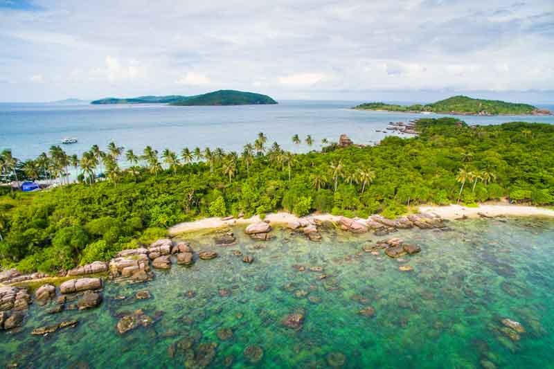 |
| Phu Quoc Island. Photo: Fahthaimag |
The Kien Giang Biosphere Reserve is located on the southwestern tip of Viet Nam. It comprises 105 islands the biggest of which is Phu Quoc Island. The reserve has a maritime equatorial and monsoon climate. In shallow waters there is a high abundance of coral reefs. The island beaches were formerly nesting sites of Hawksbill (Eretchmochelis imbricate) and Green turtles (Chelonia mydas) but no nesting has taken place in recent years.
The waters around the islands are considered some of the best fishing grounds in the southwestern region of Viet Nam of which the most important resources are squid and cuttlefish.
Designation date: 2006
Ecosystem-based network: Marine, Coastal & Island Areas and Mangroves
Surface : 1,188,105 ha
- Core area(s): 25,899 ha (terrestrial: 12,037 ha; marine: 13,862 ha)
- Buffer zone(s): 172,578 ha (terrestrial: 116,791 ha; marine: 55,787 ha)
- Transition zone(s): 978,591 ha (terrestrial: 189,439 ha; marine: 789,152 ha)
Location: 09°57’54”N – 104°32’03”E
Ecological Characteristics
The biosphere reserve has three core zones overlapping with three National Parks and one nature reserve. These contain parts of the Mekong River basin, Phu Quoc Island and several protected marine areas, some of which host coral reefs.
The reserve contains various tropical forest ecosystems including primary and secondary forests with dominant Dipterocarpaceae families, Limestone and Karst forests with dominant species of Trestonia mergvensis andDacrydium pierrei, seasonally flooded forest (Melaleuca cajuputi), mangrove ecosystems (Rhizophora, Aegiceras, Bruguiera and Avicennia genuses, especially Lumnitzera rosea), coastal mudflats and lakes, coral reef and seagrass ecosystems.
There are 89 hard coral species, 19 soft corals, 125 coral reef fishes, 132 mollusks, 32 echinoderms and 62 seaweed species.
The seagrass beds are important for foraging marine turtles, a population of globally threatened dugong (Dugong dugon), the scaly clam (Tridacna squamosal), Trochus Shell (Trochus nilotichu) and the critically endangered hawksbill turtle (Eretmochelys imbricate) and green turtle (Chelonia mydas).
Socio-Economic Characteristics
Kien Giang is recognized as an area of very rich marine resources which play an important role in the livelihoods of local people and the provincial and district economy. Fishery production ranks top among all provinces in Viet Nam. Agriculture is another key economic activity, followed by tourism, which has increased strongly in recent years.
The three main ethnic groups in the region are the Kinh, Kh’me and Hoa. The area is home to several famous historical monuments, including the temple of the hero Nguyen Trung Truc and Mac Cuu tomb.
6. Western Nghe An Biosphere Reserve
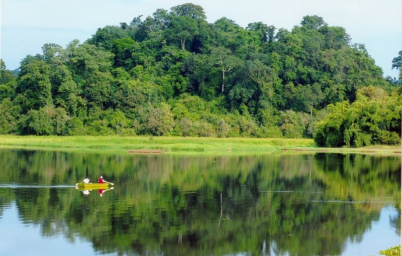 |
| Pu Mat National Park. Photo: Thuenhadulich |
The Western Nghe An Biosphere Reserve is located in central Viet Nam in mountainous and remote area which is difficult to access. Its climate is strongly influenced by a north-east and south-west monsoon. The topography of the surrounding Annamite mountain range also impacts atmospheric circulation, resulting in significant climatic differences throughout the area. The region hosts some of the most diverse and rich flora and fauna in Viet Nam.
Designation date: 2007
Ecosystem-based network: Tropical Forest and Wetlands
Surface : 1,303,285 ha
- Core area(s): 191,922 ha
- Buffer zone(s): 503,270 ha
- Transition zone(s): 608,093 ha
Location: 19°15’46”N – 104°40’50”E
Ecological Characteristics
The biosphere reserve has three core areas including one national park and two nature reserves, covering almost of types of tropical rainforest and various habitats including mountain, wetlands, rivers and others.
An area of primary forest is located along the border with Laos. Recently, around 2,500 species of vegetation have been reported, with around 2,000 species (74%) belonging to the category of Phanerophytes.
There are, at present, 130 species of large and small mammals, including 295 bird species, 54 species of amphibians and reptiles, 84 species of fish and 39 species of bats found only in Viet Nam and north-east Thailand.
In addition, there are 14 species of tortoises, 305 species of butterflies and thousands of species of other insects, including 68 valuable and rare species recorded in the Red Book of Viet Nam.
There are 295 species of birds including local and migratory birds and 22 species considered to be globally threatened and endangered. Two populations are of global significance, including the crested argus (Rheinardia ocellata) and great hornbill (Buceros bicornis), the rufous-necked hornbill (Aceros nipalensis), while the lesser fish eagle (Ichthyophaga humilis) is of national significance.
The reserve is also home to the Gong culture of the Central Highlands of Viet Nam, which is inscribed on the list of UNESCO Intangible Cultural Heritage.
Socio-Economic Characteristics
The majority of the inhabitants in the area belong to the Thaï ethnic group. Other ethnic groups include the Kho Mu, Kinh, O Du and H’Mong. The O Du population has inhabited the area since the tenth century but its numbers have dwindled. As of 2007, only 563 O Du people remained, living in poor conditions.
The main economic activities in the area are agriculture, cattle grazing, fishery, weaving and woodwork. In 2006, the Vietnamese government began construction of the Ban Ve hydroelectric plant in the area. The plant was built on the Nam Non River and covers a water surface area of 4,500 ha delivering up to 75.5 MW.
7. Mui Ca Mau Biosphere Reserve
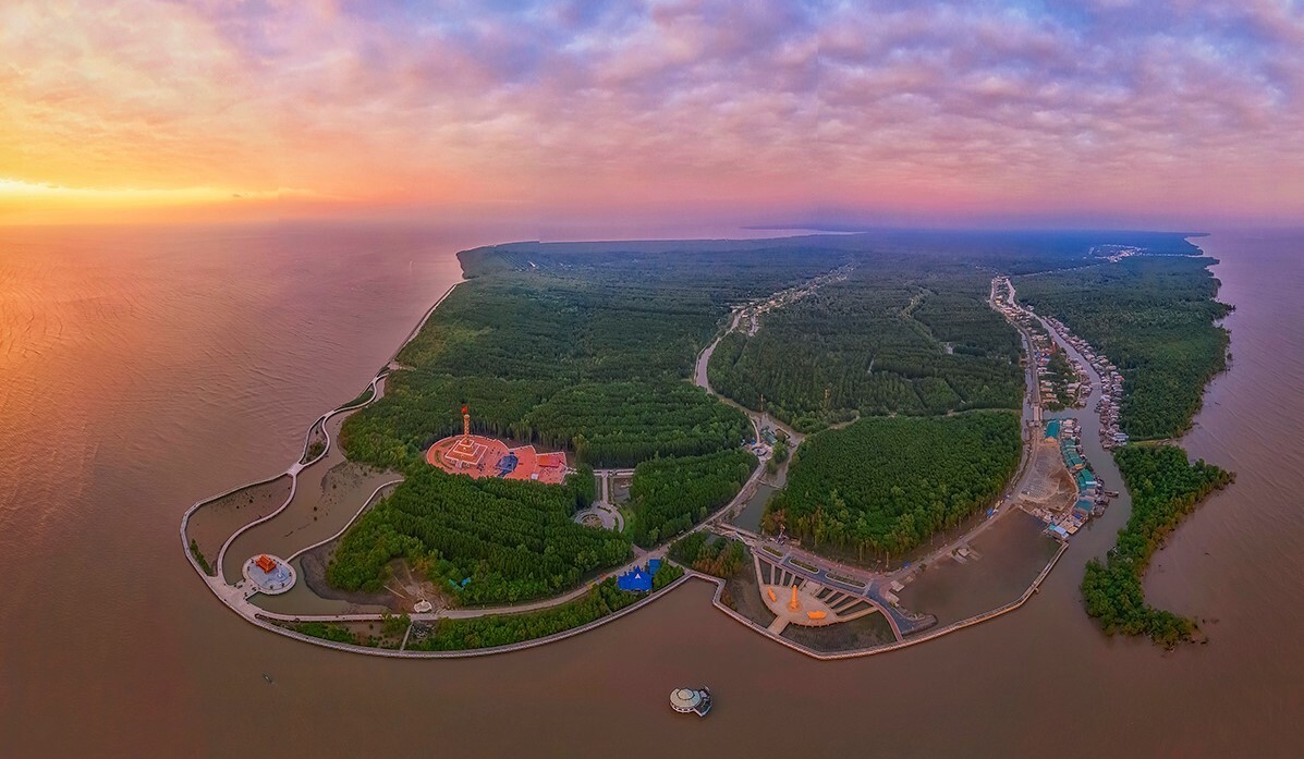 |
Mui Ca Mau Biosphere Reserve. Photo: VnExpress |
The Mui Ca Mau Biosphere Reserve is located in the southernmost tip of Viet Nam. It borders the East Sea to the east and the Gulf of Thailand to the south and the west. The area boasts beautiful land and seascapes and a high biodiversity of marine areas and peat swamp wetlands. The reserve also constitutes a transition area (ecotone) between mangrove and Melaleuca forests, which heightens its conservation value, and serves as a reproduction and breeding area for aquatic species.
Designation date: 2009
Ecosystem-based network: Tropical Forest and Wetlands
Surface : 371,506 ha
- Core area(s): 17,329 ha (terrestrial: 14,773 ha; marine: 2,556 ha)
- Buffer zone(s): 43,309 ha (terrestrial: 8,775 ha; marine: 34,534 ha)
- Transition zone(s): 310,868 ha (terrestrial: 94,688 ha; marine: 216,180 ha)
Location: 08°55’54”N – 104°48’43”E
Ecological Characteristics
The area is linked to many rivers and waterways leading to the Pacific Ocean and the Gulf of Thailand. These rivers receive alluvium from Cuu Long River, deposited mostly on the northwest side by sea currents, where it accumulates creating foundations for the development of mangrove forests.
The Mui Ca Mau Biosphere Reserve hosts a rich and varied biodiversity resulting from three types of ecosystem: marine, mangrove and a closed tropical rainforest ecosystem. Characteristic species include Bui (Ilex cymosa), Mop (Alstonia spathulata), Melaleuca forest (Melaleuca cajeputi), three-leave Dau dau (Euodia lepta) and Tram (Syzygium cinereum).
Due to its rich biodiversity many different species can be found in the area. These include the lesser short-nosed fruit bat (Cynopterus brachyotis), crab-eating macaque (Macaca fascicularis), lesser adjutant (Leptoptilos javanicus), painted stork (Mycteria leucocephala) and spot-billed pelican (Pelacanus philippinensis).
Socio-Economic Characteristics
About 20 ethnic groups inhabit the area the majority of which belong to the Kinh (more than 95%). Other groups include the Khmer and Hoa-Chinese. Major economic activities are agriculture, aquaculture, fishery and tourism.
Over 40 relics have been found in the Mui Ca Mau area. Several of these have become tourist attractions including the Quan Am Co Tu and Hung Quang pagodas and the Tan Hung temple. Another attraction is the Ca Mau floating market, situated in the middle of Ca Mau city on the Ganh Hao River. Hundreds of boats sell and buy fresh agricultural products daily from across the region at this crowded market.
8. Cu Lao Cham - Hoi An Biosphere Reserve
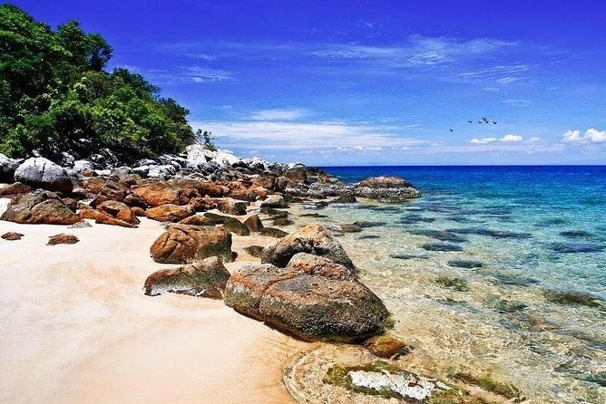 |
| Cu Lao Cham. Photo: Viator |
The Cu Lao Cham-Hoi An Biosphere Reserve is located in the central part of Viet Nam and consists of two core areas: the World Cultural Heritage Site of Hoi An and the Cu Lao Cham archipelago. The archipelago is renowned for its marine species including corals, mollusks, crustaceans and seaweed. The islands contain mountainous areas and rainforest ecosystems strongly influenced by seasonal monsoons. The Cultural World Heritage Site of Hoi An is an ancient trading port bearing witness to the fusion of Vietnamese and European cultures.
Designation date: 2009
Ecosystem-based network: Tropical Forest and Marine, Coastal and Island Areas
Surface : 33,146 ha
- Core area(s): 2,471 ha (terrestrial: 257 ha; marine: 2,214)
- Buffer zone(s): 8,455 ha (terrestrial: 2,410 ha; marine: 6,045 ha)
- Transition zone(s): 22,220 ha (terrestrial: 3,523 ha; marine: 18,697 ha)
Location: 15°15’20”N – 108°23’10”E
Ecological Characteristics
Topographical formations of maritime-marsh origin lie to the east of the township of Hoi An in the villages of Cam Chau, Cam An and Cam Thanh, and stretch along the coast south of the Thu Bon River running past Trung Phuong (Duy Xuyen district). The most typical are deposits found at Cam Chau, which reach a maximum height of 0.8–1.2 m and comprise black, muddy sediment indicating the presence of organic matter. These deposits provide evidence of ancient seas which receded leaving behind swamps and marshes that gradually filled up. They are approximately 2,000 years old.
There are two core areas where long-term conservation focuses on preserving land/seascape diversity with a view to conserving ecosystems, habitats, species and genetic resources intact, and preventing disturbance by human populations. The corridor between the two core areas is considered the ecological buffer zone and transition area linking the river mouth (Cua Dai) and the archipelago. This zone contributes substantially to the recovery of marine ecosystems in the area.
The area boasts a very rich biodiversity. According to research, there are 947 kinds of creatures living around the marine area of the islets, including 178 species of fish, 122 species of seaweed, 134 species of coral, 144 species of shellfish, 25 species of crustacean and many other marine species. Characteristic fish species include the coral grouper (Epinephelus coralicola), bumphead parrotfish (Bolbometopon muricatum), angelfishes (Pomacanthidae) and the endangered humphead wrasse (Cheilinus undulates).
Socio-Economic Characteristics
Approximately 84,000 people live in the area. Fishery is the main economic activity but tourism is regarded as a sector with strong economic potential.
During the sixteenth and seventeenth centuries, Hoi An was a meeting place for migrants from different parts of Viet Nam and people from other countries, especially Japan and China. Christoforo Borri’s memoirs and other documents of the time make clear that early seventeenth century Hoi An contained Japanese and Chinese districts, each with its own governor and regulations. Later on the Dutch East Indies Company established a trading post in the township.
9. Langbiang Biosphere Reserve, Vietnam
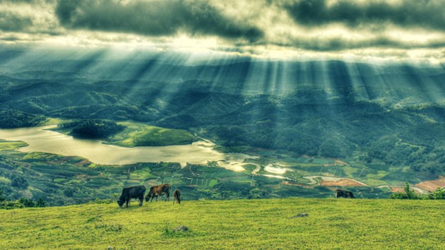 |
| Langbiang. Photo: Minh Quan |
The Langbiang Biosphere Reserve is located in Lam Dong Province. Regional biodiversity is high and includes many endangered species found on International Red Lists. The core area contains a biodiversity corridor that maintains the integrity of 14 tropical ecosystems in the east of southern Viet Nam and across Viet Nam in general. It also functions as the habitat of numerous wildlife species, including several species classified as rare and endangered, such as the sun bear (Helarctos malayanus).
Agriculture, forestry and fishery are the main sources of employment for local communities. Among the cultivated crops, flowers, coffee and tea are the strongest in terms of regional generation of revenue.
Designation date: 2015
Ecosystem-based network: Tropical Forest
Surface : 275,439 ha
- Core area(s): 34,943 ha
- Buffer zone(s): 72,232 ha
- Transition zone(s): 168,264 ha
Location: 12°01’02”N – 108°27’33”E
Ecological Characteristics
The reserve is located in the northern part of Lam Dong Province in the Central Highlands of Viet Nam. It is one of four national biodiversity centres. The altitude ranges from 650 metres to nearly 2,300 metres with several different forest systems, including middle-mountain evergreen, coniferous broad-leaved mixed forest, primeval forests, high-mountain dwarf forest, mossy forest, bamboo and savannah. The reserve also contains precious trees dating 1,000 years, which are presently ebeing researched by members of the Tree Ring Lab at the Lamont-Doherty Earth Observatory of Columbia University, New York.
The reserve is characterized by rich diversity in vegetation, including Krempf’s pine (Pinus krempfii) forest ecosystems and dwarf forest on hilly topography distributed over 60% of the total forest area. The reserve also includes a total of 1,940 plant species belonging to 825 genera and 180 families, of which 64 are listed in the Viet Nam Red Data Book and 34 are of high conservation value. Plant species play an important role in conservation and pharmaceutical use. They also, include two critical endangered species – Agarwood (Aquilaria crassna) and the spotted orchid (Gastrochilus calceolaris) – and three globally endangered species – dong nai mango (Mangifera dongnaiensis), white meranti (Shorea roxburghii) and Cinnamomum balansae.
Overall, 89 species of mammals, 247 species of birds, 46 species of reptiles, 46 species of amphibians, 30 species of fish and 335 species of insects have been recorded within the reserve. These include five globally critical endangered species: the Indochinese tiger (Panthera tigris corbetti), black-shanked douc (Pygathrix nigripes), yellow-cheeked gibbon (Nomascus gabriellae), Indian bison (Bos gaurus) and Indochinese silvered leaf monkey (Trachypithecus margarita). The sun bear (Helarctos malayanus) and clouded leopard (Neofelis nebulosi) are classified as rare, endangered species and are recorded in the Vietnamese Red Data Book.
The reserve is also home to the Gong culture of the Central Highlands of Viet Nam, which is inscribed on the list of UNESCO Intangible Cultural Heritage.
Socio-Economic Characteristics
At the end of 2011, the population of the reserve amounted to approximately 570,000 inhabitants, spread over six localities, most of which lived in the city of Da Lat. The main group are the Kinh followed by other ethnic communities including the K’Ho, Tay, Nung and Cham. The employment rate is highest in the tourism, agriculture, forestry and fishery sectors. Among the cultivated crops, flowers, coffee and tea produced the strongest revenue generation in the region.
Scientists and archaeologists have found a large number of archaeological relics during recent excavations in the area. These include Palaeolithic relics found at Dau Voi Stream, Nui Voi, the P’ro Commune and the burial site at Da Don Commune. Also of note is the Gong culture, of the Central Highlands of Viet Nam. The gongs represent the voices of the spirit and the human soul and are used to express happiness, sadness and other emotions during work and daily activities.
10. Nui Chua Biosphere Reserve
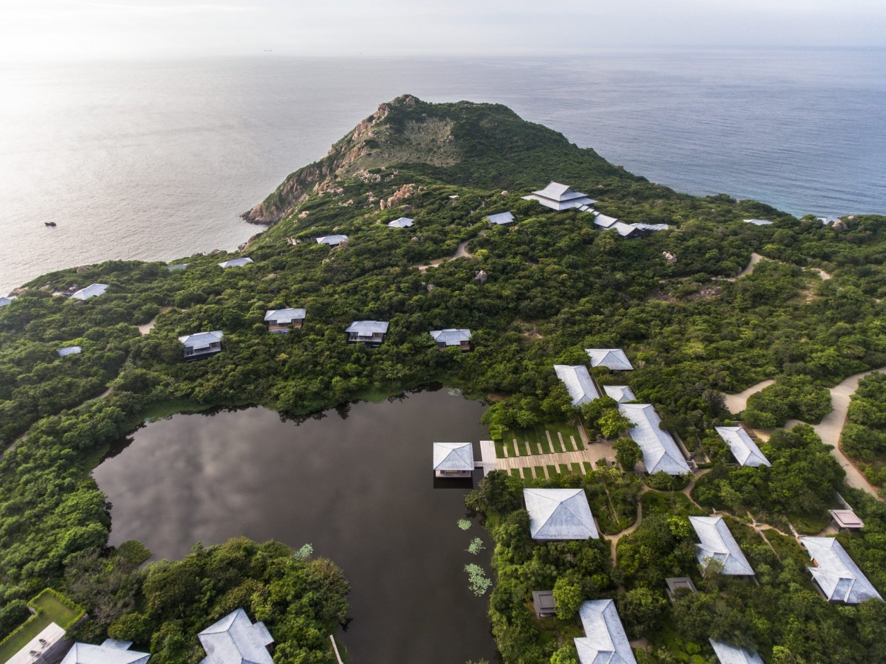 |
Amanoi Resort inside Nui Chua National Park. Photo: VnExpress |
Designation date: 2021
Surface : 106.646,45 ha
Ecological Characteristics
The Nui Chua Biosphere Reserve encompasses the terrestrial and marine areas of Ninh Thuan Province and is located at the end of the Truong Son Mountain Range where the climate is harsh with sunny, hot and arid weather and minimal rainfall. The biosphere reserve is a representative area in terms of biodiversity with a rich and diverse mosaic of ecosystems characteristic of the south-central region of Viet Nam, including unique semi-arid vegetation, sea turtle nesting beaches and coral reefs.
Nui Chua National Park has 1504 vascular plant species. In terms of fauna, it currently has 306 species of animal, of which 64 are rare and conserved species. There are several species such as Red-shanked Douc Langur (P. nemaeus) was listed in the Red List of IUCN as Endangered Asian colobine monkey. The coastal reefs are in relatively good condition, including 310 species. In addition, Nui Chua National Park is one of the rare inland spawning beaches for sea turtle, according to an article (Hoang et al., 2021).
Socio-Economic Characteristics
A total population of 447,162 people live in the site including the main ethnic groups of Kinh, Cham, Raglai, Hoa, Tay, Nung and Muong, all of whom have diverse cultures, artistic, religious and architectural traditions as well as numerous rituals and large festivals.
11. Kon ha Nung Biosphere Reserve
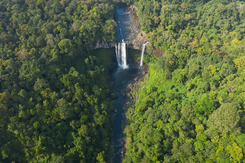 |
Hang En Waterfall inside Kon Ha Nung Biosphere Reserve. Photo: VnExpress |
Designation date: 2021
Surface : 413,511.67 ha
Ecological Characteristics
Kon ha Nung is located in the highlands of Central Viet Nam, the so called ‘Roof of Indochina’, the highest peak of which reaches over 1,700m is home to 267,493 inhabitants. The biosphere reserve is also home to rare species such as the Gray-shanked douc (Pygathrix cinerea) a rare and endemic primate species of Viet Nam, classified as critically endangered, with only about 1,000 individuals in the wild.
Socio-Economic Characteristics
The biosphere reserve is managed in line with the traditional knowledge of local communities including Indigenous and folk knowledge about production and social organization. The Gia Lai Province People’s Committee formulates policies concerning land and forest allocations to households, payment for forest ecosystem services and the development of sustainable ecotourism. The buffer zone of the reserve is home to 17 families of the Ba Na ethnic minority whose livelihood mainly depends on livestock and forest resources, according to VnExpress.
Recommended
 Viet's Home
Vietnamese Peacekeepers in Abyei Respond to World Environment Day
 Viet's Home
Can Tho Awards 500 Scholarships to Workers’ Children
 Viet's Home
Traditional Martial Arts Exchange between Sinh village (Hue City) and Katsuragi City (Japan)
 Viet's Home
Lai Chau National Assembly, People's Council Delegates Hold Dialogue with Children
 Viet's Home
24 Children with Disabilities in Northern Provinces Received Free Surgery
 Viet's Home
World Vision Promotes Comprehensive Nutritional Care for Vietnamese Children
 Viet's Home
Hanoi, South Africa Strengthens People-to-people Exchanges, Expands Multi-sector Cooperation
 Viet's Home


