Vietnam-Laos border before France invading Indochina
| Vietnam - Laos Boundary in 1945 - 1975 | |
| Lao Ambassador exalts Vietnam’s contributions to ASEAN, especially amid pandemic | |
| Vietnam-Laos sport exchange programme held in Vientiane |


Although the two countries experience different signs of progress of national establishment, both share the same high mountain ranges from Phu Xoc Sau to Truong Son. As a result, the border between the two countries was basically formed according to the actual situation and has been recognized and respected by both localities and peoples. However, the border also witnesses some fluctuation.
As early as the XIV century, The Kingdom of Lang Xan was founded and developed in the west of Vietnam. However, it was in decline. In 1770, the prosperous Siamese conquered all the land in the right bank of Lang Xan’s Mekong River which was then merged with Siam (including 13 muangs Laos, namely Nong Khai, Na Khon, Mukdahan, Khone Khue, U Don, Bassat... that are the Northeast of present-day Thailand).
In 1828, Siam continued to strike Lang Xan the second time and occupied Vientiane in 1829. Not until the XIV century was the Kingdom of Lang Xan established by Fa Ngun demolished (except for the Kingdom of Lao Qua).
By the end of the XIX century (1880-1885), as while the court of the Nguyen dynasty was busy dealing with French colonialism, the Siamese invaded the Nam Chuong and Vietnamese lands on the left bank of the Mekong River.
After occupying Vietnam (1884) and Cao-Mienism (1868), the French government divided the newly occupied lands into countries with different political regimes to rule. In which, France divided Vietnam into three regions namely Chochin (southern Vietnam), Tonkin (northern Vietnam), and Annam (central of Vietnam), Cao-Mienism was a separated region. At the same time, realizing that the eastern land by the Mekong River that newly occupied by Siam were those of Vietnam and Cao-Mienism, France pressured Siam to return it. Under the French pressure, Siam was forced to sign the Franco-Siam treaty on October 3, 1893, returning the lands occupied from Vietnam and Ca- Mienism, including some muangs Laos in the East Mekong River to France.
 |
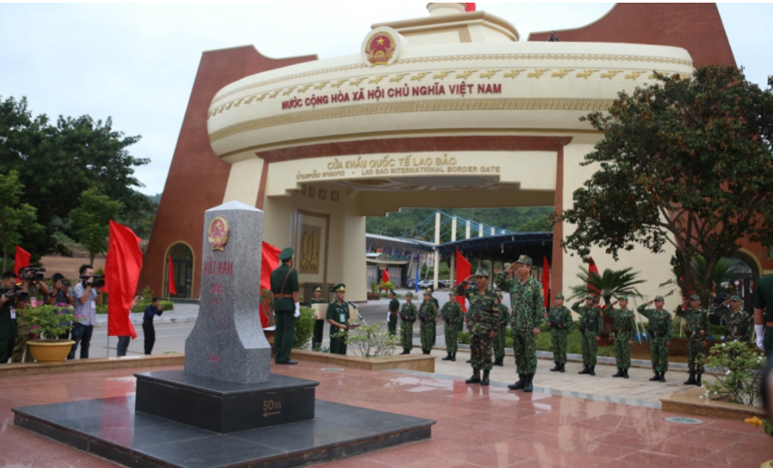
| Nam Can border gate area of Vietnam - Laos border is a complex with full services such as grocery, motel room, post office, gas station, .. for transportation. Photo: Son Pham. |
In 1893, France established two clusters namely Upper Laos and Lower Laos basing on the remainings land of the old Ai Lao, which was handed back by Siam. Upper Laos and Lower Lao clusters are two independent administrative units, each of which an army of officers was formed and directly controlled by a high-ranking commander Governors-General of French Indochina.
On September 30, 1893, the Governor-General of Indochina signed a decree to establish the Song Khon and Cam Mon groups under the management of the Hue court and the Ambassador of Annam on the basis the remaining lands of Vietnam that Siam was forced to return.
In 1895, to create the foundation for the founding of Ai Lao later, the Governor-General of Indochina decided to merge the two religions of Song Khon and Cam Mon into Quan Binh, the Lower Laos.
In 1899, the French President signed a decree to merge the two regions of Upper Laos and Lower Laos into a unified Lao administrative unit and called the Ai Lao country. Thus, Ai Lao in colonial Indochina was born on the basis of the remaining muangs Laos and the previous large land areas of Vietnam.
After the establishment of Ai Lao, from 1893 to 1905, French authorities made some adjustments to land between Ai Lao and other countries. After this period, the territory of the countries in Indochina was basically stabilized, the French authorities began to delimit the boundaries between the countries in Indochina.
For the Vietnam-Laos border, the delimitation can only be made at the boundary between Ai Lao and Annam. Specifically, on December 27, 1913, a decision was made to establish a committee in charge of demarcating the border between the Annam and Laos (from Ha Trai to the Vietnam - Laos - Cao Mien confluence), but until October 12, 1916, when the Governor-General of Indochina issued a decree fixing the border between Annam and Laos, it only clearly defined the border from Ha Trai to Thua Thien, and the southern part had not been discussed. Thus, the entire remaining part of the Vietnam-Laos border has not been demarcated by France.
Border features of Tonkin, Trung Ky and Ai Lao on French map
From 1908 to 1934, the French authorities basically completed the survey and measurement on the field to illustrate the administrative boundaries between Tonkin, Annam, and Ai Lao on the map of Indochina published by France.
According to the statistics of the Department of Surveying and Mapping, during the years between 1957 and 1963, on the Bonne map drawn on the scale of 1 / 100,000 published by the Department of Geography of Indochina (the type of map that Vietnam and Laos later used as the main ground for settling the Vietnam-Laos border), the boundary between Tonkin, Annam, and Ai Lao featured the following characteristics:
- The entire boundary was 2,095 km in total length illustrated on 48 pieces of the map. Of which, 812 km were drawn on the basis of field measurements (38.7%), the remaining 1,282.8 km were drawn on the basis of photos taken from aircraft (accounting for 61.3%). ;
- On 48 pieces of the map, there were also seven sections with the length of about 4.5 km of the boundary shown in areas without topography (blank terrain) and eight areas that have not shown boundaries.
- French maps have been reprinted many times, after each, there were corrections, as a result, the pieces of the map featured the same symbols but differed in the year of printing, and boundaries were also shown differently.
 |
| Locating 30km from Moc Chau town, Pha Luong peak was regarded as the roof of Moc Chau, between the Vietnam-Laos border. It took 3-4 hours to walk from Pha Luong border post at the foot of the mountain to the mountain peak. |
Until 1945, the border (administrative boundary in actual) between the countries in Indochina was gradually stabilized and after Vietnam and Laos gained independence, the administrative boundary between the countries Tonkin, Annam and Ai Lao naturally became the border which legated by history (please note: not the historical border) between Vietnam and Laos. Due to being formed in practice and undergoing a long management process and customary, most of the borderline is recognized by the people of both sides as the Vietnam-Laos borderline (the border legated by the history).
It should be added that, among the topographic maps published by the French government during the rule of Indochina, although there are many limitations regarding the 1 / 100,000- scale Bonne map, it is the most accurate map type, showing the most complete borderline and relatively consistent with the borderline that the two sides were managing during the period of gaining independence (1945).
 | Vietnam - Laos Boundary in 1945 - 1975 In the period from 1945 to 1975, Vietnam and Laos had to wage the war against the French and the US. Both countries agreed on ... |
 | Field management in Bu Prang: Current situations and Recommendations After the unification of the country, Bu Prang was under the management of Vietnam. However, due to the differences and shortcomings of old documents, Vietnam ... |
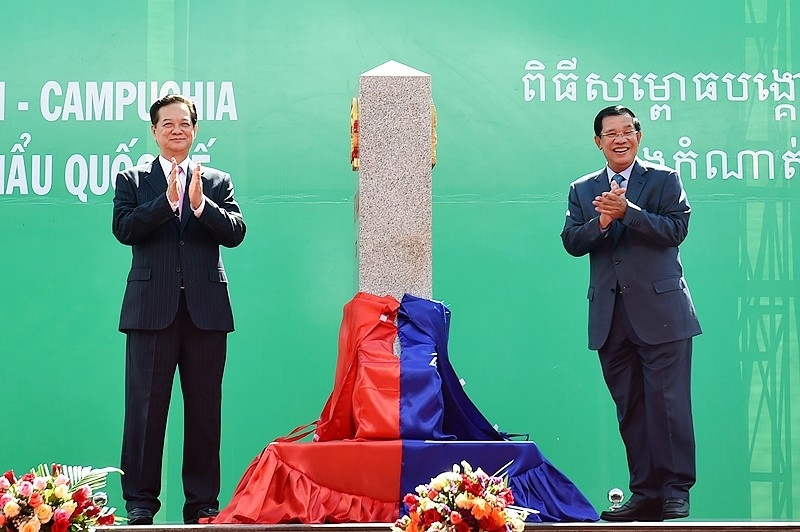
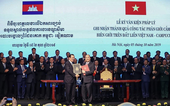
 | New progress in land border demarcation between Vietnam, Cambodia Deputy Foreign Minister and Head of the National Border Committee Le Hoai Trung has hailed the significance of the signing of two legal documents on ... |


Related Stories
 Viet's Home
French-Vietnamese Author Introduces Book Series "Memories of Overseas Vietnamese"
 National
Top Lao leader hosts welcome ceremony for Vietnamese State President
 Friendship
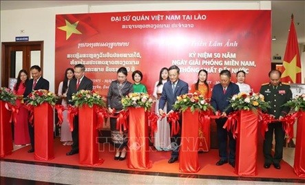
Photo exhibition in Laos: Story of Vietnam's Defense and Vietnam - Laos Solidarity
 Friendship
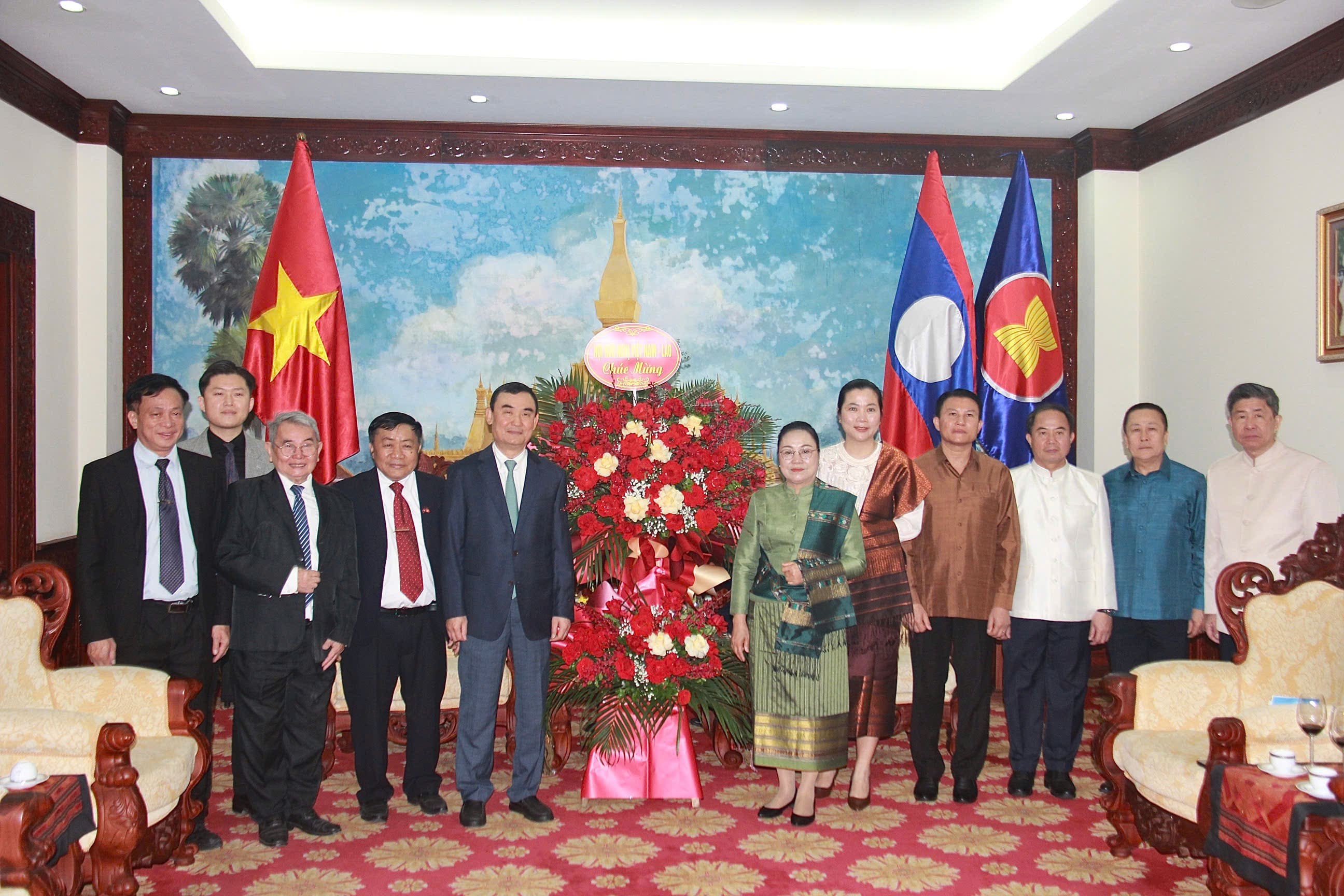
Fostering Vietnam-Laos Friendship in Celebration of Bunpimay Festival
In topics
 National
"Our coast is long, beautiful, we have to know how to keep it ..."
Recommended
 National
Vietnam News Today (Jun. 2): Vietnamese Trade Mission Sounds Out Business Opportunities in United States
 National
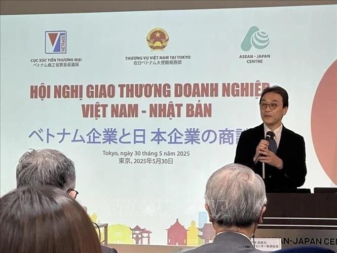
Vietnam News Today (Jun. 1): Vietnamese, Japanese Firms Foster Partnership
 National
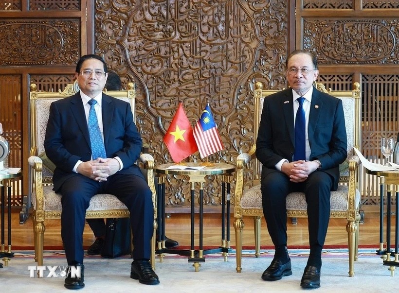
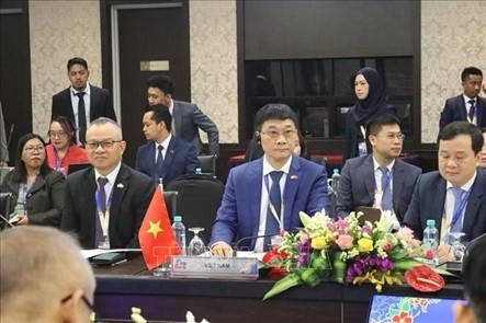
Vietnam News Today (May 31): Vietnam Strongly Supports Laos’s National Development
 National
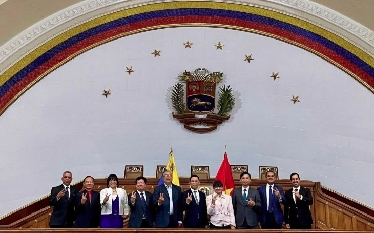
Vietnam News Today (May 30): Vietnam, Venezuela Reinforce Ties Through People-to-people Diplomacy
Popular article
 National
Vietnam News Today (May 29): Vietnam and Hungary to Expand Cooperation into New Areas
 National
Vietnam News Today (May 28): Vietnam and China Discuss Strategic Cooperation Orientations
 National
Vietnam News Today (May 27): Vietnam Treasures Multifaceted Collaboration with France
 National