Climb El Caminito del Rey – The World’s Scariest Hike Challenging The Bravest Hearts
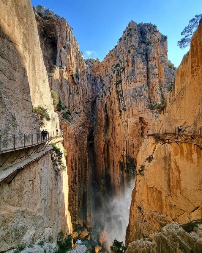
El Caminito del Rey (The King's Little Path) is a walkway, pinned along the steep walls of a narrow gorge in El Chorro, near Ardales in the province of Málaga, Spain. The name derives from the original name of Camino del Rey (King's Pathway), abbreviated locally to el caminito. The walkway had fallen into disrepair and was partially closed for over a decade. After four years of extensive repairs and renovations, the walkway re-opened in 2015. It has been known in the past as the "world's most dangerous walkway" following five deaths in 1999 and 2000.
Full length of the path El Caminito del Rey is 7.7 km. The part of the access ways is 4.8 km long and the stretch between the entrance and exit gates of the boardwalks (boardwalk – Hoyo Valley – boardwalk) is 2.9 km long.
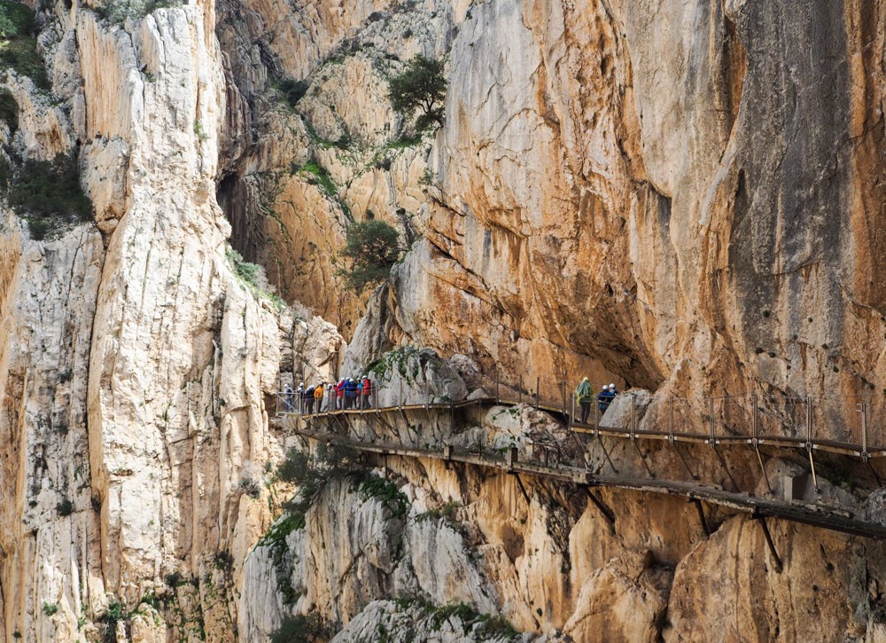
The boardwalks are the most famous part of the path due to its dangerous condition before refurbishment. Distance between the entrance to the boardwalks at the control cabin and its exit is 2.9 km. This part comprises 1.5km-long boardwalks and 1.4km-long footpaths or forest trails. Nevertheless, there is to add between 1.7km or2.7km-long way from the northern entrance to the control cabin, and 2.1km-long way from the southern entrance to the other control cabin. Because of this, estimated time needed to go across the whole route (the boardwalks, and forest trail or footpaths that lead to them) is three to four hours. Visitors should mind that, in order to get to the boardwalks, there is to walk for quite a long time and go uphill.
 |
| Photo: angeles.cuenca.lpa/ Instagram |
History of El Caminito del Rey
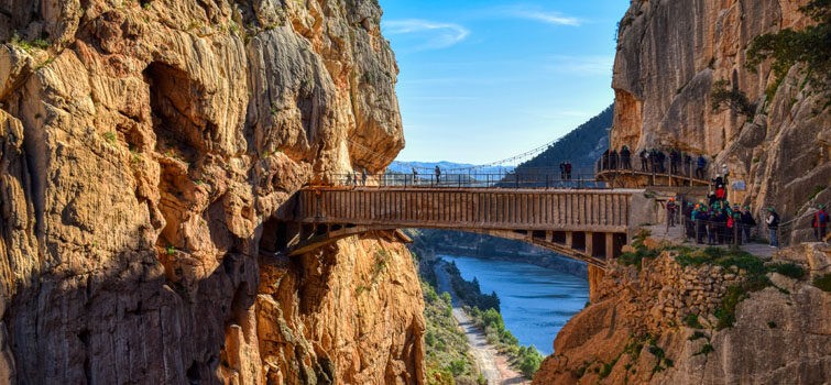
The walkway was built to provide workers at the hydroelectric power plants at Chorro Falls and Gaitanejo Falls with a means to cross between them, to provide for transport of materials, and to help facilitate inspection and maintenance of the channel. The construction began in 1901 and was finished in 1905. King Alfonso XIII crossed the walkway in 1921 for the inauguration of the dam Conde del Guadalhorce, and it became known by its present name. The walkway is 1 metre (3 ft) in width and rises over 100 metres (330 ft) above the river below.
 |
| Photo: Welcome Inn Nerja |
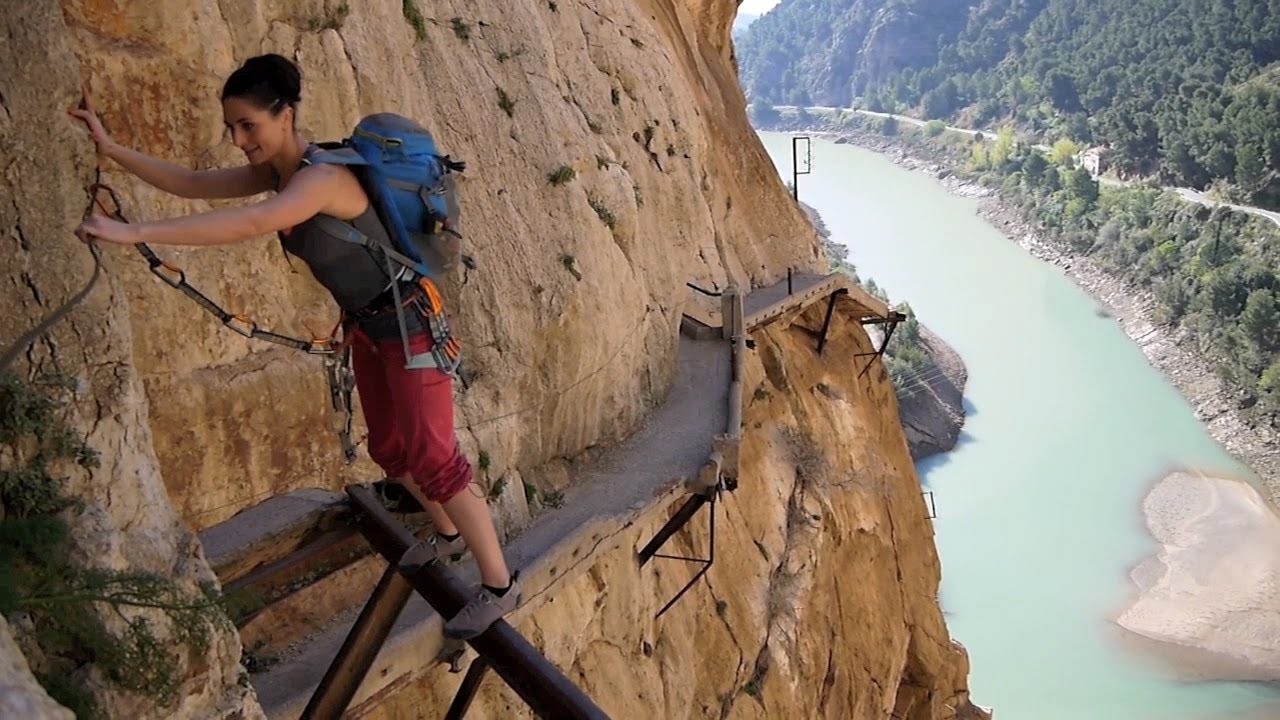
The original path was constructed of concrete and rested on steel rails supported by stanchions built at approximately 45 degrees into the rock face. It deteriorated over the years, and there were numerous sections where part or all of the concrete top had collapsed. The result was large open-air gaps bridged only by narrow steel beams or other supports. Few of the original handrails existed, although a safety wire ran the length of the path. Several people lost their lives on the walkway and, after two fatal accidents in 1999 and 2000, the local government closed both entrances. Even so, in the four years leading up to 2013, four people died attempting to climb the gorge.
The regional government of Andalusia and the local government of Málaga agreed in June 2011 to share costs of restoration (including car parking and a museum) of €9 million. The project took approximately three years to complete. Many of the original features remained in place.
 |
| Photo: GetYourGuide |
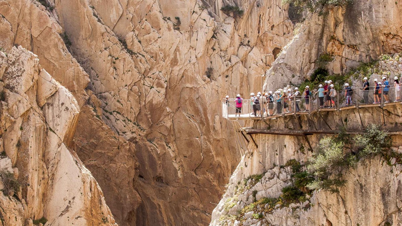
In March 2014, the cornerstone of the rehabilitation project was laid by specialized alpinists. The walkway reopened on 29 March 2015, and Lonely Planet listed it in the best new attractions for 2015. Route description and GPS track is available in Wikiloc with information, photos, and videos to help visitors. The new pathway still offers a walk of 2.9 km along the side of the gorge.
How can you arrive at the path?
You can come by train or by road. If you choose a train, currently, RENFE train service offers regional trains on daily basis to El Chorro. Check with RENFE before your trip.
The access road from Málaga to the path is the A-357, which is in good condition up to the Zalea crossroad.
From there you can go along the same road to Ardales, or take the exit MA-5403 and go towards M-442 up to El Chorro. This road goes through a lush pine wood and around the Conde de Guadalhorce Reservoir. Your other option is to follow the A-343 road up to the crossroad at Pizarra and A-7077 that leads to Álora - El Chorro.
 |
| Photo: Thrillseekers Anonymous |
Álora is 12 km away from El Chorro if you follow the road that goes up the Guadalhorce River. It is surrounded by beautiful landscape, wide orange or lemon trees orchards, and small hills with olive and almond grove in the higher zones. This is a curvy road but it offers magnificent view of the scenery above all during the flowering season when orange, lemon and almond trees become stunningly beautiful. This way goes through the small villages of Caracuel and Bermejo (where you can find restaurants, a chemist, a tobacconist's and grocery stores) to El Chorro village where varied services are provided such as train station, shuttle bus stop where you can take the bus to the northern entrance to El Caminito del Rey, the Tourist Office, the Reception Centre, a car park, as well as restaurants and accommodation.
Who is responsible for the path?
 |
| Photo: Chronic Wanderlust |
There is a committee that consists of the members from the Málaga County Council, and Ardales and Álora Town Councils. This committee will monitor and make necessary changes after having estimated this tourist attraction evolution. Therefore, these conditions can vary over the next few months.
What is waiting for the visitors?
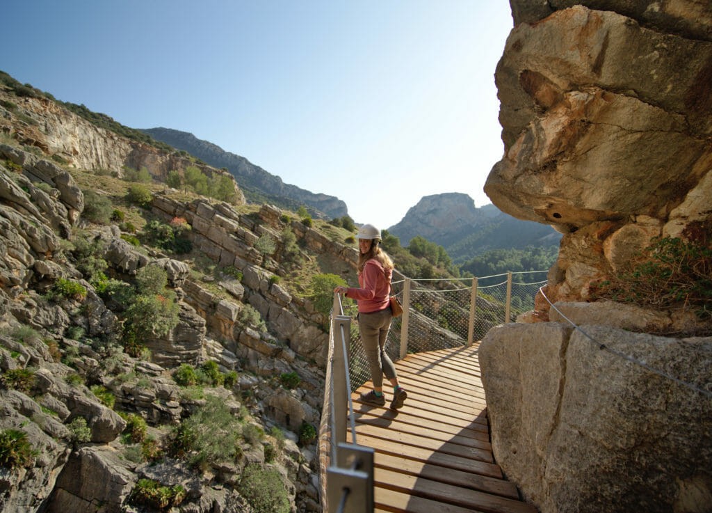
El Caminito del Rey is part of a spectacular natural beauty spot. This already makes it breathtaking and attractive, although the path is more than just a walk in the hills. The boardwalks and a hanging footbridge that stands at 105 metres height, as well as steep walls, make many visitors feel inevitably dizzy. The path is hazardous because of the heights and its very narrow parts. It was refurbished so it could be used for active tourism in natural surroundings. Therefore it is risky and requires certain level of physical effort and skillfulness, which is accepted by tourists who come to follow the route. Visitors are not risking their lives at all, but they must be aware of the strong impression this place might make on them. This is why this path is so attractive.
In film
 |
| Photo: Novo-monde |
In the film Scent of Mystery released in 1960, also known as Holiday in Spain there is a chase scene towards the end of the film that takes place on the Caminito del Rey where the hero (Denholm Elliott) and his cohort (Peter Lorre) are chased by the antagonist (Paul Lucas). At the end of the chase Paul Lucas is run down by a train in a tunnel that is also part of the Park complex.
Some of the final scenes of the 1965 film Von Ryan's Express were shot at the confluence of the gateway and the railway. In the film, they stand for the Italian-Swiss border. Some of the area's deterioration is directly attributable to the crashing of planes into the cliffs during the filming.
An extended sequence in the 2012 Spanish thriller The End was filmed on the Caminito.
 | Beauty of Japan: The Magical Kochia Hill Blooming in Hitachinaka Every year, tourists flood to Japan to witness the dreamy beauty of Kochiha Hill turning a bright and extraodrinary red colour, lending them the name ... |
 | Holiday Relaxation: Visit Las Grutas Tolantongo Mexico Hot Springs Grutas Tolantongo Hot Springs, located in the Mezquital Valley, State of Hidalgo in Mexico, is a beautiful and relaxing destination that attracts many tourists wanting ... |
 | Top 7 Best Places To See The Northern Lights Each year, Northern Lights attract many tourists to go witnessing this marvelous natural event. Take a look at these best places and spots that you ... |
Recommended
 Travel
Strategies for Sustainable Growth of Vietnam’s Tourism from International Markets
 Travel
Vietnam Strengthens Its Presence On The Global Tourism Map
 Multimedia
Phong Nha-Ke Bang National Park Named Top Adventure Travel Site
 Travel
Vietnam Welcomes Record-High Number of International Visitors
 Travel
Luxury Train From Hanoi To Hai Phong To Be Launched In May
 Travel
Phong Nha Named Top Budget-Friendly Travel Destination for Spring 2025: Agoda
 Travel
Four Indian Films Introduced to Lao Cai Audience
 Travel


