Explore The Marvelous Destinations In Bat Xat
Sharing a border with China to the north and east, where the Red River forms a natural driving line separating Lao Cai and China’s Yunnan Provinces, the mountainous Bat Xat district is a well-known place for tourists who enjoy discovering the wilderness of Vietnam.
Bat Xat attracts many travelers for its unique beauty. People will have a chance to immerse themselves in the majestic natural scenery, and fresh atmosphere and learn more about cultural diversity. This is home to more than 14 ethnic groups with 2% being ethnic minorities.
Y Ty
Situated on the Y Ty plateau at elevations of up to 2000 meters, the sleepy commune of the same name is the district’s main tourist destination. The winding road leading to the commune goes through a majestic natural scenery painted with forests, cascades, beautiful terraced fields, and some villages nestled in the mountains.
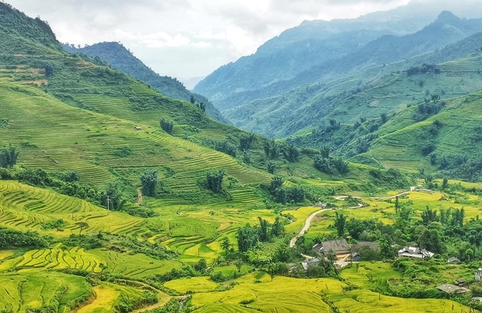 |
| The best time to visit Y Ty is from August to December. Photo: Wikipedia |
Y Ty has cool weather year-round especially in winter, when the temperature sometimes drops below 0°C, and if tourists are lucky, they will experience snow falling on some coldest days in the commune. However, they can visit there anytime as each season of the year has its own beauty, but Y Ty is the most crowded in the rice season from late August to mid-September and the cloud hunting season starts from winter to spring.
Lung Po flagpole
On the journey to Bat Xat, travelers should not miss the opportunity to visit the Lung Po flagpole in A Mu Sung commune. Lung Po flagpole was built on an area of 2,100 m2, with a height of 31.43 m, offering a panoramic view of the majestic mountains and forests below.
 |
| On the journey to Bat Xat, travelers should not miss the opportunity to visit the Lung Po flagpole in A Mu Sung commune. Photo: CheckinTravel |
Lung Po is the name of a stream in Bat Xat district, dividing two countries Vietnam and China. This stream flows to meet the Red River at milestone 92, which is the first point of the Red River flowing into Vietnam. Today, Lung Po is known to many people because it is the place to preserve the heroic historical imprints in the remote region. That’s where the brave A Mu Sung border guards fought and died to protect the country’s border. Tourists coming here should stop at this place for a little visit, in order to feel the sacred atmosphere in every inch of the homeland.
According to the tour guides, visitors can follow the spiral staircase inside the flagpole to go to the top. From the top, they can fully admire the view of the breathtaking mountains of the Bat Xat district. In the distance are villages of ethnic minorities, and nearby is the Lung Po junction where the Lung Po stream and Red River meet.
Lao Than mountain
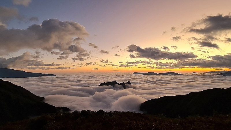
Another beautiful destination to explore in Bat Xat is Lao Than mountain peak, which is an ideal cloud hunting spot with majestic, wild, and poetic scenery. Lao Than Mountain is known as the roof of the Y Ty house, which is a perfect combination of the wilderness of nature and the dreamy, brilliant clouds. Although not as marvelous as Fansipan, and not as dangerous as climbing Ba Den mountain, Lao Than is a famous cloud hunting spot in the Northwestern mountains.
 |
| Cloud-hunting on Lao Than mountain. Photo: Saigon Tourism |
To come to Lao Than Mountain, travelers can choose to move from Hanoi to the My Dinh bus station or Giap Bat. Although Lao Than is considered not too difficult, people still need to prepare carefully before indulging in their journey.
Hunting clouds, and watching the sunrise on the top of Lao Than is a feature that creates a charming look for this Northwestern land. Climbing to the top of the mountain at an altitude of 2,862m at 6 am in the morning, photographers can capture the most unique and wonderful moments of nature.
Ky Quan San mountain
Bach Moc Luong Tu or Ky Quan San is the name of the village at the foot of the mountain and also the folk name of this mountain. Lying on the natural boundary of the two provinces Lao Cai and Lai Chau, Vietnam’s 4th highest mountain with rugged terrain has attracted the attention of adventurous people to explore the beautiful and wild landscape.
 |
| Bach Moc Luong Tu or Ky Quan San is the name of the village at the foot of the mountain and also the folk name of this mountain. Photo: Wikipedia |
The highest peak of this mountain range is at an altitude of 3,046m above sea level. The challenges to reach the top are not only the 30 km walk but also steep cliffs covered with moss. On the other hand, the scenery of barren hills, bamboo forests, and large trees is a great company.
 | Explore Yen Trung Lake – The “Petite Dalat” In Quang Ninh Thanks to its picturesque and peaceful landscapes, Yen Trung Lake is the charming reminiscence of a petite Dalat in the heart of Quang Ninh, Ha ... |
 | Discover Hanoi's Delicious Autumn Delicacies When the first days of autumn arrive, food lovers will have a chance to try the most signature delicacies, symbolizing the exquisite cuisine of Hanoi. |
 | Hanoi Among World’s Top 100 Best Tourist Cities Hanoi ranks 96th in a global listing of the 100 best tourist cities in the world and is the only Vietnamese city on the list, ... |
Recommended
 Travel
Strategies for Sustainable Growth of Vietnam’s Tourism from International Markets
 Travel
Vietnam Strengthens Its Presence On The Global Tourism Map
 Multimedia
Phong Nha-Ke Bang National Park Named Top Adventure Travel Site
 Travel
Phong Nha Named Top Budget-Friendly Travel Destination for Spring 2025: Agoda
Popular article
 Travel
Vietnam to Waive Visas for Citizens from 12 Countries until 2028
 Travel
Ninh Binh Full-day Tour among World’s Top Experiences: TripAdvisor
 Travel
Belgian Media Praises Lim Festival’s Vibrant Folk Culture
 Travel


