UK and Europe weather forecast latest, August 28: Heavy rain to smash UK before another heatwave
UK's weather forecast
According to Express, temperatures towards the end of next week are expected to reach 25C as the remains of Storm Francis leave the UK. Thursday will start chilly across the country with especially cold weather in the Scottish Highlands.
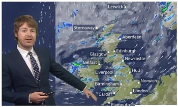
As we head through the morning powerful rain showers should be expected over much of Britain.
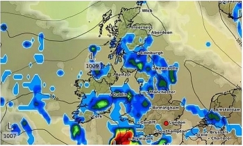
Met Office meteorologist Clare Nasir said: “Rain will move in Thursday morning and we could see some heavy showery bursts through Northern Ireland towards northern England, southern Scotland and northern parts of Wales through the morning."
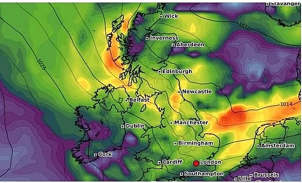 |
| Heavy rain will hit much of Britain on Thursday (Image: WXCHARTS) |
“Then another batch of rain comes in across more southern areas into the afternoon so some high rainfall totals possible on the south coast on the latter part of the day.”
Central and northern parts of Scotland will remain largely dry though there could be a few showers. Temperatures across Britain are expected to vary between the low teens and high twenties.
The Shetland Islands could peak at 13C whilst London experiences a warmer 21C. Rain will continue across much of the UK overnight.
Ms Nasir said: “Through Thursday night that low pressure system sits over us churning cloud and rain so it will be a wet night across many areas. Then the wind starts to pick up from the north as well as the west as the low clears off the scene."
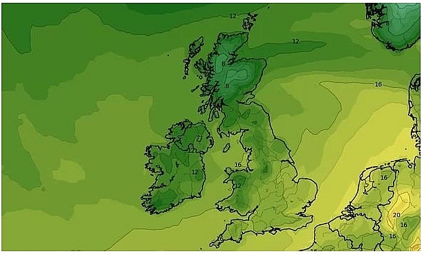 |
| Temperatures across the UK will be mild on Thursday (Image: GETTY) |
“As we head through the latter part of Thursday into Friday it really is a wet start to the day across many areas. Not as cold though, temperatures generally speaking will be holding up.”
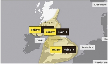
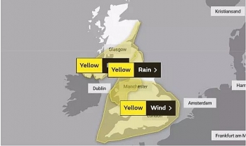
In total 13 flood alerts are in force for England meaning flooding is possible and residents should be prepared. These are concentrated around the north-west midlands, York, the Lake District and the area south of Preston.
Friday should see more heavy rain across southern parts of Scotland and northern parts of England, which will head south during the day.
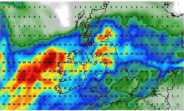 |
| Heavy rain should be expected across the Bank Holiday weekend (Image: WXCHARTS) |
Showers should also be expected across western and south-western parts of Britain some of which could turn heavy and thunders during the afternoon.
Northern Ireland will see the best of the sunshine though some showers should be expected. Scotland will also be relatively dry though it will be very windy which could produce some high waves along the eastern coast.
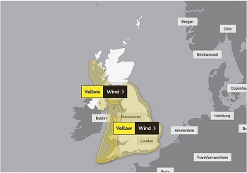
The wet weather will continue during the Bank Holiday weekend as Storm Francis lashes the UK. Netweather's latest hot weather maps show temperatures soaring in both northern and southern parts of the UK at the end of next week.
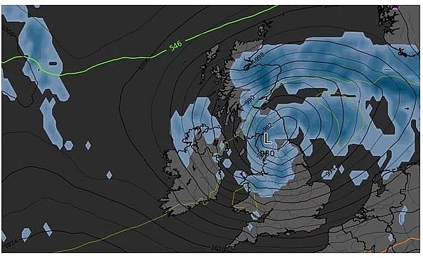 |
| Heavy rain will be hit over the next few days (Image: GETTY) |
Thursday, September 3 will see highs of 25C in North Yorkshire and 23C in London. Meanwhile, Friday, September 4 will also see temperates in the south rise a few degrees to 25C.
This comes after strong winds and rain from Storm Francis brought lows of 15C across many regions this week.
Europe's weather forecast
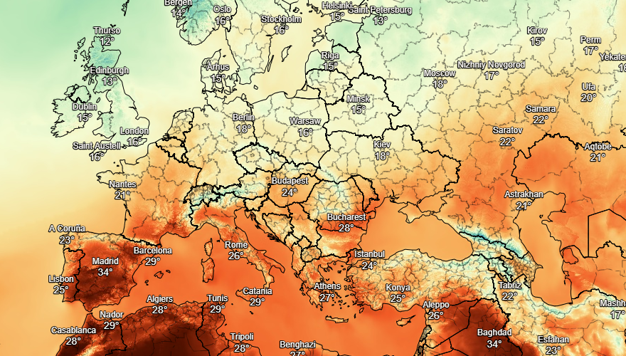
According to Weather Online, a fine day across Spain and Portugal with lots of sunshine. More sunshine in Italy and staying dry here too. Greece and Turkey will enjoy more warm and sunny weather throughout the day.
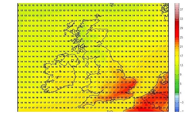 |
| Temperatures will rise dramatically towards the end of next week (Image: Netweather) |
Rain in northwest France but fair for the rest of the country with more sunshine. Showers and some cloud in the Low Countries as well as northern Germany. Rain, some of it heavy in northern Poland, but fair in southern Poland and the south of Germany. Hungary should be dry with sunny spells, but some showers in Austria and Switzerland.
Wind in Denmark with a mix of sunshine and showers. Further showers in the Baltic States and scattered showers for Finland. Sunny spells and col in central and northern Sweden, showers in the south. Further showers in southern Norway, sunshine and cool in the north.
 |
| Photo: Stirimeteo. |
On August 28
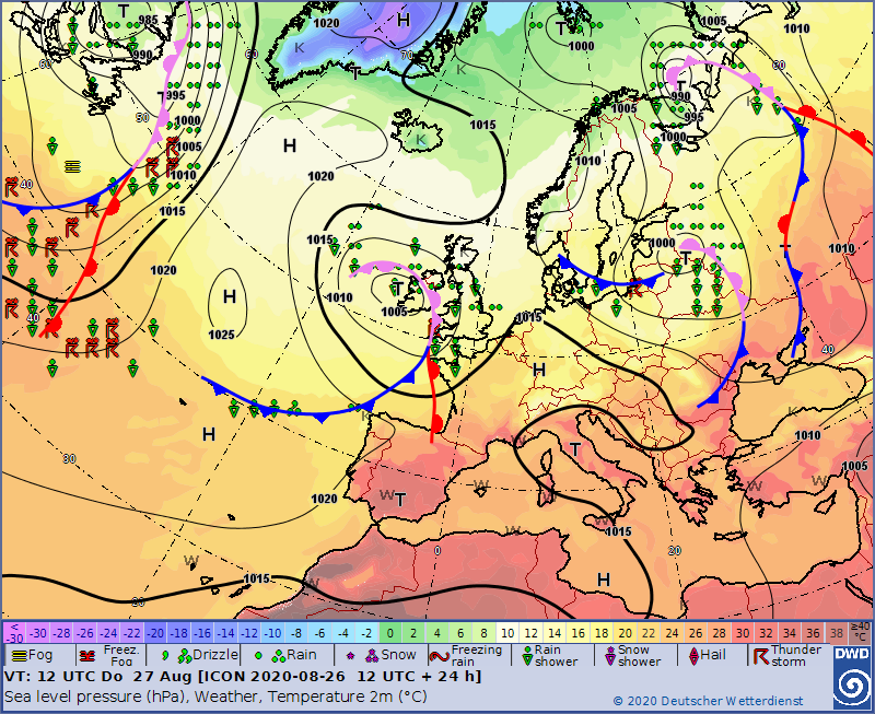
Some thundery showers affecting the beast of Spain today. Further showers over northern coasts. The rest of Spain and Portugal should be dry with good spells of sunshine. More sunshine to come in Corsica and Sardinia as well as through much of Italy, although heavy thunderstorms may affect northern Italy. Sunny and dry for Greece and Turkey.
Showers and rain in France, some of these heavy in central and northern areas. Further heavy showers or longer spells of rain affecting the Low Countries as well as northern Germany. Poland should be fair with some sunny spells. Heavy, thundery rain may extend through Austria, Hungary and into Switzerland.
 |
| Photo: Stirimeteo. |
Denmark is set to have showers and limited sunshine. Fair for the Baltic States with sunshine here. More sunshine to come in Finland and across central and northern Sweden. Southern Norway will have a few showers, but the north should be drier and brighter with sunny spells.
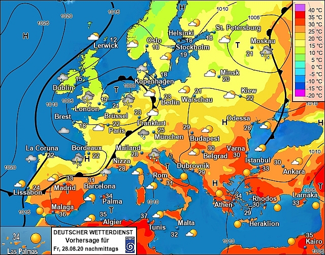
Outlook for next 48h
 |
| Photo: Stirimeteo. |
 | UK and Europe weather forecast latest, August 24: Map turns blue with plunging temperatures in the UK Temperatures in the UK is forecasted to plunge and cover weather map with blue color. Meanwhile, unsettled conditions will battle northern Europe this weekend. |
 | UK and Europe weather forecast latest, August 23: A windy weekend before the Atlantic storm hits Britain A windy weekend is predicted before the Atlantic storm hits Britain. Meanwhile, robust heatwave will bounce back to Europe. |
 | UK and Europe weather forecast latest, August 22: Storm Ellen reintroduces robust heatwave back to Europe Another heatwave will sweep across Europe as Storm Ellen introduces hot weather to the continent. Meawhile, extreme 60 mph wind of this storm is predicted ... |
Recommended
 World
World
"Will continue offering our full support to Indian govt": US FBI Director after Pahalgam attack
 World
World
"Great Leader": JD Vance Lauds PM Modi During His India Visit
 World
World
Trump’s Tariff Pause: A Strategic Move from “The Art of the Deal”?
 World
World
"Indian Navy's participation in AIKEYME exercise matter of great happiness": Admiral Dinesh Kumar Tripathi
 World
World
ASEAN and US Tariff Dilemma: Hybrid Approach to Global Trade Tensions
 World
World
Vietnam Affirms Its Active and Responsible Role at UNESCO
 World
World
US Imposes 125% Tariff on China, Pauses Tariffs for 90 Days on Over 75 Countries
 World
World

