UK and Europe weather forecast latest, January 12: Milder but colder in far north in the UK with rain then heavy snow strikes
UK's weather forecast
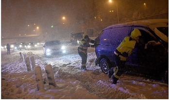
Wintry weather conditions are expected to return later this month, according to a weather expert. The forecaster warned the notorious Beast from the East could make a return and sweep across Britain from January 20/21, with the latest weather charts also supporting this assertion
Forecaster Jim Dale from British Weather Services told Express.co.uk current weather charts and conditions indicate the UK is “on the cusp” of another severe cold front.
He said: “There are signs that we could well go into another wintry spell, roughly from about the 20/21st of January onwards into February and that could actually bring another spell of seasonable weather or more than that.”
He predicts a battle will take place between the milder ridge that will be in the mid-Atlantic and west of the UK and the cold air making its way in from the east.
Mr Dale said: “That battle will take place probably around the 19th/20th."
“It will be from the east. So the Beast from the East really starts and it will come into the east first. The likes of eastern Scotland and East Anglia and the northeast they are likely to see it first.”
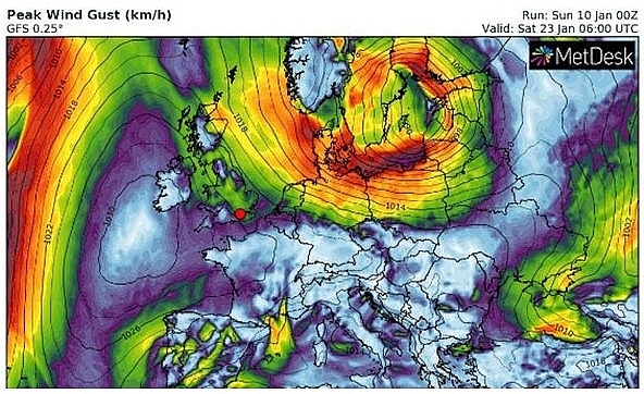 |
| UK snow forecast: The chart shows a weather front forming to the east of England on January 23 at 6am (Image: WXCharts) |
Weather charts support the weather experts claim, with a snow risk map by Netweather showing early indications of a cold front moving in from the east on Wednesday, January 20. The chart shows a mass of green and yellow approaching the east of the UK, suggesting snow is on the way.
The chart also shows Scotland is to expect a 100 percent risk of snow at 6am, while parts of East Anglia and the southeast have a moderate risk of snowfall.
WXCharts show a weather front forming to the east of England on January 23 at 6am. The swirling weather system is represented by the red, orange and yellow colours set to sweep across the UK.
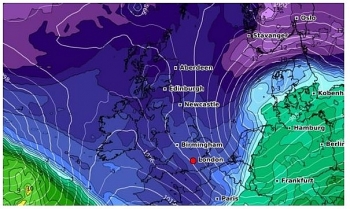
A second chart by the forecasters shows the UK turn dark blue on January 20, as temperatures are expected to plunge to lows of -10C.
WXCharts also forecast up to 11inches (28cm) of snow in Scotland on Friday, January 22 at 12pm. Forecaster Brian Gaze of the Weather Outlook also expects wintry conditions to return from the end of the month.
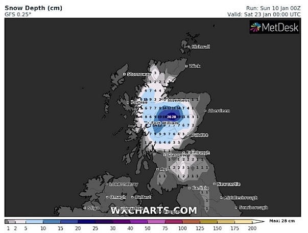 |
| UK snow forecast: Up to 11inches (28cm) of snow in Scotland on Friday, January 22 at 12pm (Image: WXCharts) |
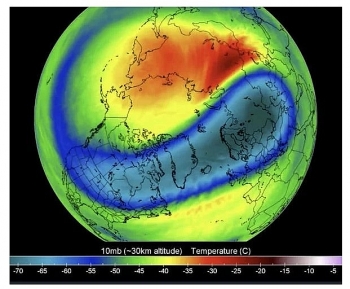
He told this website the cold weather front is set to be caused by a Sudden Stratospheric Warming (SSW) event which is currently taking place.
Mr Gaze said: “Essentially that can have impacts on the UK’s weather several weeks down the line and it can increase the chances of cold weather, maybe several weeks after it has happened. So we would be looking at late January and early February. Should that be the case then the chances of snow increases as well.”
The forecaster said even the southeast could see snow flurries during this period, particularly in the last third of January and the early part of February.
The Met Office long-range weather forecast also predicts heavy snow between Saturday, January 23 and Saturday February 6.
They said: “Through this period there is a greater than average chance of cold spells across the UK with the associated risk of wintry hazards. There is potential at times for significant snowfall on the boundary between milder and colder air masses, with greatest risk across central and northern areas.”
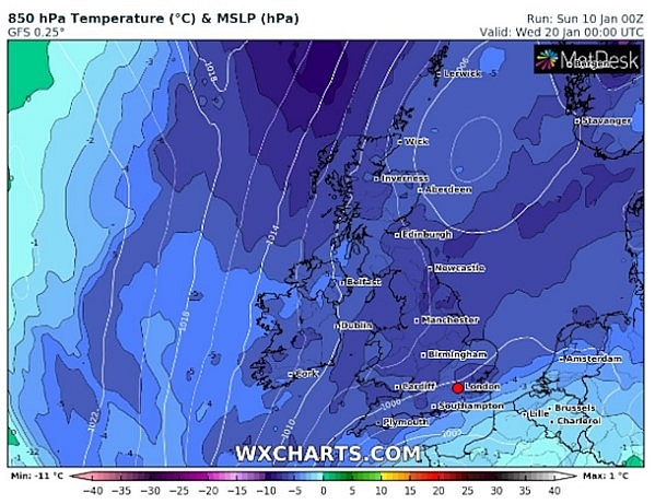 |
| UK snow forecast: The UK turns dark blue on January 20, as temperatures are expected to plunge to lows of -10C (Image: WXCharts) |
On January 12
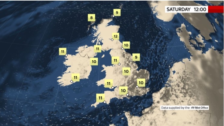
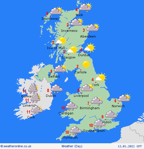
According to Weather Online, a largely dry but cold and frosty start for Scotland and the north of England with the risk of fog patches in places. Wintry showers also peppering northern coasts. Cloudier elsewhere while early patchy rain clears much of England and north Wales through the morning allowing for a dry rest of the day here. Rain, however, will push across Northern Ireland, Ireland and across much of Wales again while also spreading into to central southern and southwest England. The best of the sun to the east though coastal areas are at risk of a wintry shower or two. Highs at 2 to 6 for most, up to 10 or 11C in southwestern parts of the UK and Ireland.
Rain becoming confined to parts of southern and south-west England, Wales and returning east across Northern Ireland. Dry and sunny elsewhere, a few wintry showers far north and east, Met Office reported.
Outlook for Wednesday to Friday
Rain spreading northeast on Wednesday turning to snow over northern hills. Turning drier from the west later in the week. Milder midweek in the southwest, otherwise temperatures below average.
 |
| Photo: Weather Online |
Europe's weather forecast
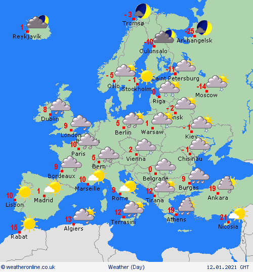
Lingering outbreaks of rain tend to clear south from Spain and the Balearic Islands to leave a dry and fine end to the day here. Dry and bright all day for Portugal. Patchy, light rain and snow lingers over central Italy and the Balkans but far northern and southern parts of Italy stay dry and bright. Pathcy rian still across Corsica and Sardinia. Heavy rain spreads into western and northern Greece and, later, into northern Turkey. Otherwise dry here but cloudy.
Much of central Europe stays dry and fine into Monday. Cloudier over northern France, the Low Countries, northern Germany and northern Poland with patchy outbreaks of rain, sleet and snow. Dry and fine for southern France, Switzerland, Austria, the Czech Republic, southern Germany, southern Poland and Slovakia.
 |
| Photo: Weather Online |
Low pressure west of Norway brings a wet and windy day to Denmark, southern Sweden and southern Finland. Rain turns to snow over Sweden and Finland. Generally a cloudy day over northern portions of Norway, Sweden and Finland with patchy snowfall here. A mostly cloudy day for the Baltic States with one band of snow clearing east through the morning and another arriving from the Baltic Sea later in the afternoon.
On January 12
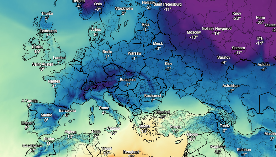
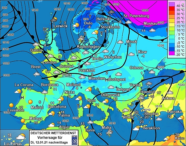
According to Weather Online, a dry and fine day across Spain and Portugal as well as the Balearics. Rain should largely clear Corsica and Sardinia but it will be breezy along the coasts here. Patchy rain across Italy will become confined to the south leaving northern areas dry. Heavy rain in Greece being confined to the south and clearing to the north. Turkey will remain mostly dry but northern areas seeing heavy spells of rain and thunderstorms.
 |
| Photo: Stirimeteo |
 |
| Photo: Stirimeteo |
A band of rain, sleet and snow will push from north to south down France, the Low Countries, Germany and into Switzerland, Austria and the Czech Republic. Poland, too, will see rain turn to sleet and snow as the front passes from west to east here. Dry down the Balkan States.
A colder day across Scandinavia with snow affecting central and coastal areas of Norway as well as northern Sweden with some rain, sleet and snow moving into the far south here. Rain intially across the Baltic States before turning to sleet and snow. Southern parts of Finland will see snow falling too but the north should remain dry. Denmark will see rain in the south turn to snow on the back edge of the front as it clears then it will be brigther but cold with wintry showers pushing in from the northwest.
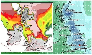 | The UK is forecasted to cope with a ferocious Arctic blast causing temperatures to drop and prompt heavy snow across the country. |
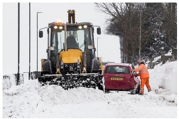 | The UK is forecasted to cope with significant polar freeze as sub-zero temperatures set to plunge. Meanwhile, cold weather sets to cover in much of ... |
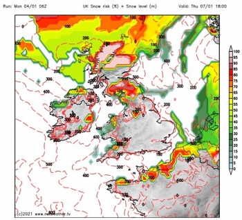 | Britain is forecasted to brace for a five-day snow blitz as a Scandinavian freeze sweeps across the country. Meanwhile, "nasty" conditions across Europe as Spain ... |
Recommended
 World
World
Pakistan NCRC report explores emerging child rights issues
 World
World
"India has right to defend herself against terror," says German Foreign Minister, endorses Op Sindoor
 World
World
‘We stand with India’: Japan, UAE back New Delhi over its global outreach against terror
 World
World
'Action Was Entirely Justifiable': Former US NSA John Bolton Backs India's Right After Pahalgam Attack
 World
World
US, China Conclude Trade Talks with Positive Outcome
 World
World
Nifty, Sensex jumped more than 2% in opening as India-Pakistan tensions ease
 World
World
Easing of US-China Tariffs: Markets React Positively, Experts Remain Cautious
 World
World

