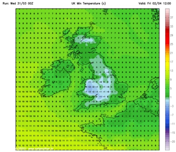
UK and Europe weather forecast latest, January 7: Significant polar freeze to sweep the UK with sub-zero temperatures
UK's weather forecast
Britain could be hit by "significant snowfall" in weeks, forecasters have claimed, as a weather event over the North Pole risks sending another Beast from the East in the direction of the UK this winter.
Forecasters have warned bitterly-cold air could soon sweep across the UK, bringing with it the risk of “significant snowfall” in weeks. The Met Office said towards the end of January, there remains the possibility of “cold air outbreaks in the north as flow across Scandinavia pushes across the North Sea”. Their forecast from January 19 to February 2, said: “Confidence for this period is low, though there is a signal for Atlantic mobility to weaken which perhaps allows conditions, at least in the north, to become drier and for temperatures to be closer to average."
“However, there is still a chance of cold air outbreaks in the north as flow across Scandinavia pushes across the North Sea. This would confine more unsettled conditions to the south, as well as milder than average temperatures."
"Further, this boundary between the cold and milder conditions could also allow for some significant snowfall where the two air masses.”
It comes as a study published by researchers at the Universities of Bristol, Exeter and Bath suggests a dramatic meteorological event could soon bring snow to Britain.
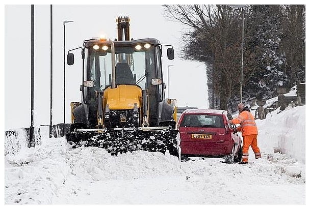 |
| A snow plough clears a road in 2018 (Image: GETTY) |
The so-called Beast from the East brought havoc to the UK two years ago - and the study suggests the sudden stratospheric warming (SSW) event could trigger something similar.
The stratosphere is the layer of the atmosphere from around 10-50km above the earth’s surface.
SSW events are some of the most extreme of atmospheric phenomena and can result in polar stratospheric temperatures increasing by up to 50C over the course of a few days.
Such events can result in very cold weather, often including snowstorms sweeping across parts of Europe.
Dr Richard Hall, the study's lead author, confirmed there was an increased chance of extreme cold, and possibly blizzards over the course of the next week or two.
He said: "While an extreme cold weather event is not a certainty, around two-thirds of SSWs have a significant impact on surface weather."
"What’s more, today’s SSW is potentially the most dangerous kind, where the polar vortex splits into two smaller 'child' vortices."
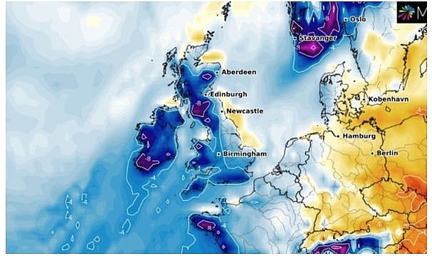 |
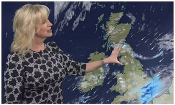
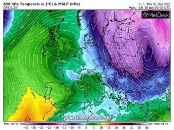
| Met Office warnings extended: Temperatures have plunged in recent days (Image: WXCHARTS) |
Dann Mitchell, Associate Professor of Atmospheric Science at the University of Bristol and another of the study's co-author, added: "The extreme cold weather that these polar vortex breakdowns bring is a stark reminder of how suddenly our weather can flip.
"Even with climate change warming our planet, these events will still occur, meaning we must be adaptable to an ever more extreme range of temperatures."
The research, published in the Journal of Geophysical Research and funded by the Natural Environment Research Council (NERC), analysed 40 observed SSW events which occurred over the last 60 years.
Researchers developed a novel method for tracking the signal of an SSW downward from its onset in the stratosphere to the surface.
The paper, entitled Tracking the stratosphere‐to‐surface impact of Sudden Stratospheric Warmings, suggests split events tend to be associated with colder weather over northwest Europe and Siberia.
Dr William Seviour, senior lecturer at the Department of Mathematics and Global Systems Institute, University of Exeter, who also helped write the paper, said: "Our study quantifies for the first time the probabilities of when we might expect extreme surface weather following a sudden stratospheric warming (SSW) event.
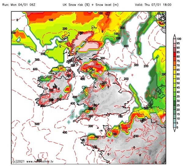 |
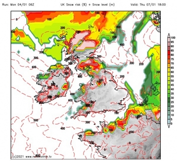
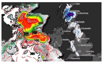
| K snow forecast: By Thursday much of the snow risk is confined to Scotland (Image: Netweather) |
"These vary widely, but importantly the impacts appear faster and stronger following events in which the stratospheric polar vortex splits in two, as is predicted in the currently unfolding event."
"Despite this advance, many questions remain as to the mechanisms causing these dramatic events, and how they can influence the surface, and so this is an exciting and important area for future research."
Met Office Professor Adam Scaife – head of long-range prediction, said: "As predicted, atmospheric observations are now showing that the Arctic stratosphere is undergoing a sudden warming event associated with a weakening stratospheric polar vortex."
Paul Davies, the Met Office’s Chief Meteorologist, added: “We can’t completely rule out a signal for colder weather following this SSW event later in the month."
"However, evidence from model data and other drivers of the UK weather support a return to relatively milder and more unsettled conditions next week.”
The Beast from the East, officially labelled Anticyclone Hartmut, was a storm which began on February 22 2018, bringing a freezing cold wave to Great Britain and Ireland.
It caused massive transport disruption and was blamed for a total of 16 weather-related deaths. It comes as the UK is bracing for the coldest night for nearly two years.
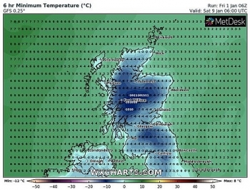
Writing on Twitter, the Met Office wrote: “A cold and frosty night, away from South East England. A locally severe frost is likely in North West Scotland, where temperatures may plummet to a low of -13C.”
If these conditions were reached, they added it would “make it the coldest night since the end of January-early February 2019”.
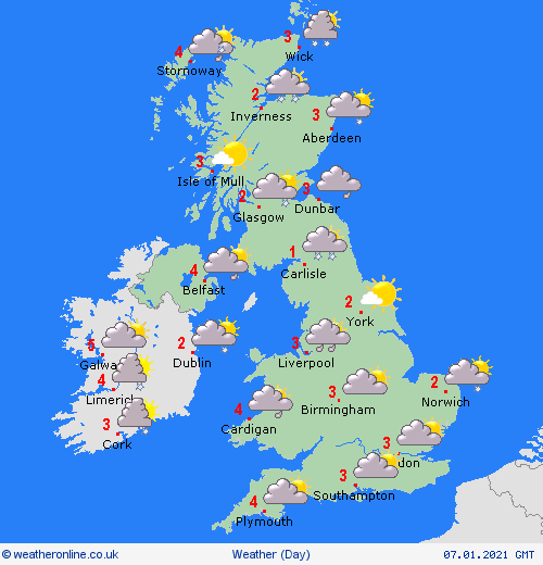 |
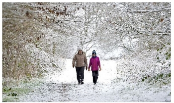
| Photo: Weather Online |
On January 7
According to Weather Online, a band of rain, sleet and snow will be passing through southern Scotland, central and southern Ireland as well as northern England on Thursday morning. This then slips into the rest of northern England, Wales, the Midlands and parts of Southwest England this afternoon. The rain may fall as snow mostly, but not exclusively, over high ground. Drier and brighter to the south and east. Much colder weather follows into Scotland and Ireland with some snow showers in northern Scotland. Highs at 4C in southern England, 2C in northern Scotland.
Europe's weather forecast
A cold day through Spain and Portugal. Plenty of sunshine here and dry overall too. Showers in Corsica and Sardinia. Heavy showers and a risk of some thunderstorms in Italy. Showers for the west of Greece but dry and sunny in the east. Turkey should be dry with plenty of sunshine to come here.
Fine for much of France with sunny spells, but some wintry showers in the north. Wintry showers for the Low Countries too whilst snow affects much of northern Germany and the west of Poland. Further snow showers across Hungary and Austria as well as Switzerland.
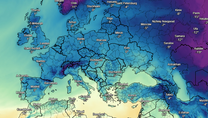 |
| Photo: Stirimeteo |
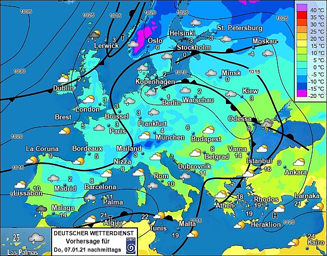 |
| Photo: Stirimeteo |
Snow in the east of Denmark as well as southern Sweden. The Baltic States will be breezy and cold. Finland looks set to be remaining chilly and breezy too. More cool weather in central and northern Sweden. Norway stays chilly but mostly dry.
On January 7
Heavy rain across eastern and southern Spain and Portugal with snow on the hills. More rain in the Balearics. Showers for Corsica and Sardinia as well as southern Italy. Northern Italy should be dry and fine. Greece will have sunshine and should be staying dry. A dry day too for Turkey with more sunshine to come here.
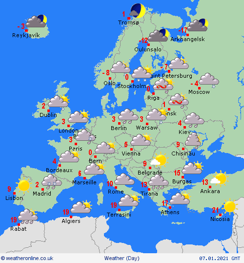 |
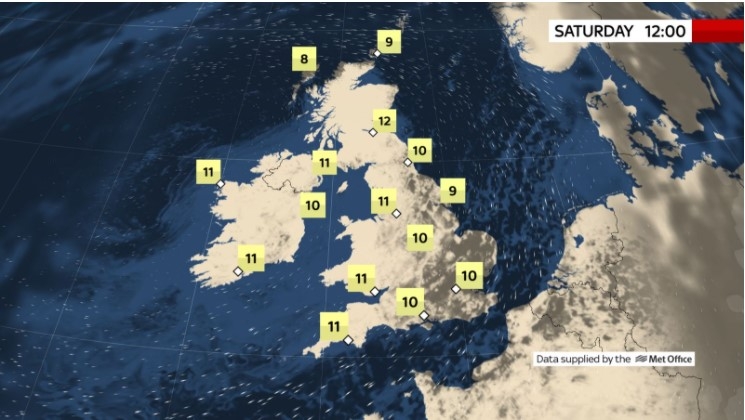
| Photo: Weather Online |
Fair for France but cold with sunshine. Showers in the Low Countries and northern Germany, these heavy and wintry. Fair in southern Germany. Poland will have sunny spells but some showers to the north. Hungary, Austria and Switzerland should all be fair with sunny spells. Coo, with wintry showers in Denmark. Cold for the Baltic States and Finland but mostly dry. Chilly too in Sweden with some showers in the east, fair for most areas. Norway will have some wintry showers on the coasts.
 | UK and Europe weather forecast latest, January 3: Brutal freezing air to blast the UK with significant snow and harsh frost Brutal freezing conditions will continue to blast the UK in the first week of January. Meanwhile, low pressure brings unsettled conditions to the Mediterranean. |
 | UK and Europe weather forecast latest, January 2: Snow showers with bitterly cold winds to hit the UK as temperatures plummet The UK is forecasted to cope with snow showers as polar bomb strikes. Meanwhile, Europe sets to bear heavy snow at first weekend of 2021. |
 | UK and Europe weather forecast latest, January 1: Heavy snow to hit Britain amid biggest winter threat in decade A savage -15C Baltic blitz sets to unleash inches of snow across Britain as the country braces for the "biggest winter threat for a decade". ... |
Recommended
 World
World
India reports 9 Pakistani Aircraft Destroyed In Operation Sindoor Strikes
 World
World
Thailand Positions Itself As a Global Wellness Destination
 World
World
Indonesia Accelerates Procedures to Join OECD
 World
World
South Korea elects Lee Jae-myung president
 World
World
22nd Shangri-La Dialogue: Japan, Philippines boost defence cooperation
 World
World
Pakistan NCRC report explores emerging child rights issues
 World
World
"India has right to defend herself against terror," says German Foreign Minister, endorses Op Sindoor
 World
World

