What Is The Longest Mountain Range in Vietnam?
| The Refreshing Magic of Fairy River | |
| Top 10 most beautiful mountains in Vietnam | |
| Bamboo-tube rice: a specialty of Vietnam's Northern mountains - Video |


Annamese Cordillera, French Chaîne Annamitique, Vietnamese Giai Truong Son, principal mountain range of Indochina and the watershed between the Mekong River and the South China Sea. It extends parallel to the coast in a gentle curve generally northwest-southeast, forming the boundary between Laos and Vietnam. A fairly continuous range for about 700 miles (1,100 km), its rather precipitous eastern slopes leave a narrow coastal plain. Although its highest point, Linh Peak, is only 8,524 feet (2,598 metres) high, the range has few substantial passes, the most important being the Keo Nua Pass in northern Vietnam, part of a route between Muang Khammouan, Laos, and Vinh, Vietnam, and the Mu Gia Pass.
 |
| Photo: Malinda Rene |
The geologically complex range comprises mainly limestones, sandstones, granites, and gneisses in the north and in the south an exposed, folded crystalline basement overlain in several places by basaltic lava flows. Among the plateaus created by these flows are the Bolovens Plateau in southern Laos and the Kontum and Dac Lac plateaus in southern Vietnam. To the south, the Annamese Cordillera curves to the southwest, reaching 7,500 feet (2,300 metres) or higher in peaks west of Nha Trang before terminating at the edge of the Saigon plain of southern Vietnam.
The range has a tropical monsoon climate with a short dry season from December to April. The heavy summer and autumn rainfall supports a tropical mountain rainforest, although U.S. military operations during the 1960s and ’70s and cutting for fuel and timber exports during the ’80s and ’90s resulted in widespread deforestation.
What is the geology and ecology of Annamite Mountains?
Geology
 |
| Photo: Uncover Vietnam |
While the Annamese Mountains don’t boast any of Vietnam’s highest peaks, their precipitous rise from the coastal plains renders them quite impressive.
The tallest mountains of the Annamite Range are Phou Bia at 9,249 ft (2,819 m), Phu Xai Lai Leng at 8,920 ft (2,920 m), and Ngoc Linh with a peak of 8,524 ft (2,598 m). While Phou Bia is actually located in Laos, Phu Xai Lai Leng straddles the border in Northern Vietnam, while Ngoc Linh is considered “the roof of Southern Vietnam”.
The Annamese Mountains also serve as a natural divider between the Mekong River Basin, with the majority of Vietnam’s territory lying to the east. On the Vietnamese side, the mountains rise sharply from the coastal plain, whereas on the western slopes, the topography is gentler as it levels off into a series of plateaus.
Ecology
Thanks to high precipitation and humidity, the Annamese Mountains are heavily covered in tropical forests. These are generally classified as the Northern and Southern Annamite Montane Rain Forests, meanwhile, other portions are considered to be “Moist Forest”, which most commonly referred to as jungle.
The Annamese is a hotspot of biodiversity, with thousands of plants and animals tucked away within its confines. Many environmental organizations are sounding the alarm as poaching and development threaten several rare and endemic species.
Among the rarest found in the Annamese Mountains is the Annamite striped rabbit, which as the name would suggest is a jungle bunny with tiger-like markings. The Large-antlered Muntjac is also an exceedingly uncommon deer species found only in this region and is under threat due to the prolific wire net poaching conducted in the area.
Similarly, the wild cattle species Saola, which looks akin to an oryx is also an endemic denizen of this unique ecosystem.
What to see in Annamese Mountains?
Not surprisingly, the Annamese Mountains are home to several national parks and some of Vietnam’s most scenic attractions.
High on that list is Phong Nha-Ke Bang National Park, in Central Vietnam. This UNESCO World Heritage Site offers a wealth of activities such as hiking, spelunking, and even ziplining. The highlight of the park is the Hang Son Doong, which is believed to be the largest cave, by volume, in the world.
 |
| Photo: Pure Luxe Travel |
In the southern reaches of the Annamese Mountains, you’ll find Yok Don National Park, which is part of the largest conservation area in the entire country. This park is known for its wildlife, with its elephants starring as the main attraction.
Farther north, you can also see Indian elephants at Pu Mat National Park. Acting as a biological haven for over 2,400 species of plants and mammals, some rare creatures seen at this park include Indochinese tigers, white-cheeked gibbons, and the Ussuri dhole, which looks like a cross between a wolf and a fox.
Though difficult to get to, Vu Quang National Park is also within the vicinity and allows for similar trekking opportunities.
Truong Son trail – A symbol of Vietnam
The name of the Ho Chi Minh trail, which runs through the Truong Son range, was given by soldiers in several provinces of central and southeast inter-regions during the national resistance war against the French colonialists. At first, it was a north-south communication route following the primitive footpaths of ethnic minority groups living in Truong Son range. When the US imperialists conducted invasion war of Vietnam’s southern region, the Vietnamese Party directed the restoration and reinforcement of the route as a transportation system that supplied manpower and materiel to the southern battlefield.
 |
| Photo: Viet Vision Travel |
A special military mission, known as Army Corps 559 – Truong Son soldiers, was officially established on May 19, 1959 to shoulder the task of opening the route.
As the terrain of the mountain range’s eastern side was particularly rough and the area had been heavily raided by the enemy, a strategic transportation route was planned in the western side of the mountain. Under the motto of “split Truong Son mountain range to save the nation” and "fight the enemy to travel, build roads to advance” raised by the soldiers, the route was quickly lengthened to Vietnam’s border areas with Laos’ Attapeu province and with Cambodia’s northeast area. It also went further to Vietnam’s Central Highlands and Southeast regions.
The trail served as a strategic transportation route to supply men and materials to the front line, contributing to the victory of the Indochinese people.
Over one decade from its operation to the signing of the Paris Agreement in 1973, the trail suffered nearly four million tonnes of bombs, which means that every kilometer of the trial incurred around 735 bombs in various types; millions of gallons of toxic chemical which exterminated to the every root of the forests; over 100 encroaching operations and more than 1,000 raids conducted by the enemy.
The US Air Force launched thousands of bombardments against 180 villages of Lao ethnic minority groups living along the trail, setting fire to 845 homes, killing 482 people and injuring 344.
Not submitting the enemy’s brutal attacks, Lao ethnic people in 17 villages and districts along the strategic transportation route in the western Truong Son were resilient to maintain the toehold, collaborate with Lao patriotic armed forces and Vietnamese soldiers to fight against the air force, prevent the enemy’s encroaching and destructive operations and protect the trail.
All Vietnamese soldiers, youth volunteers and workers who directly participated in making the trail and fighting in the western Truong Son, were sheltered and supported wholeheartedly as Lao people’s family members.
The strategic trail helped transport 1.5 million tonnes of goods, 5.5 million tonnes of petroleum, over 1.1 million officials and soldiers and a large volume of modern weapons to the south and fronts.
For both countries’ people, it can be affirmed that the strategic transportation route has been the way to the victory against the US imperialism to liberate the country
The trail’s establishment and development is a vivid symbol for the special relationship between Vietnam and Laos and for the unity of the three Indochinese countries of Vietnam, Laos and Cambodia in the national salvation fight against the US imperialism.
It was created on firm natural socio-geographical factors and vital objective requirements of the fight to protect independence and freedom, as well as to contribute to national construction of each nation.
The legendary path is resulted from a self-conscious revolutionary process in a principle of equality, solidarity, mutual interests and respect of each other’s independence and sovereignty.
| The cordillera has no uniform width or elevation. In central Vietnam, where the Demilitarized Zone (DMZ) once separated the Democratic Republic of Vietnam (North Vietnam) from the Republic of Vietnam (South Vietnam), the cordillera extends from the edge of the coastal plain westward for seventy-five miles before ending in a forested plateau. Further south, the cordillera widens out. On the outskirts of the town of Cam Ly, the undulating mountains roll on for 175 miles until descending from the heights of the Plateau des Bolovens to the banks of the milky-brown Mekong River at Pakse, Laos. Looking west from Danang, the Truong Son reveals a hodgepodge of high and low peaks. Ngoc Linh is one of the cordillera’s tallest mountains; it straddles the border between Kontum and Quang Nam provinces. Ngoc Linh stands 8,366 feet tall and is located in an old-growth forest northeast of Dak To. Another cluster of high peaks can be found west of Nha Trang, where a steep escarpment rises abruptly from the lowlands. But across the cordillera, high, dramatic peaks are the exception rather than the rule. The majority of mountain tops are no higher than 3,000 feet, which is a testament to their great age and the erosive power of centuries of monsoonal rain. In the middle of the cordillera between Ban Me Thuot and Pleiku, the terrain is predominately flat. Here, low hills and knolls are interspersed with level plains. Rather than jungle vegetation, the plateau country is blanketed by elephant grass and short, thin trees. This expansive interior region is actually a series of plateaus. The French referred to these tablelands as the Plateau du Kontum, Plateau du Darlac and the Plateau du Mnong. The plateau country acquired a strategic significance during the first and second Indochina wars. In the 1950s and 1960s, American military analysts concluded that whoever controlled the plateau region would determine the future of South Vietnam. Along the entire length of the cordillera, runoff from heavy rains has eroded deep, sun-deprived valleys. Rivers flow either east or west depending on where they originate in relation to the cordillera’s spine. East-flowing rivers are short and fast, falling rapidly from the highlands to the South China Sea. West of the divide, the streams descend more slowly, and along more circuitous paths, to an eventual juncture with the Mekong River. The Ben Hai is a notable stream flowing east from the cordillera. It begins in the remote hill country north of the old U.S. Marine base at Khe Sanh. From there, it hurriedly drops to the coastal plain. Once down in the rice paddy country, the river slows and widens out. Before reaching the South China Sea, the Ben Hai runs deep and wide. The Ben Hai is only thirty-seven miles long from start to finish. Between 1954 and 1975, the river acted as the demarcation line between North and South Vietnam. South of the Ben Hai is the Thach Han River. Its headwaters are also located near Khe Sanh. This river tumbles eastward through a land of high, round peaks and dense jungle. Near Khe Sanh, it rushes over a rocky riverbed fringed by steep, stone walls. Old French Route 9 parallels a segment of the Thach Han’s northern margin. In places, the razor-thin, two-lane highway clings to a precarious ledge situated high above the valley floor. Beyond Quang Tri City, the waters of the Thach Han mingle with those of the Meiu Giang to form the Cua Viet River. The Cua Viet spreads out into a sandy, flood-prone delta before dumping its waters into the South China Sea. For centuries, Vietnam’s east-flowing rivers, such as the Ben Hai and Cua Viet, acted as obstacles to north-south travel and communication. The streams did not make human movement impossible, but they did impede it, especially during flood periods, which frequently came on the heels of the northeast monsoon. In the often-isolated pockets of territory located between the lowland rivers, the rural population became parochial, xenophobic, self-reliant, and distrustful of centralized authority. The rivers were not the only physical feature hindering the integration of Vietnam. The cordillera acted as a major obstacle to the coupling of the lowlands with the highlands. The Vietnamese, and later French, found it impossible to fully dominate the cordillera. Terrain, tropical diseases, poor soils, a dearth of roads, and the hostility of the cordillera’s indigenous inhabitants kept the Vietnamese and French largely restricted to the lowlands. As a result, the cordillera remained in the hands of the mountain tribes, (known collectively by the French term “Montagnards”) until well into the twentieth century. |
 | "Vietnam's Grand Canyon:" Majestic Cao Cat mountain attracts adventurous tourists Cao Cat Mountain is called “The Grand Canyon of Vietnam” by the tourists, as it bears the same shape and resemblance. |
 | Helen Keller International donates medical supplies to help mountainous province fight Covid-19 The US non-governmental organization Helen Keller International assisted the northern province of Son La, aiming to drive back the pandemic and stabilize production. |
 | Hydrangea 'carpet' blooms on top of Mau Son Thousands of hydrangeas bloom on Mau Son mountain, attracting many tourists |
Related Stories
 Travel
Vietnam Through Australian Eyes: Land of Flavor, Warmth, and Timeless Charm
 National
Vietnam News Today (May 11): Vietnam, Austria to Boost Cooperation in High-Tech Development, Innovation
Recommended
 National
Vietnam News Today (Jun. 2): Vietnamese Trade Mission Sounds Out Business Opportunities in United States
 National
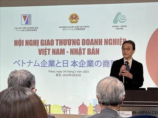
Vietnam News Today (Jun. 1): Vietnamese, Japanese Firms Foster Partnership
 National
Vietnam News Today (May 31): Vietnam Strongly Supports Laos’s National Development
 National
Vietnam News Today (May 30): Vietnam, Venezuela Reinforce Ties Through People-to-people Diplomacy
 National
Vietnam News Today (May 29): Vietnam and Hungary to Expand Cooperation into New Areas
 National
Vietnam News Today (May 28): Vietnam and China Discuss Strategic Cooperation Orientations
 National
Vietnam News Today (May 27): Vietnam Treasures Multifaceted Collaboration with France
 National