An insight into Vietnam's geography
| Vietnam may surpass Thailand in rice exports | |
| National cultural heritage spotlights the Vietnamese spirit | |
| Gorgeous Hanoi in deciduous season |


 |
| Hoan Kiem Lake from bird-eye view (Photo: Hanoi1000) |
Lying on the eastern part of the Indochinese peninsula, Vietnam is a strip of land shaped like the letter “S”. China borders it to the north, Laos and Cambodia to the west, the Eastern Sea to the east and the Pacific Ocean to the east and south.
Mountains and hills cover two-thirds of the mainland whereas areas above 500m in altitude account for three-fourths of the mainland. Mountain system extends from the Northwest border to the eastern side of the South, stretching for a total of 1,400 km. The most grandiose and highest mountain ranges lie in the west and northwest of the country.
Việt Nam’s territorial waters make around 1,000,000 km2, with over 3,000 km long coastline lines. Việt Nam lies along the Indochinese Peninsula and circles the old southeastern part of the Asian continent with its back turned to the Eastern Sea (Pacific Ocean). These mountain and sea areas boast a diversity and richness in natural resources as well as minerals.
In the South West area of Central Vietnam, there is a huge “mountain-highland” at over 1,000m high, covered by basalt soil ideal for growing tropical and temperate industrial crops (rubber, tea, coffee and cacao).
| Terrain: + Mountains, hills: Mountains and highland hold 3/4 of the total area. Mountain system extends from the Northwest border to the eastern side of the South, 1,400 km in total length. The highest point: Fan Si Pan 3,143 m. + Deltas: Red River Delta: 15,000 km2. Cửu Long River Delta: 40,000 km2. + Main rivers: total length of all rivers in Vietnam is 41,000 km with total flow is nearly 300 billions m3 of water, and 3,100 km of canals. The Red River’s length is 1,149 km in which 510 km is on Vietnam territory. The Mekong (Cửu Long) River’s length is 4,220 km in which 220 km is on Vietnam territory. |
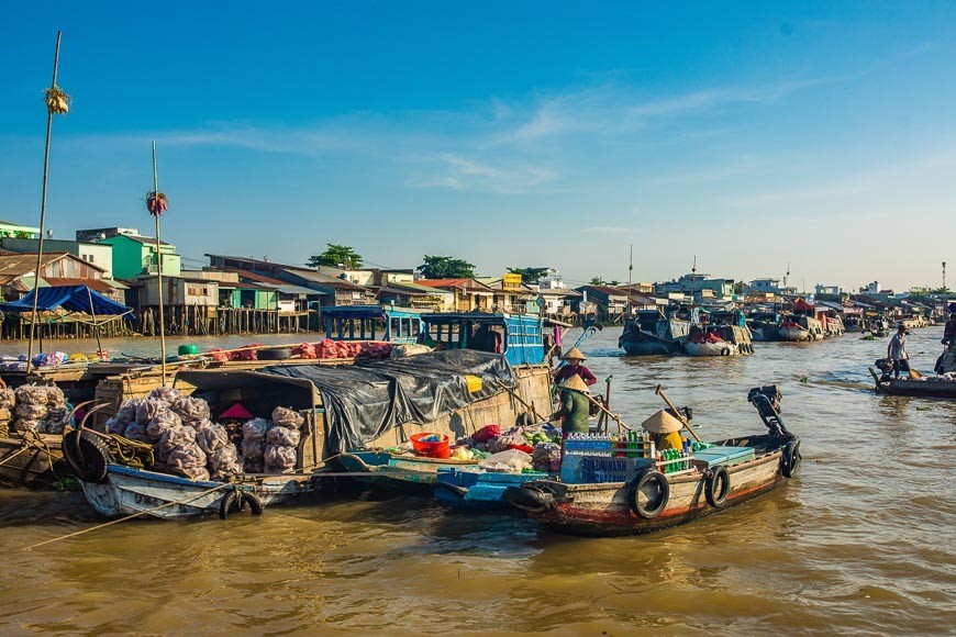
Along the coastline, from the North to the South, Vietnam has lots of beautiful beaches, especially Hạ Long Bay with more than 3,000 islands, is listed by UNESCO as a World Natural Heritage site.
In terms of weather, Vietnam is located in the tropical and temperate zone characterized by high temperature and humidity all year round, especially in rainy season.
 |
| Hai Van pass in central Vietnam (Photo: 24h) |
In Vietnam, the climate is subtropical in the north and tropical in the center and south, and it's influenced by the monsoons: the south-west monsoon affects the country from May to October, and the northeast monsoon from October to April. The former brings heavy rainfall in the exposed areas, ie both the north and the south, while along the central part, protected by the mountains, it brings relatively little rain and leaves often space to the sun. The north-east monsoon is generally drier, but it brings heavy rains in the early months (October-December) along the coast exposed to the east, and light but frequent rains in the north.
In inland areas, there are hills and mountains, which make the climate milder in the summer months, but even cold in winter in the north.
The amount of rainfall is normally between 1,500 and 2,500 millimeters (60 and 98 inches) per year, but there's also a relatively small arid zone in the Phan Thiet area (north-east of Ho Chi Minh City), where it's slightly above 1,000 mm (40 in).
The country’s average air humidity is over 80%, even 90% in rainy season and in drizzly weather.
 |
| The North-South railway of Vietnam is 1,730km in length and still active today (Photo: Invert) |
As to transportation, Vietnam owns 86,327 km roadways, 3,219 km railways, (according to 1995’s statistic). The Vietnam Airlines has 17 international routes and 16 domestic routes. Large airports are: Nội Bài (Hanoi), Tân Sơn Nhất (HCM City) , Đà Nẵng, Phú Bài (Huế), Cát Bi (Hải Phòng), Điện Biên (Lai Châu), Vinh (Nghệ An), Nha Trang, Cần Thơ. Main ports include Hon Gai, Hải Phòng, Đà Nẵng, Qui Nhơn, Cam Ranh, Vũng Tàu, Sài Gòn.
Jungles along the country are home to rare, precious animals and plants. In addition, there are some sub-climate regions in Viet Nam including regions with temperate climate and unique sight-seeing, such as Sa Pa (Lao Cai Province), Da Lat (Lam Dong province) and plenty of lakes, streams, falls and extraordinary caves.
The mineral coal such as mines, bauxite and precious metal are mainly in the North and the Central; on the offshore and coastline we have lots of oil field and natural gas. In the rivers, lakes and territorial waters, we have variety of fishes, shrimps and aqua products.
 | Promoting good traditions, enhancing Party’s revolutionary and vanguard nature Vietnam Times introduces the full text of the speech delivered by Party General Secretary and State President Nguyen Phu Trong at ceremony held in Hanoi ... |
 | Valuing Nature in Childhood program for nearly 6000 children in 3 years In order to have an opportunity to discuss the development direction of the program, the summarizing workshop of the "Valuing Nature in Childhood" program after ... |
 | Visit Thu Cuc Village to get in touch with nature Writer Nguyen Van Toai, a relative of mine, says his native village of Thu Cuc, in the northern province of Phu Tho’s Tan Son District, ... |


Related Stories
 Travel
Vietnam Through Australian Eyes: Land of Flavor, Warmth, and Timeless Charm
 National
Vietnam News Today (May 11): Vietnam, Austria to Boost Cooperation in High-Tech Development, Innovation
 Friendship
Vietnam as Land of Hope, Resilience, and Progress
 Friendship
Vietnam Is Source of Inspiration for Struggle for Freedom
Recommended
 Seas and islands
Vietnam Endorses Common Voice on Ocean Jurisdiction
 Seas and islands
Dialogue as Key to Settling Disputes and Advancing Law of the Sea
 Seas and islands
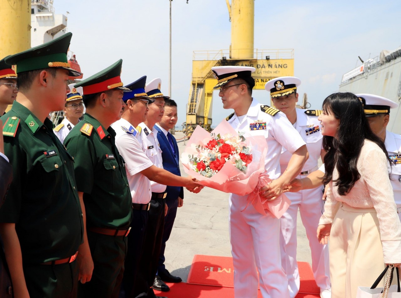
RoK Navy Ship Pays Friendly Visit to Da Nang City
 Seas and islands
Naval Region 5 Promotes Reading Culture, Fosters Patriotism
Popular article
 Seas and islands
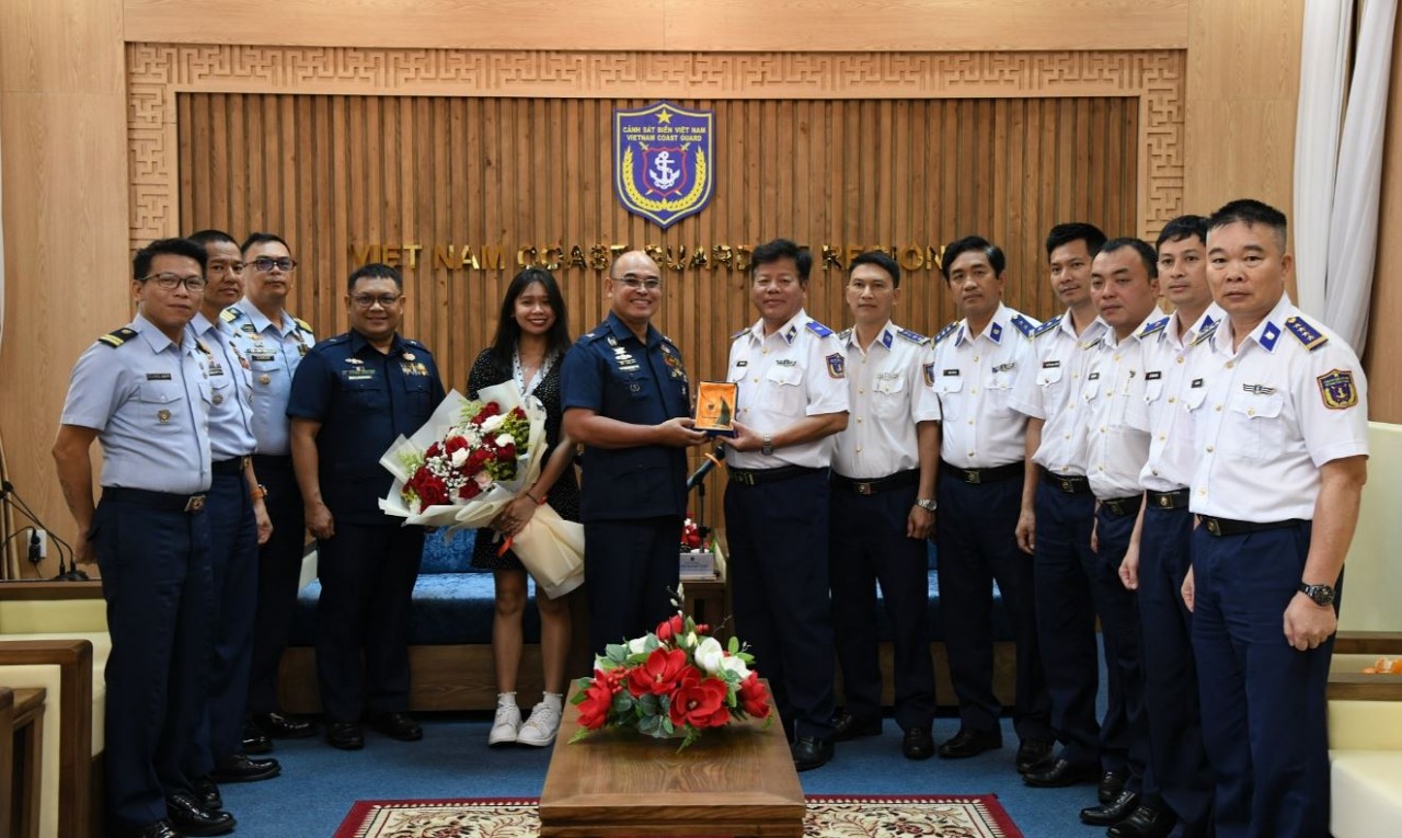
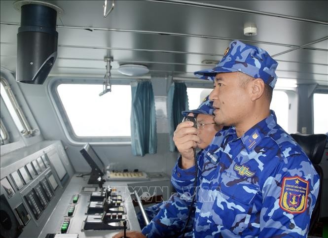
Coast Guard Region 2 Command Hosts Philippine Coast Counterpart
 Seas and islands
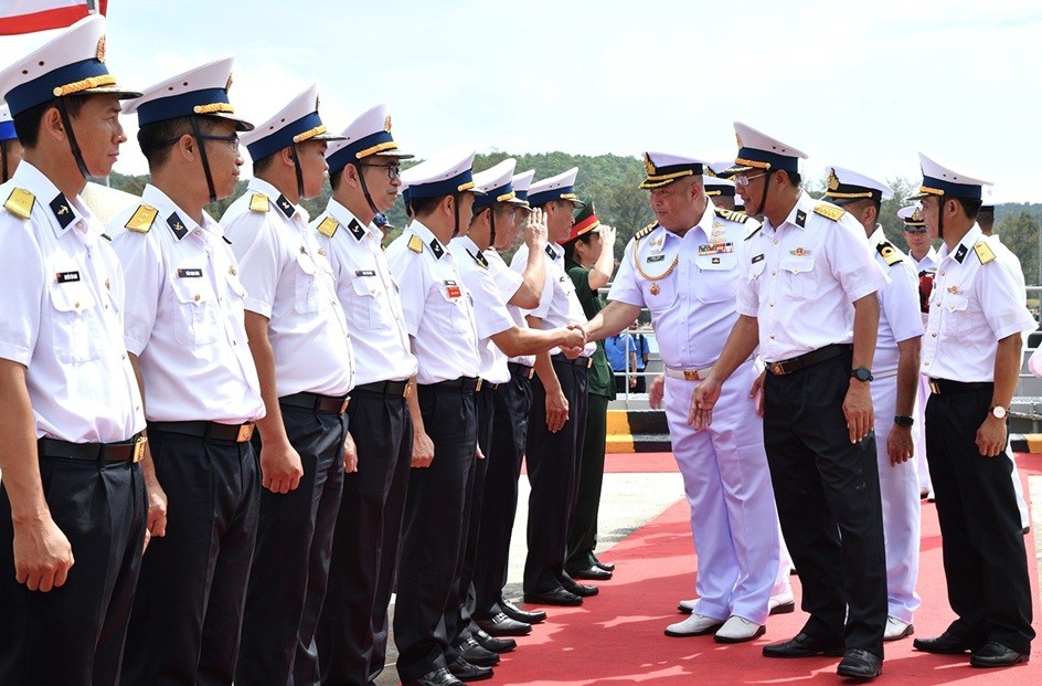
Vietnam - Thailand Navy: Coordination to Well Address Problems at Sea
 Seas and islands
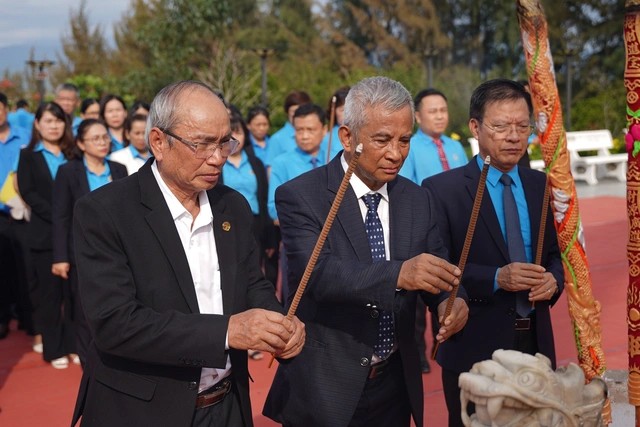
Honoring the Fallen: Incense Offering for the 37th Anniversary of Gac Ma
 Seas and islands