National Geographic: Best Travel Photos Of 2021
Even with an unsteady return to travel, 2021 proved to be a time of renewed exploration. The photographs The National Geographic published this year reflect an intimacy that comes from staying closer to home and looking deeper into the landscapes and cultural traditions all around us. The National Geographic contributors shared surprising glimpses of regions they know well, from the urban trails of San Francisco to the untamed lands of Patagonia to the watery wilds of Alaska. These images reveal the enduring essence of inspiring places.
1. VERNAZZA, CINQUE TERRE, ITALY
 |
| PHOTOGRAPH BY CHIARA GOIA, NATIONAL GEOGRAPHIC |
Raffaello Lercari, a worker for the Cantina Cheo winery in Vernazza, Cinque Terre, Italy, teeters down a narrow path carrying a box of hand-harvested grapes from the winery’s ”vigneti eroici,” or heroic vineyard. Protected by Italian law, heroic vineyards are ones where grapevines grow in hostile climates, geographies, and labor conditions.
Vernazza was founded about 1000 A.D. and was ruled by the Republic of Genoa starting in 1276. The medieval castle, Belforte, was built in the mid-1500's, primarily to protect the village from pirates.
An ideal way to arrive to this breathtaking village is by sea. The tiny port is surrounded by subtle colourful pastels and the charming piazza is lined with good restaurants and bars.
The village is surrounded by very steeply-terraced olive groves which are said to produce among the finest olive oil in the country.
There are some really romantic guesthouses and nice apartments in the center of the village with an amazing view over the main square and the colourful small harbour. We have listed the best alternatives for you: Guesthouses in Vernazza.
2. FAGRADALSFJALL VOLCANO, ICELAND
 |
| PHOTOGRAPH BY CHRIS BURKARD, NATIONAL GEOGRAPHIC |
Lava flows in waves over black basalt rocks at Iceland’s Fagradalsfjall volcano, which erupted in March 2021 for the first time in nearly 800 years. The world holds more than 1,500 active volcanoes, which draw of tourists each year to see the aftermath of an eruption. Yet, despite its danger, volcano tourism has boomed in the last decade, a trend expected to continue long after the pandemic.
Fagradalsfjall is a tuya volcano formed in the Last Glacial Period on the Reykjanes Peninsula, around 40 kilometres (25 mi) from Reykjavík, Iceland. Fagradalsfjall is also the name for the wider volcanic system covering an area 5 kilometres (3 mi) wide and 15 kilometres (9 mi) long between the Svartsengi and Krýsuvík systems. The highest summit in this area is Langhóll (385 m (1,263 ft)). No volcanic eruption had occurred for 800 years on the Reykjanes Peninsula until 19 March 2021 when a fissure vent appeared in Geldingadalir to the south of Fagradalsfjall mountain. The 2021 eruption was effusive and last emitted fresh lava on 18 September 2021. The eruption was unique among the volcanoes monitored in Iceland so far and is expected to develop into a shield volcano. Due to its relative ease of access from Reykjavík, the volcano has become an attraction for local people and foreign tourists.
3. DREŽNICA, SLOVENIA
 |
| PHOTOGRAPH BY CIRIL JAZBEC |
Drežnica, in western Slovenia’s Soča Valley, is home to the country’s only indigenous goat. Popular with hunters and, more recently, paragliders, the village is rich with cascading waterfalls and viridescent meadows.
The Drežnica area lies at the foot of the western side of Mountain Krn, surrounded by a continuous range of mountains and hills. In the area lay Drežnica, Drežniške Ravne, Magozd, Jezerca and Koseč hamlet. Sunny hills, once pastures and meadows, embrace villages and give the impression of calming warmth.
Streams descend from the mountains through number of waterfalls and water the land, which is still diligently farmed by the local people. Here you will be able to find spots to relax and rest as well as plenty of opportunities for sports activities and recreation.
4. SINGAPORE
 |
| PHOTOGRAPH BY ORE HUIYING, NATIONAL GEOGRAPHIC |
A woman tries on a traditional Peranakan ”cucuk sanggul” (comb) at the Straits Enclave, a by-appointment historic house museum in Singapore. Appreciation of the Peranakans—a cultural group that uniquely merges Chinese, Malay, and Western aesthetics, heritage, and values—is undergoing a revival around Singapore.
Cucuk sanggul is one of the important accessories for the hair. Usually, Nyonyas will keep their hair up to waist length. The hair would then be tied up into a bun, secured by hairpins, and some decorated with flowers. Nyonyas from Malacca and Singapore wore their hair buns or sanggul normally with three, five or seven hairpins, each in graduating lengths, called the cucuk sanggul.
5. KARPATHOS, GREECE
 |
| PHOTOGRAPH BY CIRIL JAZBEC, NATIONAL GEOGRAPHIC |
Two girls dressed in traditional Greek attire stand outside the church of Agios Onoufrios in Karpathos, the second largest of the Greek Dodecanese islands. In Olympos, a matriarchal village in the northern part of the island, women are forging a new path for ecotourism while keeping ancient traditions alive.
6. ABRUZZO, ITALY
 |
| PHOTOGRAPH BY CHIARA NEGRELLO |
A couple onboard the Sulmona-Carpinone railway takes in the beauty of Italy’s Abruzzo region—complete with steep mountains, lush terrain, and hilltop towns. Nicknamed “the little Trans-Siberian,” the 73-mile historic route rekindles a connection to the heyday of train travel in Europe.
Abruzzo is one of the twenty italian regions. It is situated in the central part of Italy, to the east of Rome on the Adriatic Sea. Abruzzo's western border lying less than 50 miles due east of Rome. Abruzzo borders the region of Marche to the north, Lazio to the west and south-west, Molise to the south-east, and the Adriatic Sea to the east. Despite it being geographically, culturally and economically more of a central, rather than southern, region - ISTAT (the Italian statistical authority) considers it part of Southern Italy, a vestige of Abruzzo's historic association with the Kingdom of the Two Sicilies.
Abruzzo is one of the most sparsely populated regions on the Italian peninsula. Always a wild and empty region, since the Second World War it has depopulated further, as people have left the land, and the traditional mainstay of sheep farming, for the cities and for America. A vacation in Abruzzo offers a taste of the unspoiled Italy.
7. WALRUS ISLAND, ALASKA
 |
| PHOTOGRAPH BY ACACIA JOHNSON, NATIONAL GEOGRAPHIC |
A red fox leaps past a pair of walrus skulls on a cabin porch on Round Island, Alaska. It’s one of seven craggy islands in Bristol Bay that make up Alaska’s Walrus Islands State Game Sanctuary. Since 1985, a state-run visitor program has allowed travelers to camp in the heart of the walrus habitat during the summer.
The Walrus Islands are a group of craggy coastal islands in the Bering Sea, close to the northern shores of Bristol Bay, Alaska at the entrance to Togiak Bay. They are located 18 km to the east of Hagemeister Island, and are protected as the Walrus Islands State Game Sanctuary by the state. A part of the island group is also of archaeological importance, with numerous deeply stratified sites covering 6,000 years of human use. For this reason, Crooked Island, Summit Island and Round Island were designated the Walrus Islands Archeological District, a National Historic Landmark District comprising 14 historical sites, in December 2016.
In 1968, the Walrus Islands were designated as a National Natural Landmark by the National Park Service.
8. TIERRA DEL FUEGO, ARGENTINA
 |
| PHOTOGRAPH BY LUJÁN AGUSTI, NATIONAL GEOGRAPHIC |
Alvino “El Chino” Velázquez oversees livestock, horses, and dogs as field foreman on the Bronzovich ranch in Argentine Patagonia. Gauchos like him—skillful equestrians, traditional ranchers, and occasional tour guides—have navigated the country’s untamed Tierra del Fuego (Land of Fire) for centuries.
Tierra del Fuego is the southernmost, smallest, and least populous Argentine province.
The territory of the current province had been inhabited by indigenous people for more than 12,000 years, since they migrated south of the mainland. It was first encountered by a European in 1520 when spotted by Ferdinand Magellan. Even after Argentina achieved independence, this territory remained under indigenous control until the nation's campaign known as the Conquest of the Desert in the 1870s, after which Argentina organised this section in 1885 as a territory. European immigration followed due to a gold rush and rapid expansion of sheep farming on large ranches in the area. Tierra del Fuego is the most recent Argentine territory to gain provincial status, which occurred in 1990.
9. GREAT SMOKY MOUNTAINS NATIONAL PARK, TENNESSEE
 |
| PHOTOGRAPH BY KILIII YUYAN, NATIONAL GEOGRAPHIC |
Thousands of synchronous fireflies (Photinus carolinus) dazzle travelers in Great Smoky Mountains National Park with their unique, flashing patterns. Every year, the National Park Service hosts an eight-day event at the peak of mating season, which typically lasts about two weeks around the end of May or the beginning of June. This image is a layered composite of 30-second exposures made in the same position over 10 minutes.
Great Smoky Mountains National Park is an American national park in the southeastern United States, with parts in Tennessee and North Carolina. The park straddles the ridgeline of the Great Smoky Mountains, part of the Blue Ridge Mountains, which are a division of the larger Appalachian Mountain chain. The park contains some of the highest mountains in eastern North America, including Clingmans Dome, Mount Guyot, and Mount Le Conte. The border between the two states runs northeast to southwest through the center of the park. The Appalachian Trail passes through the center of the park on its route from Georgia to Maine. With 12.5 million visitors in 2019, the Great Smoky Mountains National Park is the most visited national park in the United States.
 | Kyrgyzstan - The Hidden Gem Of Central Asia The Kyrgyzstan landscape has countless mountains, majestic lakes, which bring a breathtaking and poetic natural beauty. |
 | Foreign Photographers Capture Vietnamese Culture, Beauty, and Smiles The image of a beautiful, vivid and colourful Vietnam was highlighted through the lens of photographers from 19 different countries. |
 | The Enchanting World of Ta Xua Fairy Forest Located at a height of over 2,800m on the highest peak of Ta Xua Mountain, Ta Xua Primeval Forest looks mysterious and mesmerizing in the ... |


Related Stories
 Multimedia
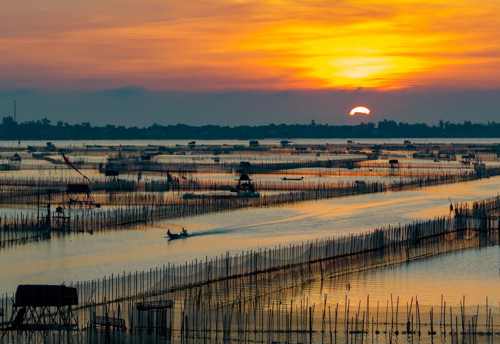
Catching Romantic Sunrise on Chuon Lagoon, Hue
 Make in Vietnam
Vietnam Summer Fair - First Cultural-Industrial Fair Ever in Hue
 Make in Vietnam
Five Vietnamese Businesses Get Permission to Export Chilies to China
 World
World
Top 8 Most Extraordinary Discoveries About Dinosaurs In 2021
Recommended
 World
World
India reports 9 Pakistani Aircraft Destroyed In Operation Sindoor Strikes
 World
World
Thailand Positions Itself As a Global Wellness Destination
 World
World
Indonesia Accelerates Procedures to Join OECD
 World
World
South Korea elects Lee Jae-myung president
Popular article
 World
World
22nd Shangri-La Dialogue: Japan, Philippines boost defence cooperation
 World
World
Pakistan NCRC report explores emerging child rights issues
 World
World
"India has right to defend herself against terror," says German Foreign Minister, endorses Op Sindoor
 World
World