The Best Hiking Routes In The U.K
The wild, dramatic scenery and varied landscape of the United Kingdom has made hiking (or walking) a hugely popular pastime. There’s something for all levels of fitness and enthusiasm with boundless natural scenery to behold.
There's nothing quite like acing up your hiking boots and heading into the great outdoors. The mountains of the UK offer a refreshing dose of fresh air, thought-clearing exercise and an unrivalled sense of freedom. Walking is an excellent way to experience a new place, too – whether you're listening to birdsong, smelling salty sea air or feeling the exhilaration of a bracing wind on your face. The best thing is you don’t have to look far to find a good hiking trail in the United Kingdom, according to Much Better Adventure.
Take a look at these best UK’s hiking routes.
1. Scafell Pike – England
 |
| Photo: Wikipedia |
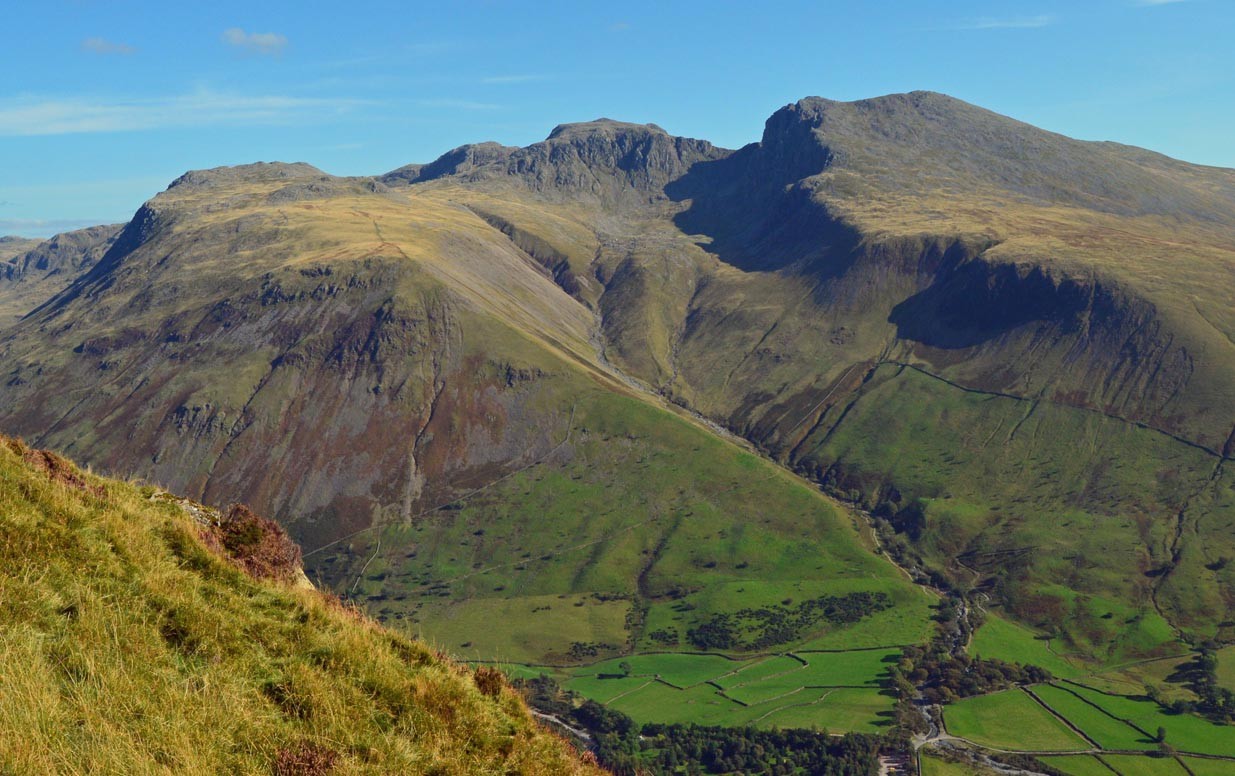
Scafell Pike, at 978 metres, is England's highest mountain and war memorial, cared for by the National Trust as a result of a gift after the war. Thousands of people enjoy Scafell Pike each year with Fix the Fells working year round to manage footpaths and care for the fragile montane habitat. The climb to the top should not be underestimated so, to have the best experience, plan ahead, use a map and compass and check mountain weather conditions before setting off.
Climbing Scafell Pike is a serious undertaking and should not be underestimated. Whichever route you take, it's a tough, steep hike which involves scrambling over hard terrain. Planning and preparation are key whatever the season - there could be high winds, rain, snow, extreme cold or poor visibility. So, check the mountain forecast, have the right clothing and equipment and know how to use it.
2. Hadrian's Wall
 |
| Photo: BBC |
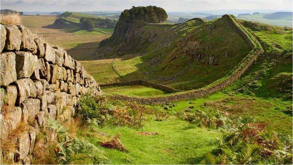
Following the line of Hadrian’s Wall from coast to coast, the National Trail is an 84-mile pathway that passes through a landscape walkers love for its diversity; bracing moorland gives way to cheerful fields, copses open out onto sky-filled vistas and all that green eventually gives way to dynamic city streets. For most of its 84 miles, the route crosses natural grass; only when you hit the most easterly urban section will you be walking on tarmac. Although most of the terrain is relatively easy, the 23-mile central section between Chollerford and Birdoswald is hilly with a series of short, sharp climbs and descents following in quick succession. Finding your way along the National Trail is easy; you can rely both on the familiar acorn symbol, as well as marking arrows.
For some, completing the trail in its entirety is the objective. It takes approximately a week to walk from one end of the frontier to the other, depending on how long you’d like to spend visiting the Roman forts and settlements along the way. Those who do intend to walk end-to-end can join the Passport scheme, which runs between May and October each year. Simply buy your passport, have it stamped at seven specific spots along the route and claim your enamel badge and achievers’ certificate. However, there also are plenty of shorter routes and circular walks that take in stretches of the Trail so walkers of all abilities are catered for.
The Hadrian’s Wall National Trail’s upkeep and protection is overseen by Northumberland National Park Authority, English Heritage, Cumbria and Northumberland County Councils, Newcastle City Council and Natural England. Before setting out to walk the Trail read the Code of Conduct, which sets out how you can help preserve and protect this heritage site for future generations.
3. Ben Nevis Mountain Path
 |
| Photo: Steven Fallon |
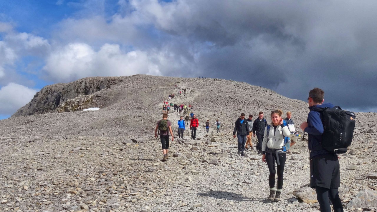
Ben Nevis Mountain Path is a 15.8 kilometer out and back trail located near Fort William, Highland, Scotland that features a waterfall and is rated as difficult. The trail is primarily used for hiking and walking and is accessible year-round.
The UK's highest mountain, "The Ben" or Ben Nevis, is frequently travelled. Sometimes rugged and rocky, this mountain track features wildlife, birding, a waterfall, and beautiful landscape. Start from the car park of the Glen Nevis Visitor Centre, near Fort William. Follow the Mountain Path to the summit. At the summit plateau, you'll find some ruins and a sweeping view. Come prepared for sudden changes in weather conditions and rocky, uneven surfaces.
4. South West Coast Path
 |
| Photo: Outdooractive |
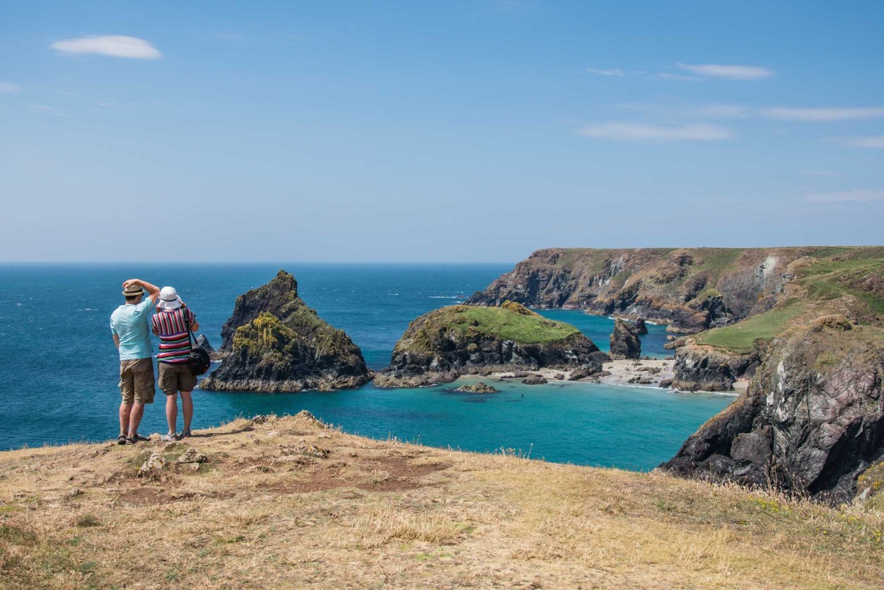
The South West Coast Path is England's longest waymarked long-distance footpath and a National Trail. It stretches for 630 miles (1,014 km), running from Minehead in Somerset, along the coasts of Devon and Cornwall, to Poole Harbour in Dorset. Because it rises and falls with every river mouth, it is also one of the more challenging trails. The total height climbed has been calculated to be 114,931 ft (35,031 m), almost four times the height of Mount Everest. It has been voted 'Britain's Best Walking route' twice in a row by readers of The Ramblers' Walk magazine, and regularly features in lists of the world's best walks.
The final section of the path was designated as a National Trail in 1978. Many of the landscapes which the South West Coast Path crosses have special status, either as a national park or one of the heritage coasts. The path passes through two World Heritage Sites: the Dorset and East Devon Coast, known as the Jurassic Coast, was designated in 2001, and the Cornwall and West Devon Mining Landscape in 2007.
In the 1990s it was thought that the path brought £150 million into the area each year, but new research in 2003 indicated that it generated around £300 million a year in total, which could support more than 7,500 jobs. This research also recorded that 27.6% of visitors to the region came because of the Path, and they spent £136 million in a year. Local people took 23 million walks on the Path and spent a further £116 million, and other visitors contributed the remainder. A further study in 2005 estimated this figure to have risen to around £300 million. Following investment through the Rural Development Programme for England, more detailed research was undertaken in 2012, and this found the annual spend by walkers to have risen to £439 million which sustains 9771 full-time equivalent jobs.
5. The Quiraing
 |
| Photo: Martin Lawrence Photography |
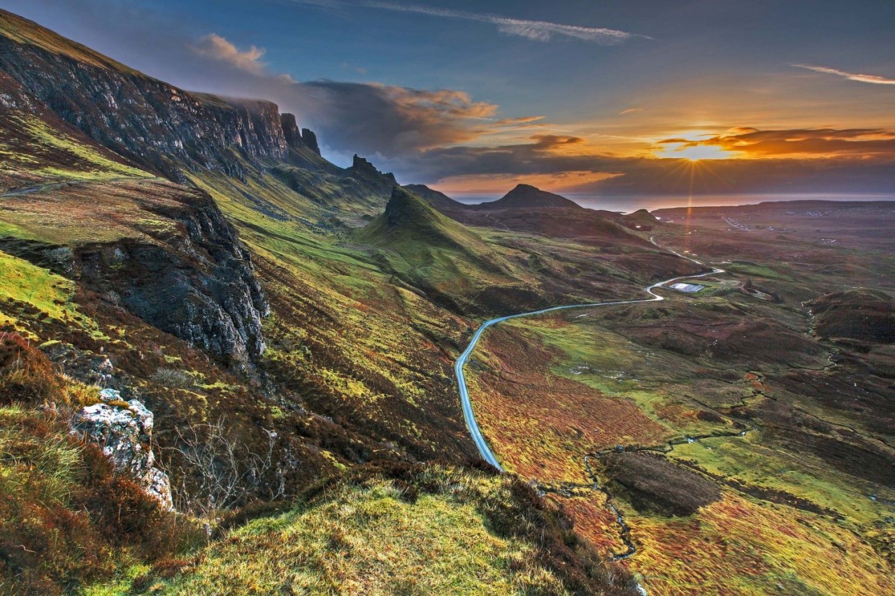
This is an essential walk for any photographer as it passes though some of the most spectacular landscapes in Scotland.
As part of the Trotternish ridge it has been formed by a massive landslip which has created high cliffs, hidden plateaus and pinnacles of rock. Choose a clear day and bring your camera.
The Quiraing walk is a loop, returning you to the same point (the carpark). It covers a distance of 6.8km, with the average time to complete the walk being 2 hours (with no stops).
The Quiraing is situated in the north of Skye in the area known as ‘Trotternish’. The start of the walk is accessed from either of the villages of Staffin or Uig, which are joined by a single track road.
This walk is not suitable in all weather conditions. As it take you near high cliffs so it cannot be recommended in windy conditions or if it’s misty (low visibility).
The carpark is located at the highest part of the single track road 5.5miles from Uig or 2.5miles from Staffin. If traveling from Portree it is 21miles and will take about 30 minutes to drive.
The carpark is not that big so fills up quickly mid-summer, you may need to drive further along the road to find a spot.
6. South Downs Way
 |
| Photo: South Downs Discovery |
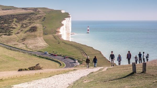
With wildlife, white cliffs and watering holes along the way, the 100-mile South Downs Way is a quintessentially British walk. That’s how it’s earned its place on our list of the best hikes in the UK! It’s also on our list of best hikes in London. Which makes sense, if it’s on this one. The route begins in Winchester, the first capital of England, and traverses pretty countryside until you reach the rippling chalk cliffs at Eastbourne. It takes around eight days to hike the entire easy-to-follow route. The hike is best done from west to east, or it can be split into short sections. Just make sure you stay well away from the edges when traversing the cliffs, well away! There are frequent landslips, and no fence.
Highlights along the way include the Seven Sisters Country Park, the Amberley Working Museum and Devil’s Dyke. It is also dotted with some great pubs, such as the Bull at Ditchling, which is a good spot to rest weary feet.
7. Aberglaslyn Pass
 |
| Photo: Wikipedia |
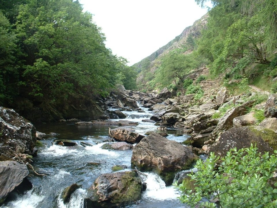
Along this route you'll take in the spectacular Aberglaslyn gorge with the Glaslyn river raging alongside the path, Bedd y Ci (the grave of Prince Llywelyn's faithful hound), the beautiful village of Beddgelert, the placid waters of Llyn Dinas and the old copper mine workings of Sygun and Cwm Bychan.
From the car park, go through a gate near the toilet block and turn left for Aberglaslyn. Walk up through the woods, when you reach the river turn right to follow it upstream. This fisherman's path will take you along the side of the Aberglaslyn gorge. Great care should be taken when negotiating this part of the path, especially the stone buttress above the river. Continue until you reach the railway tracks and take care when crossing: the Welsh Highland Railway service travels between Caernarfon and Porthmadog along this route. Cross the railway line and turn left onto the bridge to cross the river, then turn right towards Beddgelert and continue upstream.
Don't miss the detour on the left to see Gelert's Grave and see if you can spot the special bronze sculpture of Gelert nearby.
At Beddgelert head right over a footbridge then left, following the river upstream, cross a street and go through a gate.
At the next gate, turn right onto a narrow lane, follow this past Sygun Copper mine. At the river, turn right to follow the path upstream towards the lake.
By the lake shore (Llyn Dinas) turn right up a stone-pitched footpath that zig-zags up the hill. At the top continue for half a mile (ignore the first path on the right) at the fork, bear right.
From Bwlch y Sygun take the left path (heading south) then bear right, down Cwm Bychan to the car park.
8. Southern Upland Way
 |
| Photo: Scotland's Great Trails |
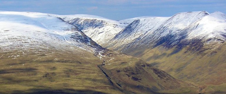
The Southern Upland Way is a 344-kilometre (214 mi) coast-to-coast long-distance footpath in southern Scotland. The route links Portpatrick in the west and Cockburnspath in the east via the hills of the Southern Uplands. The Way is designated as one of Scotland's Great Trails by NatureScot and is the longest of the 29 Great Trails. The Southern Upland Way meets with seven of the other Great Trails: the Annandale Way, the Berwickshire Coastal Path, the Borders Abbeys Way, the Cross Borders Drove Road, the Mull of Galloway Trail, the Romans and Reivers Route and St Cuthbert's Way.
The path is maintained by the local authorities of the two main council areas through which it passes: Dumfries and Galloway Council and Scottish Borders Council; a short section in the Lowther Hills lies in South Lanarkshire. It is primarily intended for walkers, but many parts are suitable for mountain bikers; some sections are also suitable for horse riders. About 80,000 people use the path every year, of whom about 1,000 complete the entire route and a completion certificate can be applied for through the Southern Upland Way official website. It is considered the most difficult of Scotland's Great Trails but also one of the most rewarding to complete passing through some of the UK's most remote land. A popular and less challenging option is to walk it in two stages: typically Portpatrick to Moffat, then Moffat to Cockburnspath at a later date.
 | Three Top Hiking Trails Near Ho Chi Minh City If you love trekking, hiking, immersing yourself in nature, the following trails are good choices for this holiday season. |
 | Emotional Journeys: Hiking Lang Son's "Everest" Experience a thrill with joy and more as you climb this Lang Son mountain peak. |
 | Lao Than - A Splendid Hiking Getaway in Vietnam's Far North Check out Lao Than mountain peak for an exciting cloud hunting adventure. |
Recommended
 Travel
Vietnam Through Australian Eyes: Land of Flavor, Warmth, and Timeless Charm
 Travel
Strategies for Sustainable Growth of Vietnam’s Tourism from International Markets
 Travel
Vietnam Strengthens Its Presence On The Global Tourism Map
 Multimedia
Phong Nha-Ke Bang National Park Named Top Adventure Travel Site
 Travel
Vietnam Welcomes Record-High Number of International Visitors
 Travel
Luxury Train From Hanoi To Hai Phong To Be Launched In May
 Travel
Phong Nha Named Top Budget-Friendly Travel Destination for Spring 2025: Agoda
 Travel


