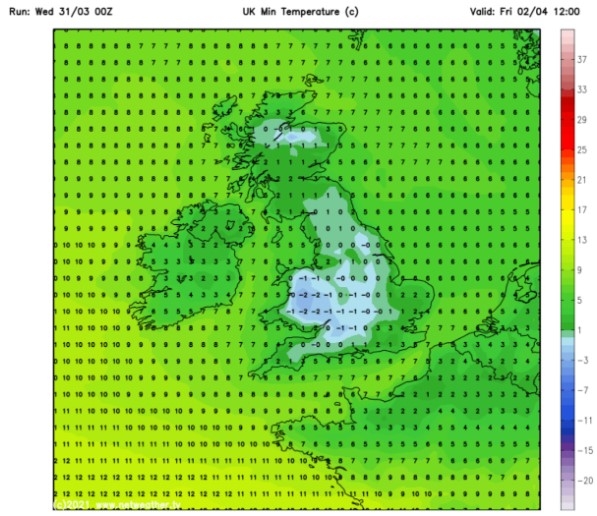
UK and Europe weather forecast latest, December 23: Ferocious Arctic snow bomb sets to bombard Britain
UK's weather forecast
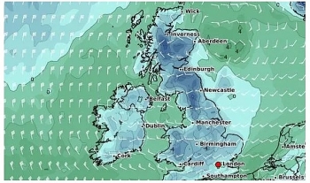
Britain is bracing for a ferocious -5C Arctic snow bomb to hit this week, according to Express.
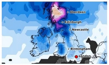
Low pressure is forecast to push across the UK from a northerly direction from Greenland. The latest snow risk maps from Netweather turn red in the southwest of England on Sunday, December 27, suggesting there is up to 85 percent chance of snow in Bristol, Birmingham, and Oxford. The maps also show more red and green swirls of snow surrounding western Scotland and most of the northeast and west of England on the same day.
Central Scotland is also predicted to be hit with a barrage of six inches of snow on Sunday, according to WXCHARTS' snow depth models. But the next day the snow depth could rise as high as 17 inches in the same area.
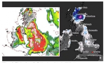
Temperatures could also plummet to freezing sub-zero levels by the end of the week, with Scotland potentially seeing -5C on Sunday. The cold air is expected to sweep down to the northwest regions including Carlisle being blasted with -2C.
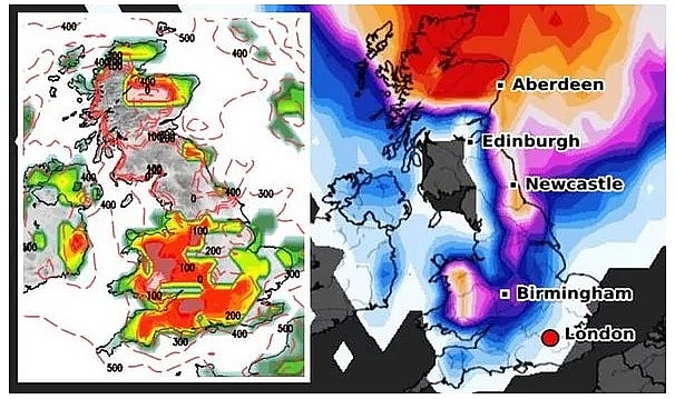 |
| UK snow forecast: A fierce Artic blast could smash into the UK this week (Image: WXCHARTS) |
Gavin Partridge, the owner of GavsWeatherVids, warned cold northerly air from Greenland is expected to be pulled towards the UK. He said: "The suggestion for December 27 is rain, sleet, and snow rotating around. Temperatures will also begin to drop on Sunday. In the south, temperatures will be around 5C and 6C but around Wales, temperatures will struggle to get much above freezing."
"By Monday, a cold jet stream with a mid-Atlantic ridge is heading up towards Greenland pulling in these cold northerly winds."
Netweather's Jo Farrow added freezing low temperatures are likely to last all through the festive week. She said: "This week will be turning colder with perhaps the white coating of frost to start Friday and finally drier after all this rain. A colder start away from southeast Britain where the mild air manages to hold on."
"There will have been further pulses of heavy rain for overnight, but Tuesday looks ore settled, sunny and fine although still with more cloud over southern England."
"Later in the day, showery outbreaks of rain begin to edge in from the southwest as the midweek low gets closer. That brings more rain in the south but as it clears, with strong winds, it will draw down much colder air Wednesday night into Christmas eve and that cold air will still be over the UK when Santa visits."
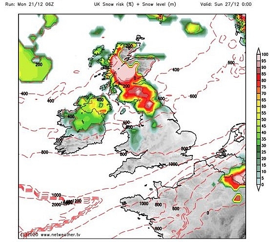 |
| UK snow forecast: The snow charts turn red in Scotland this week (Image: NETWEATHER) |
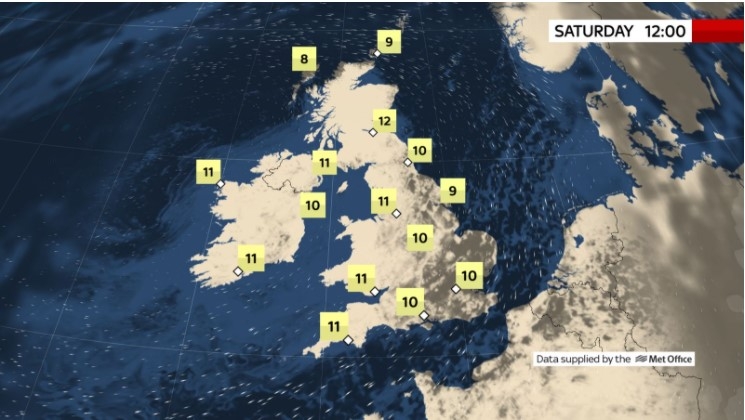
The Met Office's forecast for the end of December added cold air will strike after a slightly warmer Boxing Day on Saturday.
It said: "A ridge of high pressure extending across the country on Christmas Day bringing mainly dry conditions with southern areas seeing the most prolonged sunshine."
"Rather cold with a widespread frost to start the day. Cloud amounts increasing from the northwest with more unsettled conditions spreading southeast across the country into Boxing Day."
"Very unsettled conditions continuing to dominate through to the end of the year with spells of heavy rain and strong winds. After a milder interlude on Boxing Day, turning colder again with hill snow expected, also a chance of snow down to lower levels in places."
"Rather cold, showery conditions look likely to continue into early January. However, there is an increased chance of pressure building from the southwest which may bring drier, more settled conditions for a time."
The BBC's long-range forecast predicted the cold weather could linger into early January.
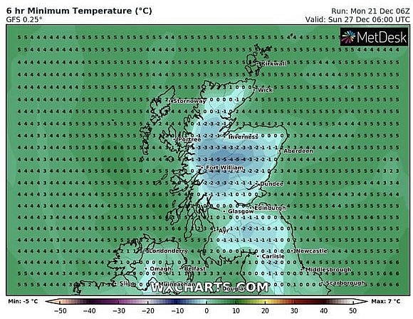 |
| UK snow forecast: Temperatures could fall as low as -5C (Image: WXCHARTS) |
The long-range forecast said: "A ridge of high pressure extending across the country on Christmas Day bringing mainly dry conditions with southern areas seeing the most prolonged sunshine. Rather cold with a widespread frost to start the day."
"Cloud amounts increasing from the northwest with more unsettled conditions spreading southeast across the country into Boxing Day. Very unsettled conditions continuing to dominate through to the end of the year with spells of heavy rain and strong winds."
"After a milder interlude on Boxing Day, turning colder again with hill snow expected, also a chance of snow down to lower levels in places. Rather cold, showery conditions look likely to continue into early January. However, there is an increased chance of pressure building from the southwest which may bring drier, more settled conditions for a time."
On December 23
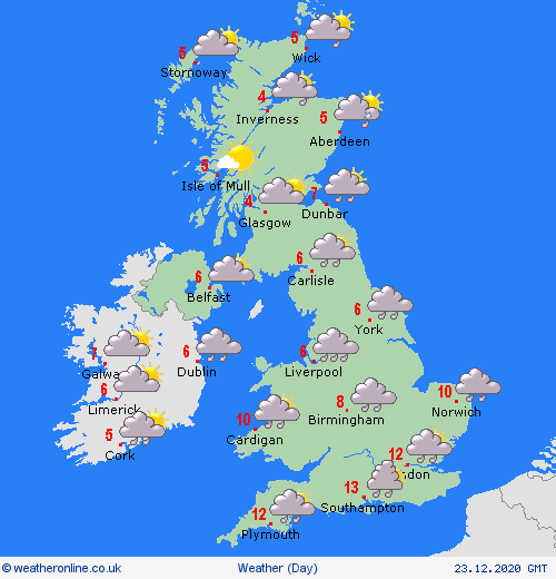
According to Weather Online, an area of low pressure will cross southern England on Wednesday. This will bring cloud and strong winds as well as rain to many areas of England and Wales. The rain may be heavy at times and could lead to local flooding.
 |
| Photo: Weather Online |
A tendency for the rain to turn to snow over the high ground of northern England and Wales, especially later in the day. Some heavy showers across southern England where there may be a few bright spells. Brighter and colder across Scotland and Ireland with some wintry showers affecting the north and east of Scotland. Highs at 13C in the south, 2 to 5C in northern areas.
Europe's weather forecast
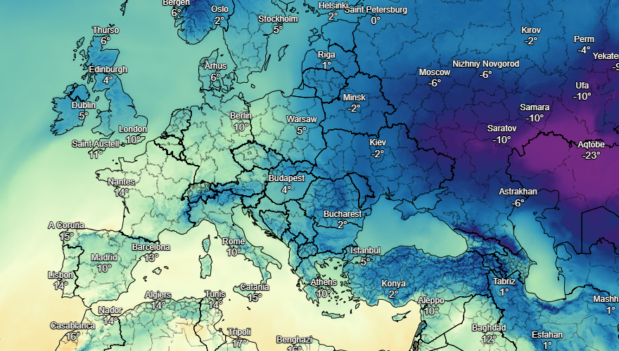
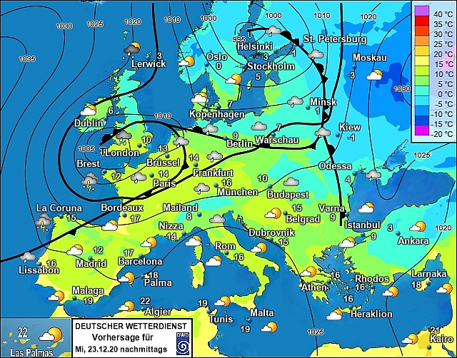
Fair over most of Spain and Portugal on Friday, although there will be some rain in the far northwest. Showers again in the Balearics and around Corsica and Sardinia. Greece and Turkey are staying in fine weather with plenty of sunshine.
More sunshine to come through France, although some rain in the far northwest later. The Low Countries will be breezy with some sunny spells. Germany will be dry with more sunshine to come here. Further sunshine in Poland and dry. Austria and Hungary should be dry and this dry and sunny weather is expected to extend into Switzerland too.
 |
| Photo: Stirimeteo |
 |
| Photo: Stirimeteo |
Breezy through Denmark with a broken cloud. The Baltic States will have a broken cloud. Some brightness in Finland after morning rain clears. Sweden will have rain and strong winds to the south but dry in the north. Breezy for Norway with a risk of some rain and showers.
On December 23
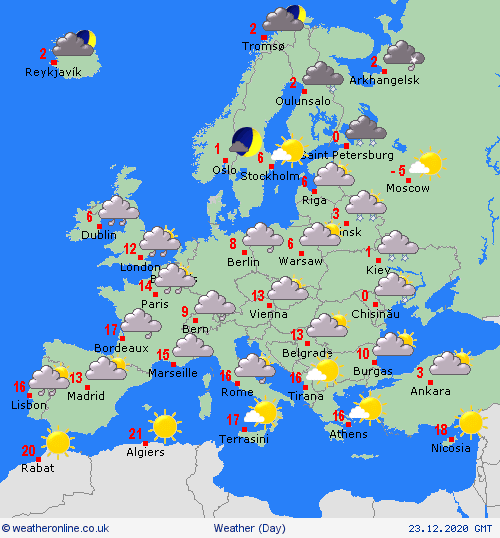
Rain in Portugal as well as northwest Spain today. Fine for the rest of Spain with good spells of sunshine. Staying fair across the Balearics and Italy with more sunshine here. Fine too in Greece and Turkey with plenty of sunshine.
 |
| Photo: Weather Online |
France will be windy in the north with outbreaks of rain and showers. To the south, it will be drier with some sunny spells. Heavy rain across the Low Countries and much of central and northern Germany. Poland will be far in the north but with rain to the south. Austria and Hungary as well as Switzerland will be dry, with plenty of sunshine to come here.
A mainly fair day in Denmark. Staying dry across southern Sweden and the Baltic States. Wind and some showers in Finland as well as northern Sweden. Norway will have showers on the coasts with more persistent rain in the north.
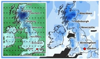 | UK and Europe weather forecast latest, December 19: Snow fall to cover over the festival period in Britain Britain is forecasted to brace for freezing weather with snow covering over Christmas Day. Meanwhile, rain is expected for western Europe and dry conditions to ... |
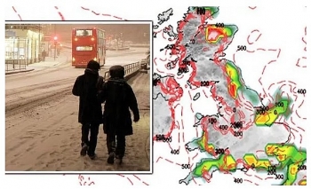 | UK and Europe weather forecast latest, December 18: Conditions turn colder with snow over northern hills for Christmas A white Christmas with snow and freezing temperatures are forecasted in the UK as a cold northerly flows from the Artic. Meanwhile, fair conditions is ... |
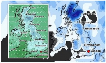 | UK and Europe weather forecast latest, December 17: Bitterly cold air brings wintry conditions and snow to cover the UK The UK is forecasted to cope with bitterly cold weather carrying wintry conditions and snow to cover over the festival period. Meanwhile, heavy rain sets ... |
Recommended
 World
World
India strikes back at terrorists with Operation Sindoor
 World
World
India sending Holy Relics of Lord Buddha to Vietnam a special gesture, has generated tremendous spiritual faith: Kiren Rijiju
 World
World
Why the India-US Sonobuoy Co-Production Agreement Matters
 World
World
Vietnam’s 50-year Reunification Celebration Garners Argentine Press’s Attention
 World
World
"Will continue offering our full support to Indian govt": US FBI Director after Pahalgam attack
 World
World
"Great Leader": JD Vance Lauds PM Modi During His India Visit
 World
World
Trump’s Tariff Pause: A Strategic Move from “The Art of the Deal”?
 World
World

