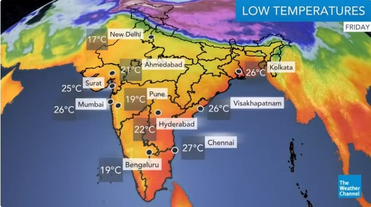
India daily weather forecast latest, February 4: Widespread rain, snow with thunderstorms, lightning and hail expected in some regions
According to Skymet Weather, a Western Disturbance is over North Pakistan and adjoining area. An induced cyclonic circulation is over Central Pakistan and adjoining parts of a Rajasthan.
A cyclonic circulation is persisting over Bangladesh. Another cyclonic circulation in the lower levels is over the south-east Arabian Sea.
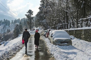
During the next 24 hours, light rain and snow may occur over Jammu and Kashmir, Gilgit Baltistan, Muzaffarabad, isolated pockets of Himachal Pradesh and Ladakh.
Rain and snow activities will increase over Uttarakhand. Scattered rain is possible over parts of Punjab. Minimum temperatures will increase for the over Northwest, Central and Eastern parts of the country. The intensity of fog will reduce further over Punjab, Uttar Pradesh, and Bihar.
A Western Disturbance is likely to cause widespread rain in northwestern, central, and parts of eastern India from Wednesday, the Indian Meteorological Department (IMD) said and issued a moderate intensity rain warning for Roorkee, Gangoh, and Saharanpur.
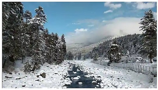 |
| Representational image. (ANI) |
An induced cyclonic circulation over central Pakistan and adjoining western Rajasthan was likely to affect the weather in north-western India and the western Himalayan region from Tuesday night. “The confluence of south-westerlies in association with the Western Disturbance and lower level southeasterlies is very likely over the plains of northwest and adjoining areas of central India during February 3 to 5 [Wednesday to Friday],” the IMD said in a statement.
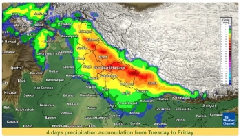
Under the influence of these systems, widespread light to moderate rainfall or snow with isolated thunderstorms, lightning, and hail was likely in the western Himalayan region until Friday.
Heavy rainfall or snowfall is also expected in Jammu & Kashmir on Wednesday and Thursday and Himachal Pradesh on Wednesday.
Moderate rain or thundershowers with isolated lightning and hailstorm is likely in northwestern India from Wednesday to Friday and in Madhya Pradesh, eastern Uttar Pradesh, Bihar, and Jharkhand on Thursday and Friday, Hindustan Times reported.
“It will be an intense Western Disturbance, which is likely to impact a very large area from northwest to east India. Rain and thunderstorms are likely in the entire stretch,” said RK Jenamani, senior scientist, National Weather Forecasting Centre.
The Western Disturbance will bring rain to the plains also because there is an induced cyclonic circulation over western Rajasthan. “There is also moisture incursion from the Arabian Sea. Rain will begin from Wednesday night. Light to moderate rain is likely in Delhi-NCR [National Capital Region] on February 4 [Thursday] and over Uttar Pradesh and Bihar on February 4 and 5 [Thursday and Friday],” said Kuldeep Shrivastava, head, Regional Weather Forecasting Centre.
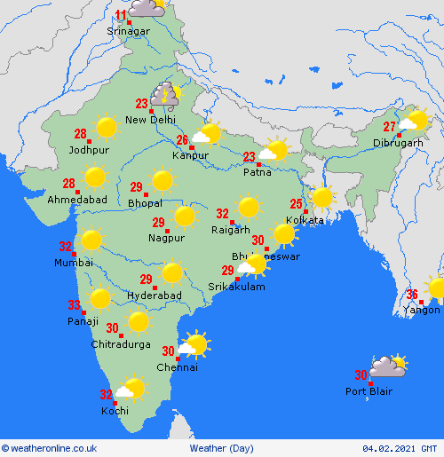 |
| Photo: Weather Online |
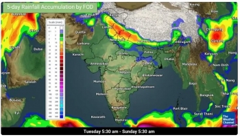
5-Day Nationwide Weather Forecast
According to Weather.com, a western disturbance is very likely to impact the plains of northwest India from today. The system is expected to bring—scattered to fairly widespread—light to moderate rain or snow over Jammu & Kashmir, Ladakh, Gilgit-Baltistan and Muzaffarabad on February 3. In addition, some isolated areas of these places are also likely to witness thunderstorms, lightning and hail on Wednesday.
Likewise, these aforementioned weather conditions are predicted to prevail over Himachal Pradesh on February 3-4 and over Uttarakhand on February 4-5. The best snowfalls of 15-50 cm are expected across northern parts of Himachal Pradesh and Uttarakhand for the next three days from Wednesday to Friday.
As per the India Meteorological Department (IMD), the interaction between this western disturbance and lower level southeasterlies from the Bay of Bengal is likely to cause isolated to fairly widespread light to moderate rain over Punjab, Haryana, Chandigarh, Delhi, north Rajasthan, northwest Madhya Pradesh and west Uttar Pradesh on February 4. Moreover, these similar conditions are in forecast over east Uttar Pradesh, east Madhya Pradesh and north Chhattisgarh for February 5.
High humidity is expected to give rise to dense fog and the resultant low visibility across Punjab on Friday morning.
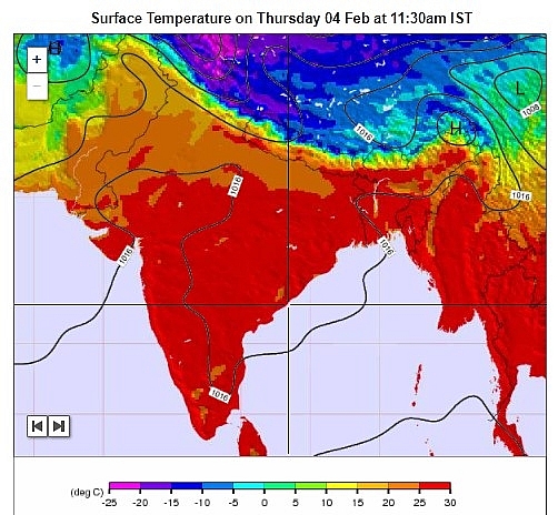 |
| Photo: Weather-Forecast.com |
Other areas are likely to experience dry weather conditions during this forecast period. Some parts of Arunachal Pradesh may witness isolated snow.
Maximum temperatures will be warmer than normal across Rajasthan and the adjoining areas on Wednesday with southerly winds. As northwesterly winds gradually get notable across northern plains, temperatures both in maximums and minimums are expected to decrease this weekend.
Regional Forecast
 |
| Photo: IMD |
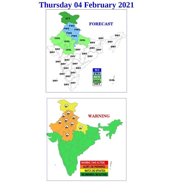
Widespread snow/rain and thunderstorms are likely over Himachal Pradesh and Uttarakhand. Scattered rain and thunderstorms are possible over Punjab, Haryana, and Uttar Pradesh. Isolated snow/rain and thunderstorms are possible over Jammu & Kashmir.
Isolated snow/rain is expected over Ladakh and Arunachal Pradesh. Isolated rain is possible over Andaman & Nicobar Islands. Dense fog is likely at isolated places of north and central India.
 | India daily weather forecast latest, January 31: Cold wave to persist parts of Northwestern India for days India is forecasted to bear cold conditions over parts of Northwestern for the next 2-3 days and lowest minimum temperature is expected at -0.3 degree ... |
 | India daily weather forecast latest, January 30: Wet, cold weather and dense fog to cover over plain areas of some parts India is forecasted to cope with wet, cold weather and dense fog over the plain areas of Northern, Nort-Central and Northeast parts for the next ... |
 | India daily weather forecast latest, January 29: Light rain, snow to cover Northeast India as cold conditions persist India is forecasted to cope with cold weather persisting over northwest till the weekend while light rain or snow are expected to cover northeast. |
Recommended
 World
World
Thailand Positions Itself As a Global Wellness Destination
 World
World
Indonesia Accelerates Procedures to Join OECD
 World
World
South Korea elects Lee Jae-myung president
 World
World
22nd Shangri-La Dialogue: Japan, Philippines boost defence cooperation
 World
World
Pakistan NCRC report explores emerging child rights issues
 World
World
"India has right to defend herself against terror," says German Foreign Minister, endorses Op Sindoor
 World
World
‘We stand with India’: Japan, UAE back New Delhi over its global outreach against terror
 World
World

