Super Typhoon Haishen predictedly record-breaking hits Okinawa Japan Sunday
| Super typhoon slams into China after pummelling Philippines, Hong Kong | |
| Super Typhoon Mangkhut smashes into Philippines | |
| Urgent preparations as super typhoon Mangkhut closes in on Philippines |
 |
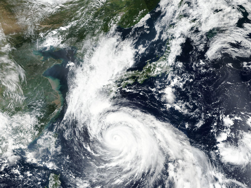
| Typhoon Haishen is poised to make landfall in southwestern Japan Sunday, bringing with it heavy rains and lashing winds. Forecasters predict it will then head toward the Korean peninsula. AP |
A powerful typhoon is making its way toward southwestern Japan, forcing authorities to urge caution and prepare for powerful winds and heavy rainfall.
With sustained winds up of up to 180 kilometers (112 miles) per hour, Haishen remains on course to make landfall in Okinawa by Sunday and reach the main southern island of Kyushu shortly afterward, according to the Japan Meteorological Agency.
The storm is predicted to hit Okinawa Sunday, before moving onto the central island of Kyushu. Japanese meteorologists predict the winds, heavy rains and high tide will begin lashing the islands ahead of Haishen's arrival.
The Japan Times reports Okinawa is expected to be hit by winds strong enough to topple homes. TheAP reports that the storm is predicted to drop 4 to 8 inches of rain across southwestern Japan and is expected to make landfall with the equivalent conditions to a Category 3 or Category 4 hurricane.
Officials with Japan's Meteorological Agency warn that rivers and levees may overflow due to heavy rainfall.
Japanese broadcaster NHK reports that an emergency warning is expected for Sunday and that residents are being urged to remain alert and prepare to evacuate early in line with advisories and local government orders.
The impact of the Category 5 typhoon will be felt in southern Japan long before its 36-mile-wide center reaches the coastline.
 |
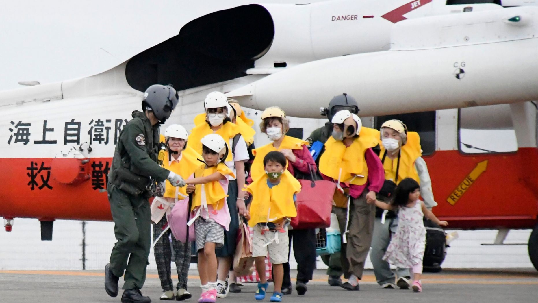
| People arrive at a heliport in Kagoshima to take refuge ahead of a powerful typhoon. (Kyodo News via AP) |
Haishen, whose name means “sea god” in Chinese, is also expected to slam the Korean Peninsula near Busan -- South Korea's second-largest city -- on Tuesday, according to The Associated Press. Recent measurements showed the system moving northward at 15 kph (9 mph), according to the foxnews.
Meteorological agency official Yoshihisa Nakamoto told reporters he was worried about people staying home instead of fleeing due to fears about the COVID-19 pandemic.
“You should not avoid getting out because of such fears,” he said.
 |
The typhoon is forecast to have atmospheric pressure of 915 hectopascals at its middle point, and sustained winds of up to 198 kph (123 mph) on Sunday, the meteorological agency noted.
Earlier last year, Typhoon Maysak battered the same region, injuring dozens and cutting power to thousands of households.
 | Nearly 7,000 Korean people displaced by torrential rains, Vietnam sends condolences Prime Minister Nguyen Xuan Phuc on August 10 sent a message of condolences to Prime Minister of the Republic of Korea (RoK) Chung Sye-kyun over great losses in ... |
 | Super typhoon Mangkhut to hit Vietnam on September 17 Super Typhoon Mangkhut is forecast to hit the northern mainland of Vietnam on September 17 and 18, according to the National Centre for Hydro-Meteorological Forecasting ... |
 | Typhoon and super typhoon expected in East Sea this week The National Centre for Hydro-meteorological Forecasting (NCHMF) on September 10 announced that a tropical low-pressure is forming in the eastern territorial waters of Taiwan (China). |
Recommended
 World
World
‘We stand with India’: Japan, UAE back New Delhi over its global outreach against terror
 World
World
'Action Was Entirely Justifiable': Former US NSA John Bolton Backs India's Right After Pahalgam Attack
 World
World
US, China Conclude Trade Talks with Positive Outcome
 World
World
Nifty, Sensex jumped more than 2% in opening as India-Pakistan tensions ease
Popular article
 World
World
Easing of US-China Tariffs: Markets React Positively, Experts Remain Cautious
 World
World
India strikes back at terrorists with Operation Sindoor
 World
World
India sending Holy Relics of Lord Buddha to Vietnam a special gesture, has generated tremendous spiritual faith: Kiren Rijiju
 World
World


