Vietnam - China Borders Hotspots: Where is Ai Nam Quan (Friendship Pass)?
| Vietnam - China Land Border | |
| New evidence cast doubt on China to deploy bombers near the disputed border with India | |
| The Definition of National Territory and Border |
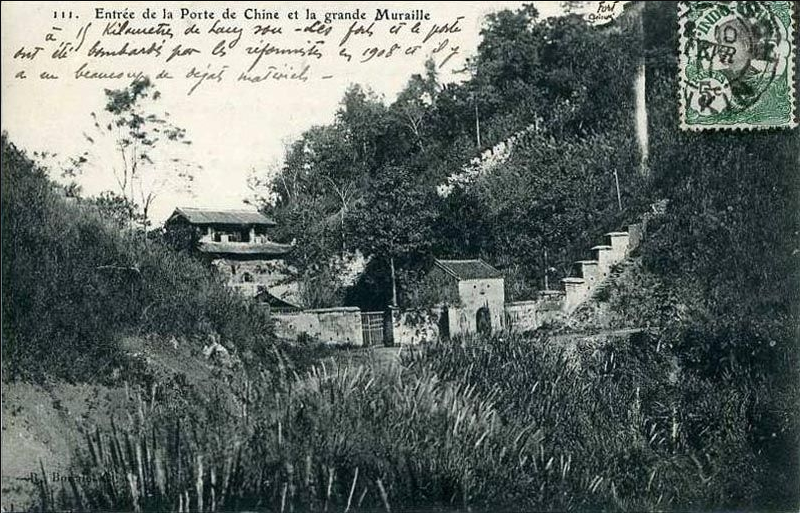 |
| A photo of Nam Quan in the early 20th century |
To clarify these questions and doubts, as a person directly involved in the process of negotiation, border delimitation and abornement, the author - Dr. Tran Cong Truc, would like to provide official information about the settlement process in some areas which are considered as the "hotspot" of the Vietnam-China land border.
"Huu Nghi Quan" (Friendship Pass), also known as "Ải Nam Quan", "Mục Nam Quan" (the gate that looks towards the South), is a China-Vietnam border gate located in Aikou Village, Youyi town, Pingxiang City, Guangxi Zhuang Ethnic Autonomous Region. Huu Nghi Quan is 15km from Pingxiang (China) to the west and 5km from Dong Dang (Vietnam) to the north.
The Huu Nghi Quan border area is one of 164 type C areas, which was formed after Vietnam and China compared the proposed 1994 border map. This area relates to the border section crosses the road connecting the two countries and the intermodal railway.
The Vietnam-China border crosses the road described in the Convention on Border Delimitation signed in 1886 between France and the Qing dynasty as "the border lies in the south of Nam Quan, on the road from Nam Quan to Dong Dang village". When demarcating, France and Qing Dynasty (China), installed landmark 18 to fix this border, the location of this landmark is also described as "lying on the road from Nam Quan to Dong Dang". However, this landmark was lost. On the map of French-Qing landmarks in 1894, there is a place named "Nam Quan" shown on the North of the border.
 |
| Dr. Tran Cong Truc in a field survey on the Vietnam - China border |
According to the Convention on Border Delimitation signed by France and the Qing on July 4, 1896, the border of Nam Quan region is described verbatim:
"La Commission de Délimitation Franco-Chinoise a reconnu, le sept avril mil huit cent quatre-vingt-six, qu’à partir du point situé à cent mètres en avant de la Porte de Nam-Quan, sur la route de Nam-Quan à Ðồng-Ðăng, la frontière remonte à l’Ouest jusqu’au sommet de la montagne rocheuse sur lequel est situé le fort marqué A sur le croquis ci-joint,…"
Roughly translated:
The France-China Delimitation Commission recognizes, from the point located one hundred meters from the Nam-Quan Pass, on the road from Nam-Quan to Ðồng-Ðăng, the border heads west to the top of the rocky mountain on which the fort marked A on the attached map is located,…
According to the Convention on the Fieldwork Abornement dated April 21, 1891, Nam Quan area is determined as follows:
“18th column, the suburb of Nam Quan Town 鎭 南 關 外: On the road from Nam Quan to Dong Dang, about 100 meters to the south of the gate. Originally in French: "A environ 100m en avant de la porte de Nam-Quan.”
Thus, based on the legally valid documents under the Agreement on Fundamental Principles for Settlement of Territorial Border Issues signed by Vietnam and China in 1993, it is clear that the borderline in this area is always lying to the south of "Ải Nam Quan", not cutting through "Ải Nam Quan " as subconsciously understood by the Vietnamese.
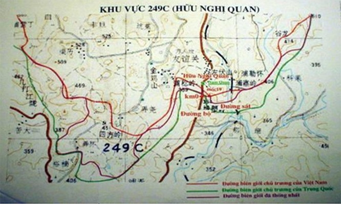 |
| Vietnam-China demarcation map in the area of Nam Quan |
When showing the proposed border in this area, Vietnam drew the borderline (in red on the above map). Accordingly, the proposed borderline of Vietnam is not drawn through the "Ải Nam Quan" but to the south "Ải Nam Quan". Besides, China's proposed border (in green on the map) is drawn southward, passing through the column of Km0 on the road connecting the two countries. With these two different borderlines, the two sides form the quite wide 294C area, stretching from west to east of the road.
While negotiating to delimit the border in this area, neither of the two countries have enough decent legal basis to protect their proposed border. Therefore, both countries agreed to choose a borderline in compliance with the principles for delimiting border in category C areas where each side has its own perceptions, which was previously agreed by the two countries.
The purple line on the attached diagram is the final borderline that both sides accept, in accordance with the basic principles agreed by them, ensuring fairness and satisfaction, together with long-term fundamental interests of the two countries.
Thus, there is no way that Vietnam has "ceded" Ải Nam Quan to China as many people speculate based on their non-objective feelings or information of no legal validity.
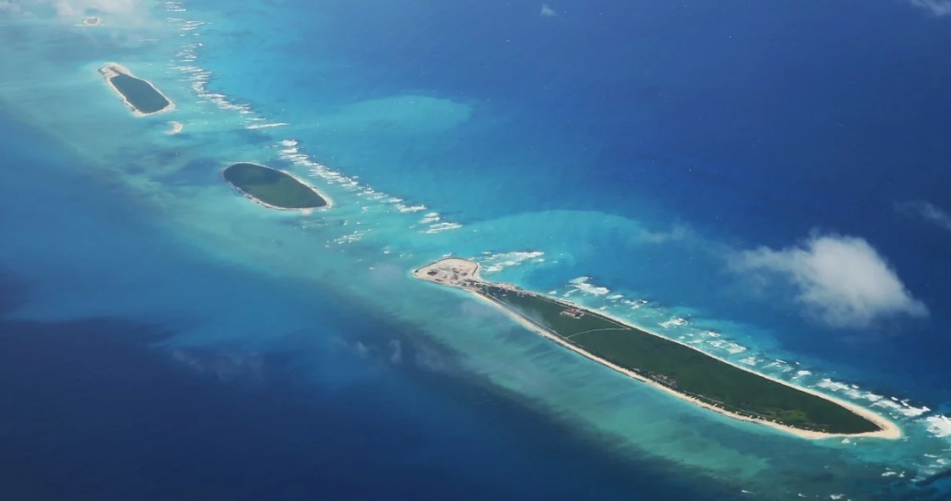 | Vietnam resolutely opposes Chinese illegal moves in South China Sea (Bien Dong Sea) In response to the news that China sent warships and fighters to Vietnam's Hoang Sa (Paracel) archipelagos in Bien Dong Sea (South China Sea internationally known) that China ... |
 | Vietnam and China discuss measures to resuming socio-economic activities Deputy Foreign Minister Le Hoai Trung, Vietnam’s General Secretary of the Steering Committee for Vietnam–China Bilateral Cooperation, held an online conference with the committee’s Chinese ... |
 | Hundreds of fruit trucks still jammed at border gates with China Hundreds of fruit container trucks have remained stuck for days at border gates in the northern province of Lang Son, bordering China where millions of ... |
Recommended
 Seas and islands
RoK Navy Ship Pays Friendly Visit to Da Nang City
 Seas and islands
Naval Region 5 Promotes Reading Culture, Fosters Patriotism
 Seas and islands
Coast Guard Region 2 Command Hosts Philippine Coast Counterpart
 Seas and islands
Vietnam - Thailand Navy: Coordination to Well Address Problems at Sea
 Seas and islands
Honoring the Fallen: Incense Offering for the 37th Anniversary of Gac Ma
 Seas and islands
Vietnam Coast Guard Expands International Cooperation for Maritime Security
 Seas and islands
Three Vietnamese Fishermen Saved Off Jeju Coast
 Seas and islands

