Vietnam - China Land Border
| The Definition of National Territory and Border | |
| Vietnam territory: throughout history and in the new era | |
| Vietnam - Cambodia agree 500 sets of border topographic maps |
History and establishment of land border
Vietnam - China border was planned, demarcated and marked for the first time in the June 26, 1887 Borderline Convention and the June 20, 1895 Supplementary Convention between the Government of France (on behalf of Vietnam at that time) and the Qing dynasty (of feudal China).
After revolution in each country, in the late 1950s, Vietnam and China agreed to maintain the borderline as in the aforementioned two conventions signed by French government and Qing dynasty in 1887 and 1895. Border re-planning process will be done at another appropriate time.
Amid 1970s, Vietnam and China started official borderline negotiations. Due to many reasons, two countries could not make any progress and negotiations were delayed in a long period. After the normalization of their relations in November 1991, Vietnam and China agreed to conduct negotiations on settlement of border issues, including:
- In November 1991, Vietnam and China signed a provisional agreement on the settlement of affairs in border areas, including the management of borderline on the basis of actual situation, the authority to resolve border issues at governmental level and the matter of maintaining border markers.
- In October 1993, Vietnam and China signed the agreement of basic principles on territorial and border issues, in which both countries agreed to open 4 forums on territorial border negotiations in 3 levels of experts and 1 governmental level.
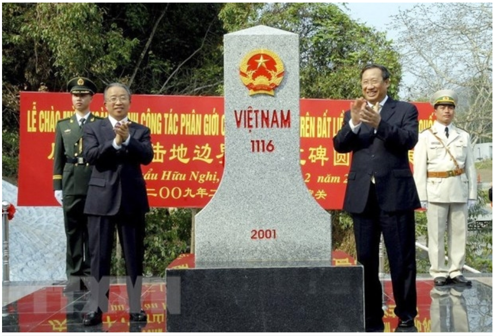 |
| Vietnamese Deputy Prime Minister, Foreign Minister Pham Gia Khiem and Chinese State Councilor Dai Bingguo at the landmark 1116 (Vietnam side) in the ceremony of demarcation of land border markers in February 23, 2009 at Huu Nghi border gate (Lang Son). (Photo: Nhan Sang/TTXVN) |
Legal basis of negotiations were approved as follows: “Both sides agree to compare and redefined the entire Vietnam-China land borderline founded on the Convention on Border Delimitation concluded by China and France on June 26, 1887, and the Additional Convention on Border Delimitation on June 26, 1895, and other enclosed documents and delimitation and demarcation maps, confirmed or defined by the above-mentioned two Conventions, as well as founded on clearly demarcated markers.”
From February 1994 to December 1999, two countries held 6 meetings at governmental level, 16 rounds of joint working groups and 3 rounds of drafting the Treaty.
In the second round held in July 1994, both sides exchanged maps showing the borderline defined unilaterally. Through comparison, of the total length of about 1,360 km, a nearly dispute-free 870 km (accounting for 67% of the total length of the border line) was viewed the same by both sides, and some 436 km saw divergent opinions regarding 289 areas with the total square of 236 km2. These areas include 74 areas A with differences arising from overlapping of drawn lines, 51 areas B with differences arising from an absence of a line and 164 areas C with differences of positions due to different interpretations of the conventions and disputes.
Demarcation and border management
In December 1999, Vietnam and China officially signed the Land Border Treaty, ratified by the National Assembly of the two countries in 2000. In this treaty, the direction of the borderline is given in text and is shown in a red line on topographic map at scale of 1/500,000. Based on this Treaty, from December 2001, two sides demarcated and planted landmarks.
By the end of 2008, demarcation process was completed. As a result, the exact length of the borderline is 1,449,566 km, of which 383,914 km goes along rivers and streams, plugging 1,970 milestones, including 1,548 major landmarks and 422 auxiliary landmarks.
The process of resolving border and territorial disputes to establish a clear, regular, modern and sustainable system of border lines and landmarks between Vietnam and China is a lengthy process. Over 30 years, both sides have to overcome many difficulties and obstacles, not only due to history but also due to the causes of natural conditions, scientific and technical, political, legal, psychological, emotional matters.
There are three stages in the process of settling the land border issue between Vietnam and China, including: Principal Negotiation, Border Planning and Demarcation. This process is fully consistent with the international legal principles and procedures that both sides agreed to apply, derived from the legitimate interests of the two countries, meeting the aspirations and interests of the two peoples.
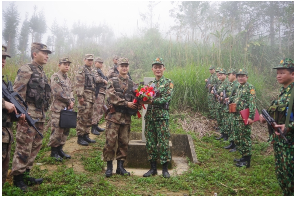 |
| Patrol squads of the two sides met at the landmark 125 (Photo: Thoi Dai) |
After completing the demarcation process, in order to cooperate on protection and management of borders and national landmarks, Vietnam and China in 2009 signed the Agreement on Management of Vietnam-China Land Borders and the Agreement on Vietnam-China border gates and management regulations of border gates. In 2015, the two sides officially signed the Agreement on free boats and ships in the Bac Luan estuary and the Agreement on cooperation, exploitation and protection of tourism resources in Ban Gioc waterfall.
After signing the Agreement on Vietnam-China land border management regulations in 2009 and to implement the above-mentioned Agreement, Vietnam issued a Government Decree detailing the border area, border belt and restricted area (Decree No. 34/2014/ND-CP dated April 29, 2014). This Decree consists of 4 Chapters and 24 Articles with very specific provisions on the scope of regulation, subjects of application, prohibited behaviors in the land border area, managing activities of people, vehicles in the land border area, the responsibility to build, manage and protect the land border area, etc.
The promulgation of this Decree shows the Vietnamese Government’s effort to actively implement its responsibilities as a signatory, as well as its interest in border protection and management in relations with neighboring country, knowing that both countries had suffered so many ups and downs of history and have gained many lessons regarding borderline issues, sacrificing by blood and tears of many generations of Vietnamese and Chinese.
The northernmost point on the land of Vietnam is located in Lung Cu commune, Dong Van district, Ha Giang province at 23,391185°N 105,323524°E. The southernmost point on Vietnam's mainland lies at the tip of Rach Tau, Ngoc Hien district (the former Nam Can district as of December 17, 1984), Ca Mau province at 8,562035°N 104,836335°E. The westernmost point on Vietnam's mainland lies in A Pa Chai-Ta Mieu (in Sin Thau commune, Muong Nhe district, Dien Bien province, the Vietnam-China-Laos border junction) at 22,397745°N 102,143297°E. The easternmost point on the mainland of Vietnam lies at the Double tip on Hon Gom peninsula, Van Phong bay, Van Thanh commune, Van Ninh district, Khanh Hoa province at 12,38941°N 109,27899°E.
 | Borders under strigent control to contain the coronavirus Municipal and provincial border guard forces and agencies are cracking down on travel via border gates, in a bid to prevent further spread of the ... |
 | United States Transfers 2 Patrol Vessels To Vietnam Coast Guard Through the Foreign Military Financing program (FMF), the United States has transferred 2 Hamiltonian-class patrol vessels which worth 58 million USD of the US Coast Guard to the Vietnam Coast Guard. |
 | China, India agree to speed up border troop pull back Chinese and Indian diplomats agreed on July 24 to a fast pull back of troops eyeballing each other across a disputed border in the western ... |
 National
"Our coast is long, beautiful, we have to know how to keep it ..."
Recommended
 Seas and islands
Vietnam Endorses Common Voice on Ocean Jurisdiction
 Seas and islands
Dialogue as Key to Settling Disputes and Advancing Law of the Sea
 Seas and islands
RoK Navy Ship Pays Friendly Visit to Da Nang City
 Seas and islands
Naval Region 5 Promotes Reading Culture, Fosters Patriotism
 Seas and islands
Coast Guard Region 2 Command Hosts Philippine Coast Counterpart
 Seas and islands
Vietnam - Thailand Navy: Coordination to Well Address Problems at Sea
 Seas and islands
Honoring the Fallen: Incense Offering for the 37th Anniversary of Gac Ma
 Seas and islands

