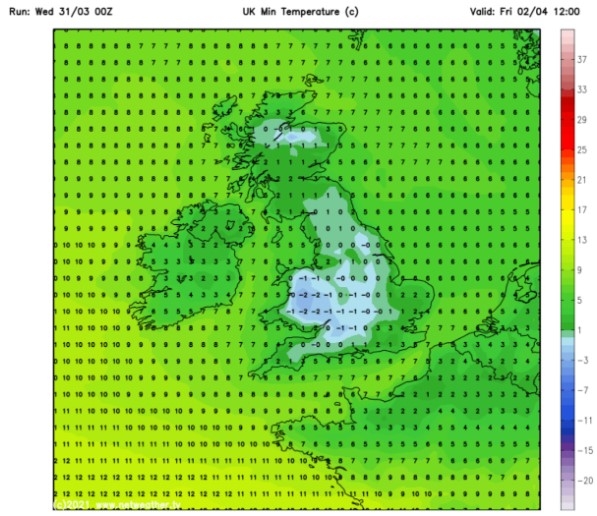
UK and Europe daily weather forecast latest, January 31: Heavy snow to sweep Britain as a brutal Icelandic freeze strikes
UK's weather forecast
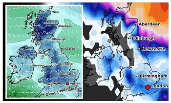
The Met Office confirmed to Express.co.uk that the coldest day of 2021 so far was on January 6, when -12.3C hit Loch Glascarnoch in Scotland. But freezing northerly winds from the Arctic region are predicted to bring even colder temperatures to central Scotland on Friday, February 8, with a low of -13C. The same region is also expected to be hit with 18 inches of snow on the same day, the latest snow depth models from WXCHARTS show.
Northwestern parts of England could be battered by heavy snow on February 8, as the maps show 11 inches in the Lake District. The Arctic freeze appears to then make its way down as far south as Luton, where six inches is expected to fall on the same day.
The fierce ice blast is likely to linger until at least Sunday, February 14, with Scotland being hit with 21 inches. Dr Claire Kennedy-Edwards, senior meteorologist at The Weather Company, warned the cold air could be pushed over to the UK this weekend.
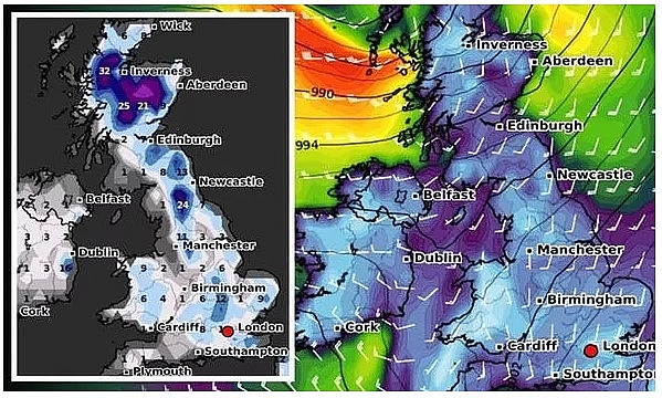 |
| Snow forecast: Britain could be hit with a brutal Icelandic air (Image: WXCHARTS) |
She told Express.co.uk: "High pressure is currently ridging over Iceland and will continue to do so through the coming weekend, as areas of low pressure move in from the Atlantic to bring periods of wet and windy conditions for many areas of the UK and Ireland.
"Northern parts of the British Isles may see at least see some of this turn to snow, maybe as far south as the English Midlands, although the main threat for most areas will be further local flooding (due to saturated ground and more rain)."
"Most areas will be turning cooler through Friday 29, with Sunday 31 probably being the coldest point."
Dr Kennedy-Edwards added colder conditions may persist as February progresses. She said: "Early next week, the high over Iceland is expected to extend to the Nordic region. For the British Isles, little change is expected in the overall forecast, cool to the north with some snow risks, mild to the south with more rain and local flooding."
"Tuesday 2 and Wednesday 3 are currently looking the mildest days of next week. Later next week, the high pressure intensifies and expands over the Nordic region – the Scandinavian block."
"This will result in a colder easterly flow across the British Isles, with temperatures falling widely and some significant wind-chill for England and Wales in particular."
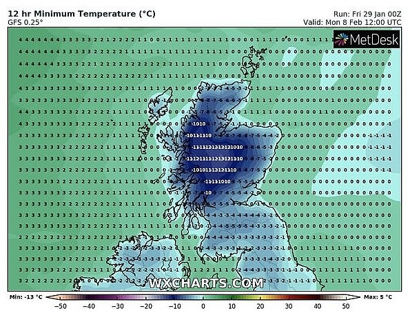 |
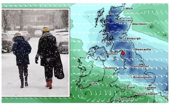
| Snow forecast: Temperatures could drop as low as -13C in Scotland (Image: WXCHARTS) |
"Snow may become common for eastern coastal counties of Britain, although it is too far out to say how far westwards the snow may extend."
"Beyond that, into mid-February, for the UK/Northern Europe, models do try to bring less cold conditions back in from the west or north-west but some scenarios see the colder conditions persisting. Confidence is low for mid-February."
The BBC's long-range forecast warned of winter storms at the start of February.
The forecast said: "High pressure is expected to build over Greenland and northern Europe in early February, strengthening as we head deeper into the month. This will tend to push the low-pressure track further south into the Mediterranean Sea. It will be a slow process though and is not likely to happen until a bit later in the month."
"However, there will be plenty of cold air nearby to the north and northeast that will become increasingly widespread."
"The cold snaps in early February may tend to last a few more days compared to late January. As the low-pressure systems move in from the sub-tropical Atlantic, they will be able to tap into some warmer air to give them a bit more energy. here is a chance that we can see a few stronger winter storms push through bringing some significant winds or rain."
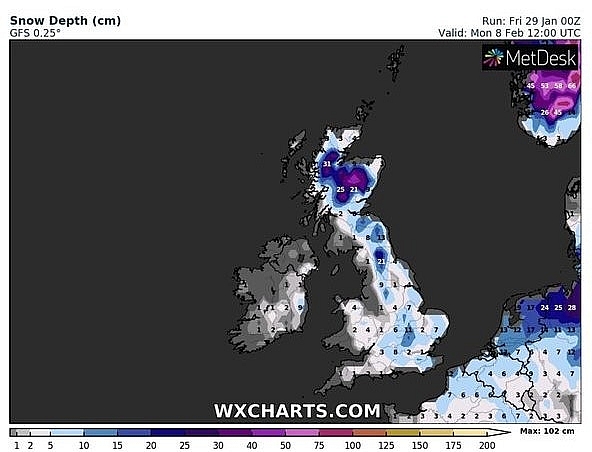 |
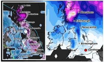
| Snow forecast: Britain is bracing for heavy snow to fall in February (Image: WXCHARTS) |
The Met Office added the wintry conditions should start this weekend after issuing a yellow weather warning for snow on Saturday that will last from 3am until 6pm along western parts of England.
These areas include Manchester, Stoke-on-Trent, Oxford, and the West Midlands, with up to 15cm expected to fall on higher ground. Caerphilly, Monmouthshire and Wrexham in Wales could also be hit will snow on higher levels.
The Met Office said: "An area of rain pushing in from the southwest through the early morning will readily turn to snow in places as it encounters colder air."
"There remains a good deal of uncertainty in how far north the rain and snow will get, before the band stalls and starts to move south again as it eases."
"3-7 cm of snow is possible to low levels with the potential for 10-15 cm over high ground (above 200-300 m), mainly in Wales and the West Midlands. There is a very low chance of perhaps as much 20 cm over highest parts of the Shropshire and Snowdonia."
On January 31
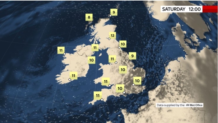
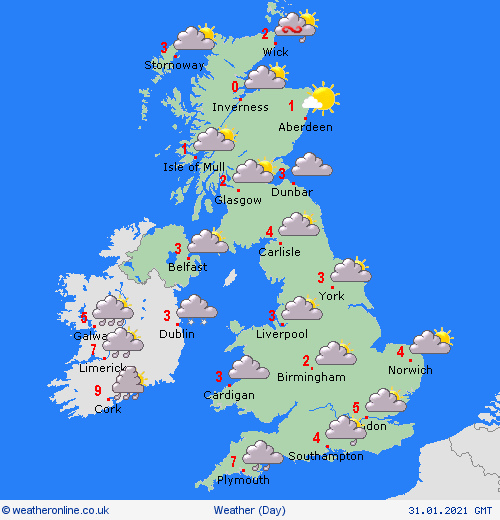
According to Weather Online, a weak ridge of high pressure stays across the British Isles on Sunday giving a widespread frost and ice patches to start. This should bring a drier and colder day to all. There will be some bright or sunny spells especially at first.
 |
| Photo: Weather Online |
A few snow showers affecting northern and eastern Scotland as well as north east England. Outbreaks of rain, sleet and snow spread across Ireland and into the southwest of the UK. The winds will be increasing here too. A general increase of cloud across England, Wales and Northern Ireland throughout the day. Highs around 1 to 5C for many, but 10C in the Isles of Scilly and 8C in southwest Ireland. Cold and clear for many, though cloud increasing from west bringing another band of rain to the southwest, Met Office reported.
Outlook for Monday to Wednesday
Rain will spread across many areas, turning to snow across central and especially northern parts of England and southern Scotland. Remaining cold in the north, milder in the south.
Europe's weather forecast
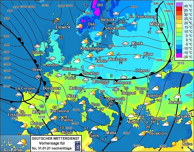
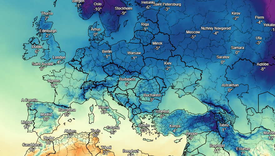
Rain in northern Spain. Some showers through central and southern parts of Spain. The Balearics should be mostly bright with sunny spells. Fair across most of Italy, a few showers in the west, rain arriving tothe north later. Breezy for Greece scattered showers in the west but heavier showers in the east. Thundery rain in western and southern Turkey could lead to some flooding.
 |
| Photo: Stirimeteo |
 |
| Photo: Stirimeteo |
Unsettled in France with periods of heavy rain across France. More rain and sleet into the Low Countries. Rain, sleet and some snow in southern and western parts of Germany but generally fair in the northeast. Rain, sleet and snow for southern Poland, fair in the north. Fair in Hungary, some rain and snow for northern Austria.
Fair and cold in Denmark with good spells of sunshine. Some snow for the Baltic States. Cloud and some snow showers to come across Finland. Further snow showers in eastern Sweden. Cold again with snow in the north and west of Norway but fair to the south.
On January 31
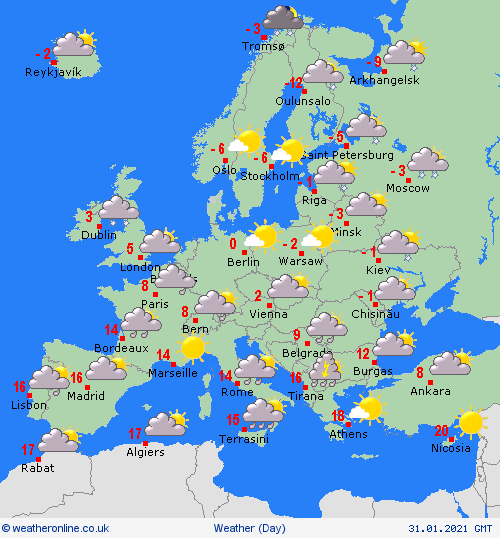
According to Weather Online, patchy rain and scattered showers for Portugal and Spain. Eastern coastal areas should stay dry and fine. Mostly dry and fine too for the Balearics. Outbreaks of rain and gusty winds clear southeast from Corsica, Sardinia and northern Italy through the day. Staying wetter over southern Italy and Sicily for longer. After a dry and fine start, heavy rain moves into western Greece. Early snow and rain clears east from Turkey to leave a dry and fine day here too.
 |
| Photo: Weather Online |
Early rain and sleet clears south from France before another more widespread area of rain spreads across the country from the northwest. This rain also extends into Belgium. Dry and fine for Luxembourg and the Netherlands. Early snow clears from the Alps to leave a dry and fine day for Switzerland, Austria and Germany. Mostly dry and bright for Poland, the Czech Republic and Slovakia while Hungary sees some snowfall. Northern coasts of Poland could se frequent wintry showers.
Isolated wintry showers and sunny spells for Denmark, the Baltic States, Finland, northern Sweden and western Norway on Sunday. Mostly fine elsewhere across southern Sweden and southeast Norway with good spells of sunshine.
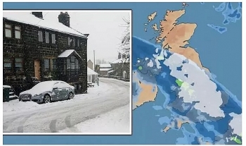 | UK and Europe daily weather forecast latest, January 27: Wall of snow to cover Britain while temperatures expected to plunge Britain is forecasted to cope with a large wall of snow while temperatures set to plunge to lows of -7 degree Celcius. Meanwhile, rain and ... |
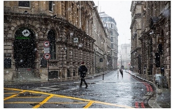 | UK and Europe daily weather forecast latest, January 26: Warnings for heavy sleet and snow issued as ice blast to hit the UK The UK is forecasted to cope with heavy sleet and snow as ice blast covers the country. Meanwhile, unsettled conditions spread from the central to ... |
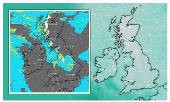 | UK and Europe daily weather forecast latest, January 25: Freezing sub-zero temperatures hit the UK with heavy snow and a cold blast of Arctic air The UK is forecasted to cope with 10 cm of snow with a cold blast of Arctic air sweeping. Meanwhile, an unsettled spell of weather ... |
Recommended
 World
World
India reports 9 Pakistani Aircraft Destroyed In Operation Sindoor Strikes
 World
World
Thailand Positions Itself As a Global Wellness Destination
 World
World
Indonesia Accelerates Procedures to Join OECD
 World
World
South Korea elects Lee Jae-myung president
 World
World
22nd Shangri-La Dialogue: Japan, Philippines boost defence cooperation
 World
World
Pakistan NCRC report explores emerging child rights issues
 World
World
"India has right to defend herself against terror," says German Foreign Minister, endorses Op Sindoor
 World
World

