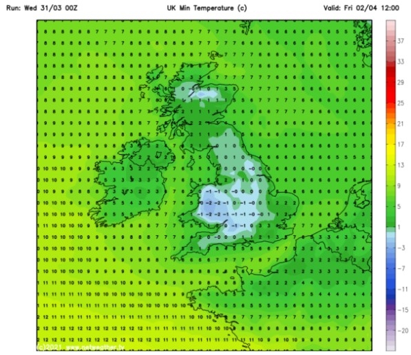
UK and Europe weather forecast latest, December 29: Temperatures plunge as snow showers to smash parts of Britain
UK's weather forecast
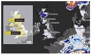
Snow showers are set to smash parts of Britain from as early as tonight, with up to 18cm expected to fall in Scotland by 9am on Monday morning, 4cm in north Wales and 2cm in the south of England, according to WXcharts. A bitter cold snap will see temperatures plummet to freezing and below for vast areas of the UK throughout the next fortnight as a deep area of low pressure engulfs the country.
Storm Bella - which has brought 100mph winds and flash flooding - will be replaced by a jet stream of cold air from the Atlantic and Greenland.
The latest weather maps forecast snow showers will begin overnight tonight and become more widespread in the coming days.
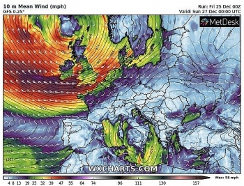
By December 30, cold air from the Atlantic will see western areas of the UK hit by snow showers with 13cm landing in the far west of Scotland, 3cm in north Wales and 4cm in the north west. Temperatures will drop to lows of 0C for central and southern parts of the UK with -2C in the north and -5C in Scotland.
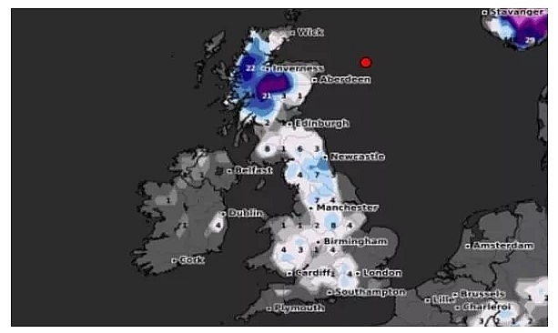 |
| UK weather: Britain is set to be hit by widespread snow showers (Image: WXCHARTS) |
Just 72 hours into the New Year is set to bring a blanket of snow showers across the whole of Britain, Express reported.
On January 3, up to 22cm of snow is expected to fall in Scotland, 7cm in the north of England, 8cm in Birmingham and even 4cm in London and the south east, according to WXcharts.
The covering of snow will send temperatures spiralling once again with overnight lows of -3C in the south, -3C in the north and -4C in Scotland. Persistent spells of wintery conditions are forecast to remain for the next 48-72 hours before clearing northwards.
During this period there is set to be widespread freezing fog in the early hours and the threat icy roads. Heavy snow showers are set to continue into the following week with up to 47cm expected and temperatures falling to -10C overnight in Scotland on January 11.
Snow maps produced by Wxcharts show central and western parts of Scotland turning dark purple. The cold front will begin tonight as temperatures fall below 0C for the whole of the UK, bringing widespread frost.
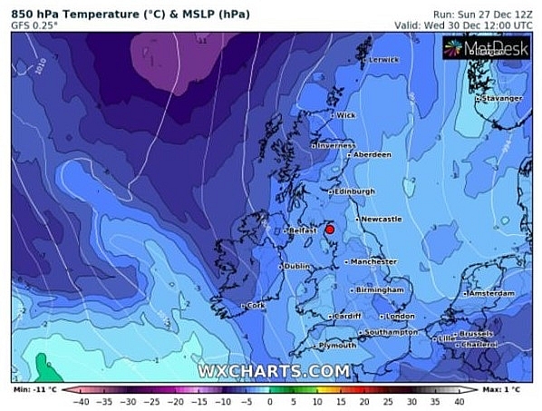 |
| UK weather: Cold air will close in from the Atlantic (Image: WXCHARTS) |
According to the BBC long range forecast, the cold and unsettled conditions are being triggered by a weather system from the Atlantic moving southwards to allow Arctic conditions to push in from Iceland and Greenland.
The seven-day forecast warns the cold weather system will head towards Europe before moving in a westerly direction towards the UK.
It says: “This pattern will steer several low pressure areas south over the UK. This will allow cold air from Iceland, Greenland and even deeper into the Arctic to flow southwards over the UK, in the wake of these systems."
“A combination of cold and unsettled weather in mid-winter means that sleet and snow will be on the cards for some of us, even over some lower lying areas."
“Fronts pushing south-eastwards are most likely to bring snow to some of the hiller parts of the UK, where a covering of snow will build up during the week."
“At low-levels, it is more likely to be a very fine balance between rain, sleet and snow, with the detail very challenging.”
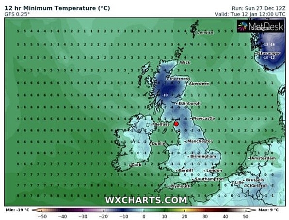 |
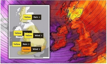
| UK weather: Temperatures are set to fall to lows of -10C (Image: WXCHARTS) |
Netweather.TV forecaster Terry Scholey added: “The now slowly filling storm Bella, continues to move South on Monday, when it may be the turn of parts of England and Wales to wake to a carpet or dusting of snow, particularly in hilly areas."
“But for most, it'll end up another day of sunny intervals and wintry showers after an icy start. Further snowfall is likely, especially on northern hills, but at lower levels the showers may fall as rain, sleet or hail at times. It'll be another cold, raw day in a northerly wind, with top temperatures only 2 to 5C.”
On December 29
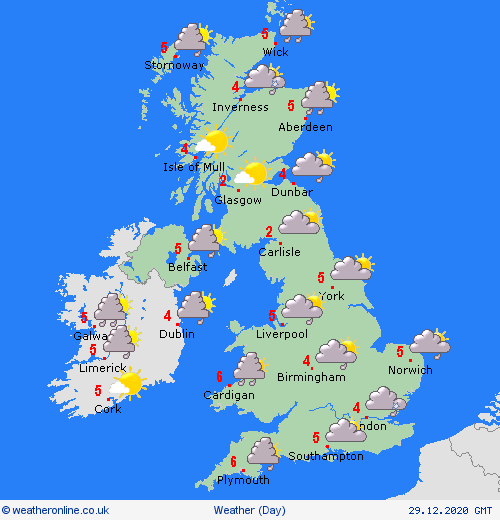
According to Weather Online, another cold day with low pressure now to the east of the country and a general northerly wind, rather brisk towards western coasts. This brings with it rain, sleet and snow to northern and eastern areas of Scotland. Showers, some wintry to the coasts of Wales and southwest England, including showers for eastern coasts of England, again, some likely to be wintry. Risk of more persistent snow developing for eastern Scotland and northeast England later. Largely dry with sunshine elsewhere. Highs 3 to 6C.
 |
| Photo: Weather Online |
Europe's weather forecast
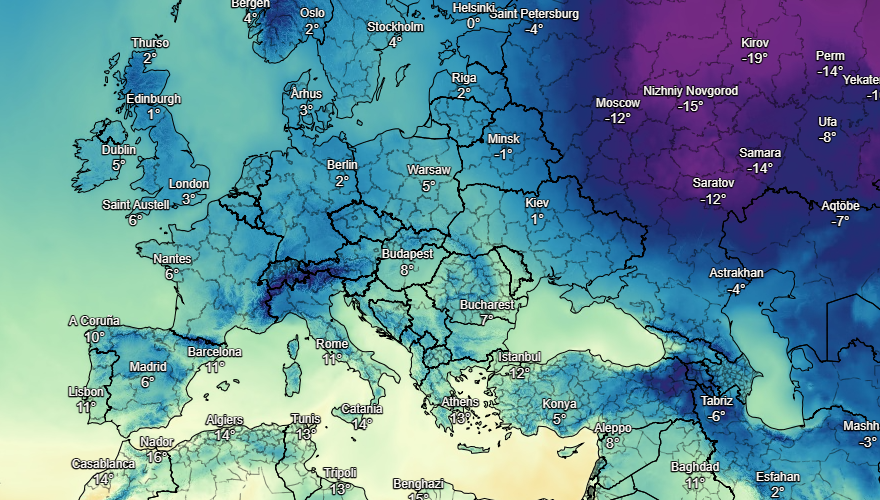
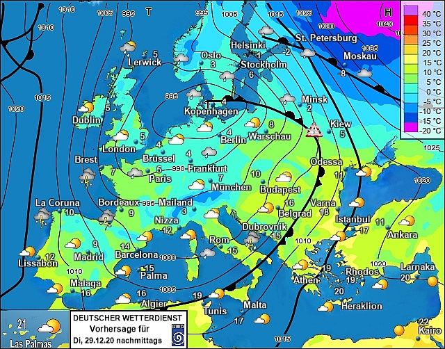
Windy and wet conditions continue across many parts of Spain and Portugal on Monday with the windiest and wettest areas in the far north. Strong winds through the Balearic Islands with rain and or showers about. Italy will also see heavy rain push across the country and brisk winds. Showers or longer spells of rain affecting Greece as well as Turkey, Weather Online reported.
Unsettled across France with heavy rain concentrated across more western areas with strong to gale force winds along the Biscay coast. Sunshine and showers for the Low Countries and Germany. Outbreaks of rain across Austria and Switzerland with heavy rain down the Balkan States. Rain in eastern Poland but largely dry elsewhere here.
 |
| Photo: Stirimeteo |
 |
| Photo: Stirimeteo |
Rather unsettled for large parts of Scandinavia as rain, sleet and snow sweep through many parts of Norway and Sweden. Mainly dry across Finland but with some wintry showers in the far north. A wet start for Denmark but it should dry up through the day. Showers developing through the Baltics and it will be windy here.
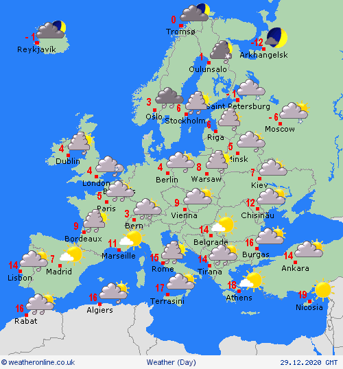
On December 29
Breezy conditions expected still across Spain and Portugal with persistent rainfall in the far north and along the coasts and then showers pushing through central areas. Showers or longer spells of rain across the Balearics and the surrounding Italian islands. Rain, some heavy, across more the west side of Italy. Showers across western Greece with a few scattered showers for west Turkey but mostly dry elsewhere.
 |
| Photo: Weather Online |
Unsettled still across much of France with rain pushing over southern areas and a mix of rain, sleet and snow showers towards the north. Brisk coastal winds too. Snow showers for the Low Countries and Germany. Snow for the higher ground across Switzerland and Austria and a mix of wintry showers towards lower ground. Patchy rain down the Balkan States, turning heavy and persistent later on.
Snow affecting eastern areas of Norway and much of Sweden although it looks to stay mostly dry in the north of Sweden and western parts of Norway. Snow showers across parts of Finland but with sunny spells too. Snow showers and blustery winds through the Baltic States. A mix of rain, sleet and snow for Denmark.
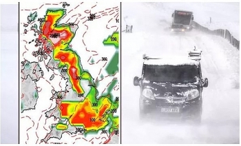 | UK and Europe weather forecast latest, December 25: Ferocious polar blast and snow to blanket the UK The UK is forecasted to cope with freezing weather with ferocious polar blast and snow sweeping across the country. Meanwhile, a chilly night is expected ... |
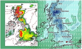 | UK and Europe weather forecast latest, December 24: Freezing air, widespread snow to cover the UK over the next couple of weeks The UK is forecasted to cope with widespread of snow, cold air as well as wintry conditions that could last for a two week period ... |
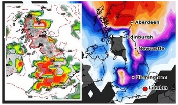 | UK and Europe weather forecast latest, December 23: Ferocious Arctic snow bomb sets to bombard Britain The UK is forecasted to cope with cloud, strong winds as well as rain to many areas. Besides, a ferocious Artic snow bomb with -5 ... |
Recommended
 World
World
Pakistan NCRC report explores emerging child rights issues
 World
World
"India has right to defend herself against terror," says German Foreign Minister, endorses Op Sindoor
 World
World
‘We stand with India’: Japan, UAE back New Delhi over its global outreach against terror
 World
World
'Action Was Entirely Justifiable': Former US NSA John Bolton Backs India's Right After Pahalgam Attack
 World
World
US, China Conclude Trade Talks with Positive Outcome
 World
World
Nifty, Sensex jumped more than 2% in opening as India-Pakistan tensions ease
 World
World
Easing of US-China Tariffs: Markets React Positively, Experts Remain Cautious
 World
World

