UK and Europe weather forecast latest, January 17: Powerful Arctic bomb to prevail Britain with heavy snowfall
UK's weather forecast
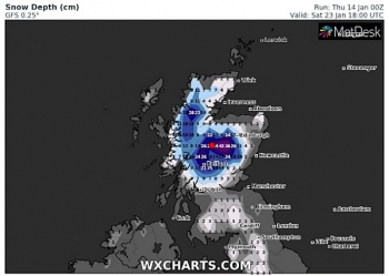
Cold air from Scandinavia is being pushed towards the UK by the polar vortex, with ferocious weather forecast. Forecasters have predicted this Arctic front could bring heavy snow as far south as London by the end of the day and into the weekend. Central Scotland is forecast to be smashed with 16 inches of snow by 6am tomorrow, the latest snow depth maps from WXCHARTS show.
The Met Office added 4 inches of snow could fall in East Anglia on Saturday, while northern areas could see as much as 8 inches, including Newcastle in the north-east being hit, as well as Leeds, Cumbria and York.
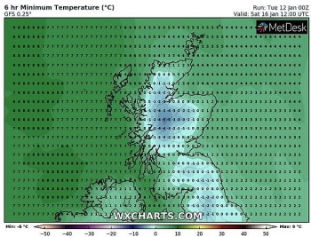
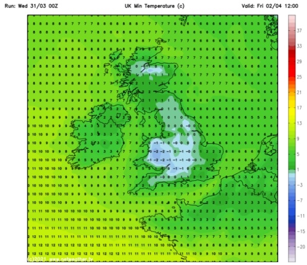
Temperatures are also expected to plunge to -5C in Scotland overnight, with Carlisle in the north west seeing -2C and London shivering at 0C.
Gavin Partridge from GavsWeatherVids issued a warning over "significant" levels of snow falling tomorrow.
He said: "Tomorrow, rain and snow spread east across the country but the early part of next week should turn less cold with rain rather than snow. Later next week winds probably turn into the north and the risk of snow will increase once again.Tonight wet and windy weather moves in from off the Atlantic."
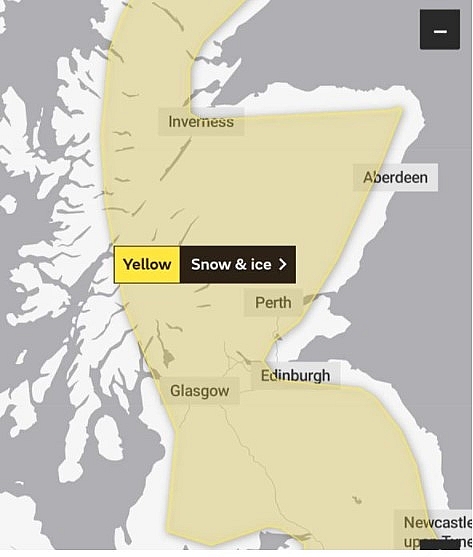 |
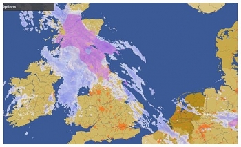
| UK snow forecast: Scotland and northern England could be hit with both snow and ice (Image: MET OFFICE) |
"As the rain bumps into the cold air it will turn to sleet and snow in central and eastern regions with significant snow possible over high ground of central and northern Britain."
"Tomorrow the band of rain, sleet and snow will push through the country, giving more significant snow across northern regions with a covering coming down to low levels in places."
"The afternoon will see brighter skies moving back from the west and most places become dry. Mild in the west. Cold in the east."
The BBC's long-range forecast added a low pressure system is expected to blast cold air this weekend.
The forecast said: "The next low pressure system will begin to push in from the west, reaching Northern Ireland and western Scotland overnight Friday into the weekend."
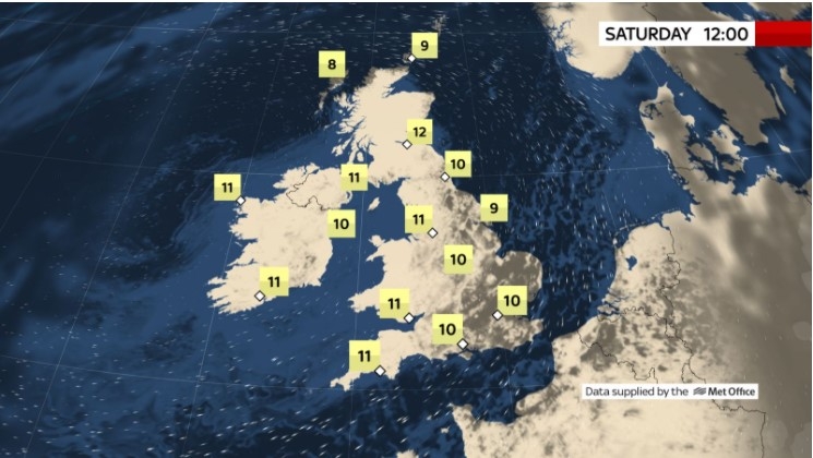
"This low will make for an unsettled weekend with some milder but wetter weather for Saturday followed by a drier, colder and windier Sunday."
"There will be a split in temperatures with northern areas a bit colder than normal on Sunday while the southern half of the country is near or a little above normal, but cloudier. In short, we expect a volatile week of temperature swings and frequent rain, along with a chance of some snow for northern areas."
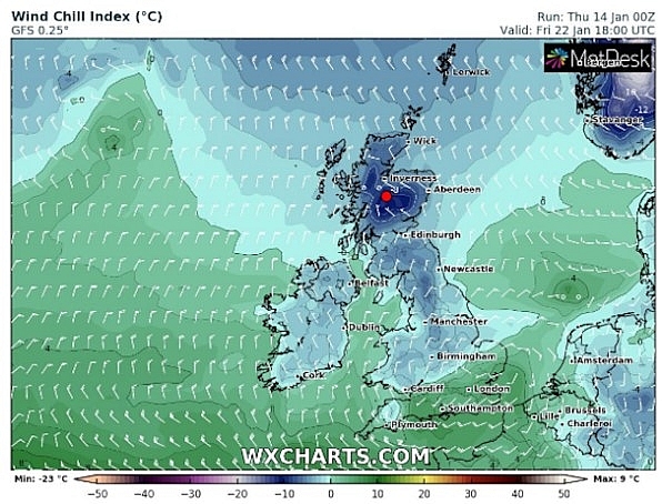 |
| UK snow forecast: A second map by WXCharts also shows the weather front forming above Scotland on January 22 (Image: WXCharts ) |
The forecast added the cold air is heading over from the Arctic. It said: "This is due to the colder Arctic air being displaced into Scandinavia and Russia from the polar vortex."
"This air will occasionally feed into the UK, bringing some colder than normal days mixed with days of milder sub-tropical air pushing in from the southwest."
Most of Scotland, northern England and the Midlands has been issued a yellow snow and ice warning on Saturday between midnight and 6pm.
The Met Office said up to 8 inches of snow could accumulate over higher ground in some areas. The warning said: "An area of rain pushing eastwards is expected to turn to snow in places. Snow is likely to fall to low levels over east Scotland and northern England for a time on the leading edge of the rain before the snow level rises to above 300-400m by mid morning."
"1-3cm is possible at low levels here but is more likely at higher elevations where 5-10cm of snow may accumulate above 200m and possibly 20cm on highest routes."
"Icy stretches are also likely with rain and wet snow falling onto sub zero surfaces at times. Further south the most likely scenario is for rain though there is a small chance of snow falling down to 150m or so leading to 2-5cm in places."
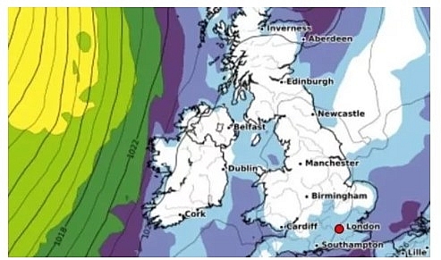 |
| UK snow: Britain's is set to see heavy snowfall at the end of January (Image: WXCHARTS) |
A yellow snow warning has also been issued for London and parts of the South East and eastern England tomorrow. Some of the counties affected by the warning include Cambridgeshire, Essex, Hertfordshire, Kent, Oxfordshire and Sussex.
The yellow snow warning will last from 3am until 8pm on Saturday.
The warning added: "An area of rain will move eastwards through Saturday and is likely to turn to snow as this runs into cold air over east and southeast England."
"Snow is likely to fall to low levels on the leading edge of the rain area before snow levels gradually rise for many from the west."
"East Anglia and parts of Kent and Sussex look most at risk of seeing snow for longest. 1-3cm of snow may fall fairly widely over these areas with 5-10cm possible in places, mostly over parts of East Anglia and any higher ground."
"Given recent wet weather and high river levels with rain and snow falling, then melting some flooding impacts are also possible."
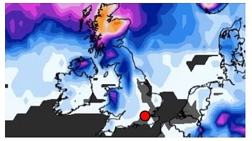 |
| UK snow: Britain's is set to see heavy snowfall at the end of January (Image: WXCHARTS) |
On January 17
According to Weather Online, a ridge of high pressure builds to the south on Sunday, although low pressure stays to the north. There will be some wintry showers in northern and western Scotland. Elsewhere it is likely to be brighter although always with a fair amount of cloud, the best of any sunny spells in the east. Highs at 4 to 7C.
Southern and eastern parts dry with sunny spells. Showers affecting the northwest, with a spell of more persistent rain later, Met Office reported.
Outlook for Monday to Wednesday
Unsettled, rather mild and windy with rain at times, heavy in the west. Colder for Scotland with some hill snow. Gales in the south, and later in the north.
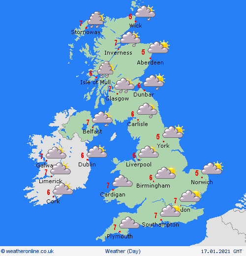 |
| Photo: Weather Online |
Europe's weather forecast
According to Weather Online, dry and fine for Spain and Portugal. Early showers clear south from the Balearics, Corsica, Sardinia, Italy and Sicily to leave a dry and fien day here too with good spells of sunshine. An area of heavy rain, sleet and snow spreads over Greece and into Turkey. Drier and brighter for western Greece later.
After a dry and fine start, an area of rain, sleet and snow spreads across northern France, the Low Countries and into western Germany.Dry but increasingly cloudy for eastern Germany and Switzerland. Snow showers affect Austria, the Czech Republic, Poland, Slovakia and Hungary. These merge to give longer spells of snow for Poland later.
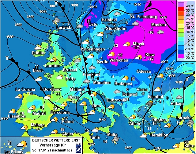 |
| Photo: Stirimeteo |
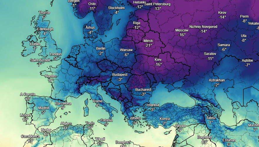 |
| Photo: Stirimeteo |
Mostly dry and fine for Norway, Sweden and Denmark. Rain edges into southwest Norway and western Denmark later. Early snow showers fade over Finland and the Baltic States to leave a dry but rather cloudy day here.
On January 17
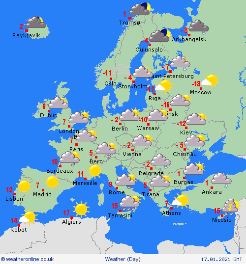
According to Weather Online, staying largely dry and fine across Spain and Portugal although more in the way of cloud and possible patchy rain affecting the far northeast of Spain. A brisk but now westerly wind through the Balearics but it should be dry here. Strong winds with blustery showers across Sardinia and Corsica pushing into southern Italy and across Siciliy later. Precipitation clearing to the east of mainland Greece but will still affect the islands. Rain, sleet and snow still affecting Turkey.
 |
| Photo: Weather Online |
Rain, sleet and snow continue to affect southern and some eastern areas of France. More in the way of rain in the south. Germany too will see rain, sleet and snow push southwards with northern areas becoming drier. Snow affecting Switzerland and Austria with snow showers still down the Balkan States. Any snow will clear the southern areas of Poland first thing to allow for a dry and bright day here.
Largely dry across Scandinavia but with snow affecting the far southwest of Norway. Wintry showers also pushing across the Baltic States but plenty of dry weather here too. Cloud and some rain, sleet and snow pushing into mainly western areas of Denmark while eastern areas stay drier with the best of any sunshine here.
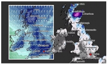 | UK and Europe weather forecast latest, January 13: Low pressure brings extreme wintry conditions and heavy snow The UK is forecasted to bear extreme wintry conditions and heavy snow to much of the country. Meanwhile, windy, snow are expected in Scandinavia, rain ... |
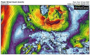 | UK and Europe weather forecast latest, January 12: Milder but colder in far north in the UK with rain then heavy snow strikes The UK is forecasted to brace for temperatures to plunge and heavy snow to return. Meanwhile, conditions are easing across the Med but there will ... |
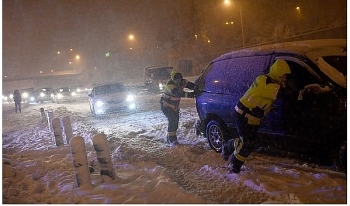 | UK and Europe weather forecast latest, January 11: Heavy snow to blanket the UK with record-breaking cold and freezing fog The UK is forecasted to cope with cold weather with heavy snow and record-breaking freeze. Meanwhile, high pressure brings settled conditions to many areas in ... |
Recommended
 World
World
Pakistan NCRC report explores emerging child rights issues
 World
World
"India has right to defend herself against terror," says German Foreign Minister, endorses Op Sindoor
 World
World
‘We stand with India’: Japan, UAE back New Delhi over its global outreach against terror
 World
World
'Action Was Entirely Justifiable': Former US NSA John Bolton Backs India's Right After Pahalgam Attack
 World
World
US, China Conclude Trade Talks with Positive Outcome
 World
World
Nifty, Sensex jumped more than 2% in opening as India-Pakistan tensions ease
 World
World
Easing of US-China Tariffs: Markets React Positively, Experts Remain Cautious
 World
World

