US and Canada weather forecast August 2: Isaias forecast to regain hurricane strength as it approaches Florida
US weather forecast
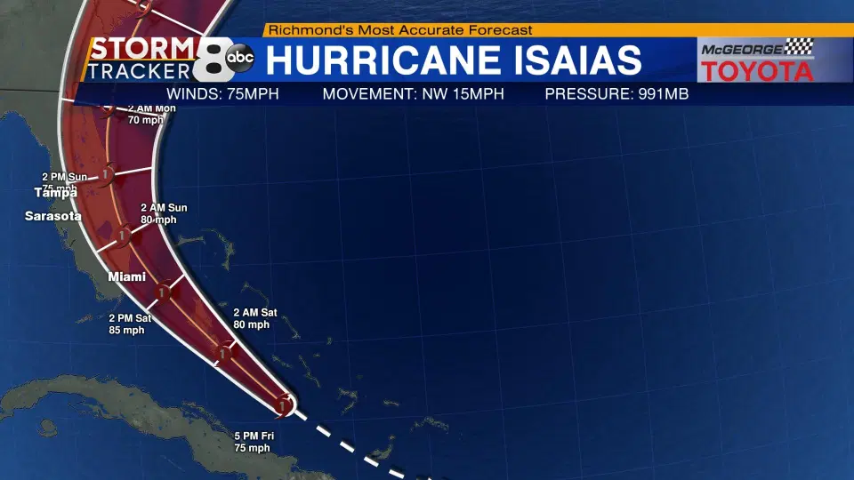
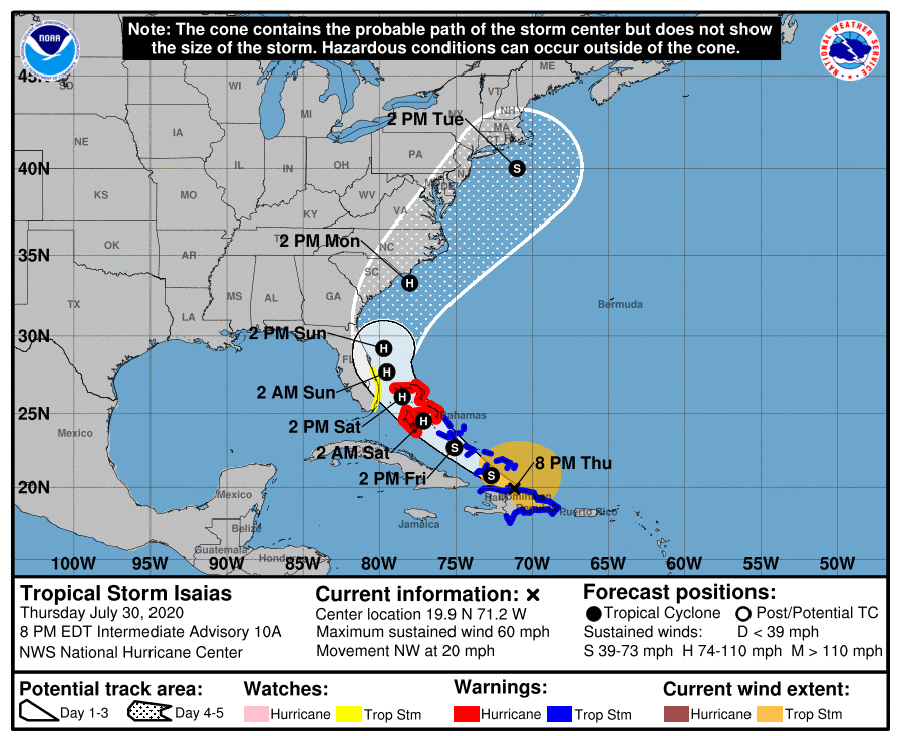
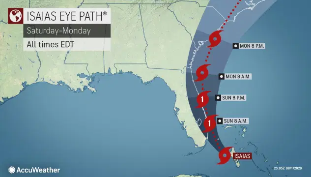
It is reported by CNN that the forecast track as of Saturday afternoon has Isaias' center moving within miles of Florida's east coast on Sunday, and moving along it as a Category 1 hurricane.
 |
| Photo: Accu Weather |
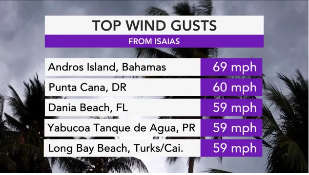
Isaias made landfall around 11 a.m. Eastern Time Saturday on the northern part of Andros Island in the Bahamas, NHC reported. The storm's maximum sustained winds had fluctuated between 80 and 85 mph throughout the morning before the storm weakened a bit due to its interaction with land. Its forward speed had also slowed as it crept along at around 12 mph, down from as much as 18 mph on Friday.
 |
| Photo: Accu Weather |
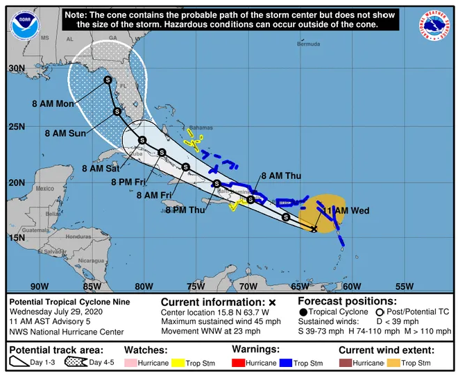
The storm came within 40 miles west-southwest of Nassau, the capital city of the Bahamas Saturday, after leaving behind scenes of flooding in Puerto Rico late in the week. The National Guard rescued at least 35 people who were swept away by raging floodwaters in Puerto Rico, including small children and infants, but one woman remained missing, The Associated Press reported.
 |
| Photo: Accu Weather |
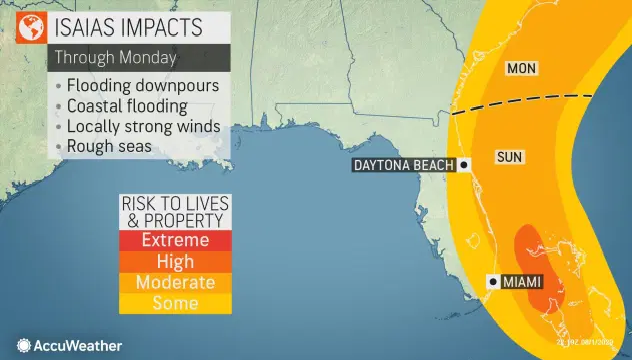
Despite a forecast of lessening wind strength throughout the day on Monday, Isaias is still forecast to bring areas of flooding and strong winds to the region. Because of this, Isaias is forecast to be a 1 on the AccuWeather RealImpact™ Scale for Hurricanes, a nuanced scale that AccuWeather introduced during the 2019 hurricane season to help better indicate the level of impacts a storm will bring.
 |
| Photo: Accu Weather |
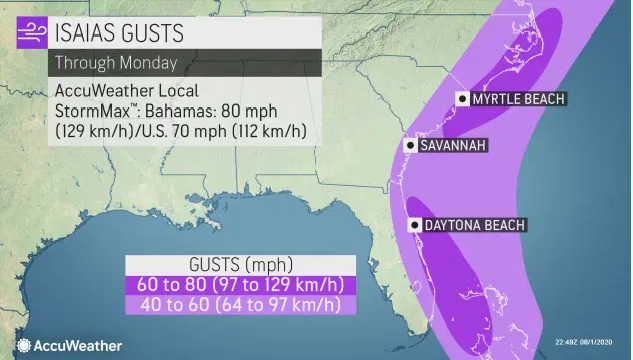
Winds will pick up across South Carolina late Sunday night as the storm approaches the region, then will spread into eastern North Carolina throughout the day.
 |
| Photo: Accu Weather |
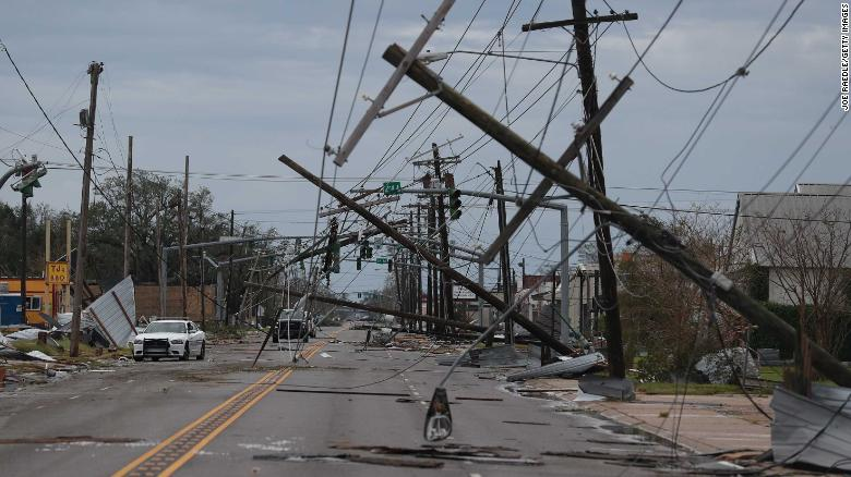
At least two deaths have been blamed on Isaias' impacts, thus far, according to Reuters. Civil Defense officials said Chiche Peguero, 53, was killed when powerful winds caused a high-voltage power line to fall in Río San Juan, a city in the María Trinidad Sánchez province. A 5-year-old boy was also killed after a tree crushed his home on Thursday evening, according to el Caribe, a local news organization.
 |
| Photo: Accu Weather |
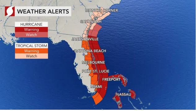
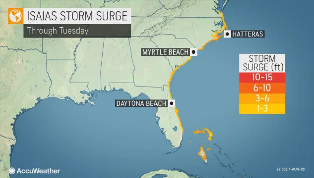
Florida Gov. Ron DeSantis declared a state of emergency in every coastal county of Florida’s Atlantic Coast, stretching from Miami-Dade to Nassau counties, on Friday in preparation for the storm. The governor also sent a letter to President Donald Trump requesting a pre-landfall emergency declaration, according to the Accu Weather.
AccuWeather National Weather Reporter Jonathan Petramala reported live from Cocoa Beach, Florida, on Friday and noted that sandbag locations were being opened up all across Florida's east coast ahead of the storm's anticipated heavy rain.
 |
| Photo: Accu Weather |
Businesses were seen boarded up as beaches were closed in West Palm Lake and Lake Forth Worth, Florida, on Saturday, but other areas along the east coast looked like any normal day at the beach with people out and about instead of making final preparations.
The storm will unleash wind gusts of 40-60 mph with an AccuWeather Local StormMax™ of 70 mph over eastern Florida during Saturday and Sunday before it makes its way toward the Carolinas. Winds of this magnitude will be strong enough to cause localized power outages and cause some minor damage, added the Accu Weather.
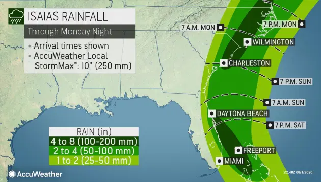
Rainfall amounts in the range of 2-4 inches across eastern Florida will be common although some locally higher amounts are possible.
 |
| Photo: Accu Weather |
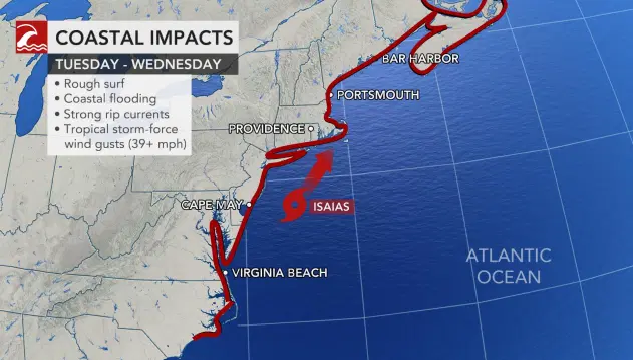
“Although the track and arrival of the hurricane could still change, now is the time for North Carolinians to prepare,” Cooper said. “Hurricane preparations will be different given the COVID-19 pandemic, and families need to keep that in mind as they get ready”, said North Carolina Gov. Roy Cooper.
North Carolina Emergency Management (NCEM) readied the National Guard should they need to respond to flood rescues, and the North Carolina Department of Transportation was also on standby with equipment should they need to respond to storm damage early in the week.
Canada weather forecast
Environment Canada has issued a heat warning for the Boundary, West Kootenay, and South Thompson regions in B.C.’s Southern Interior.
For Sunday through Wednesday, the Boundary region forecast is sunny with highs of 32 to 35 C, with overnight lows of 15 to 16 C.
For the Central and North Okanagan and the Shuswap, Saturday’s forecasts are similar.
Environment Canada is forecasting a 30 percent chance of showers, with a risk of a thunderstorm late in the afternoon, along with a high of 32 and a low of 17, reported the Global News.
Notably, in South Okanagan, Saturday’s forecast is mainly sunny with some clouds, and a high of 34 C.
For Sunday to Wednesday, the projected forecast is sunny, with highs of 28 to 33 C, and overnight lows of 15 to 16 C. A severe thunderstorm watch is also in place for the Kootenays.
 |
| The weather forecast in Calgary in the next five days Photo: Canadian environment |
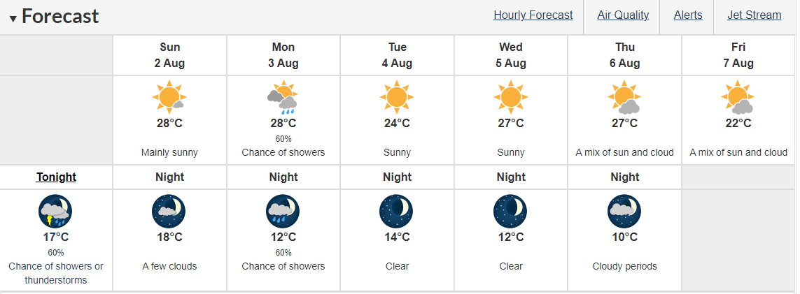
In Calgary, it is forecast to be sunny. Becoming a mix of sun and cloud in the afternoon. Risk of a thunderstorm late in the afternoon. Wind becoming southeast 20 km/h near noon. High 28. Humidex 33. UV index 9 or very high. At night, it will be partly cloudy. Becoming clear in the evening. Risk of a thunderstorm early in the evening. Wind southeast 20 km/h becoming light in the evening. Low 18.
 |
| The weather forecast in Edmonton in the next five days Photo: Canadian environment |
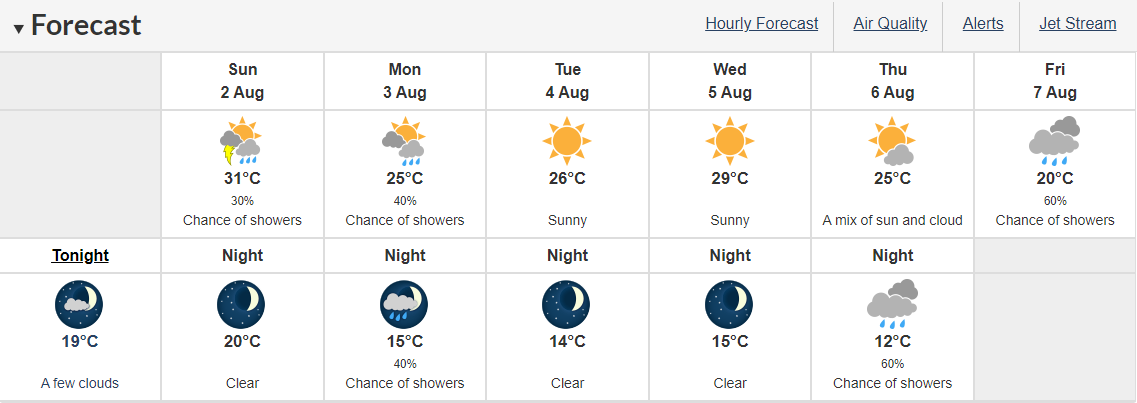
In Edmonton, there is likely to be a mix of sun and cloud with 30 percent chance of showers early in the morning and risk of a thunderstorm. Clearing in the morning. Wind southeast 20 km/h gusting to 40. High 31. Humidex 36. UV index 8 or very high. At night, it will be clear. Wind southeast 20 km/h gusting to 40 becoming light near midnight. Low 20.
 |
| The weather forecast in Montreal in the next five days Photo: Canadian environment |
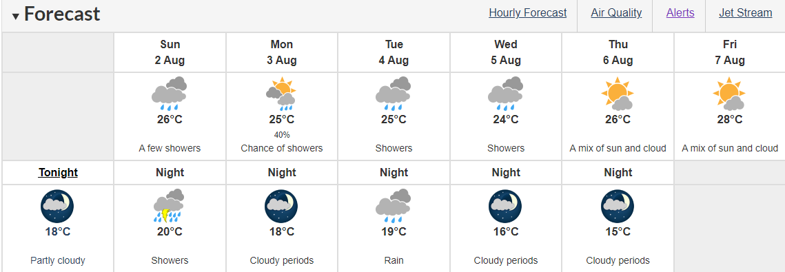
In Montreal, it will become cloudy in the morning. A few showers beginning in the afternoon. Wind becoming east 20 km/h gusting to 40 near noon. High 26. Humidex 31. UV index 5 or moderate. At night, it is expected to showers. Risk of a thunderstorm in the evening. Amount 15 to 25 mm. Wind southwest 30 km/h. Low 20.
 |
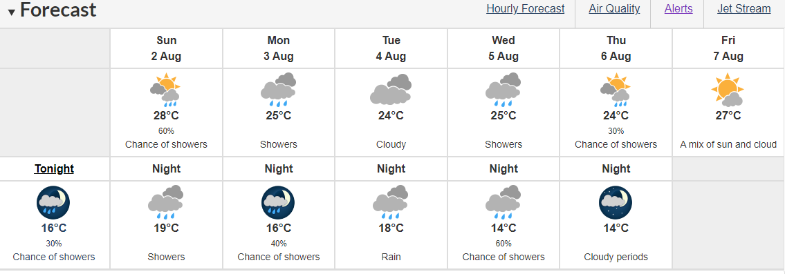
| The weather forecast in Ottawa in the next five days Photo: Canadian environment |
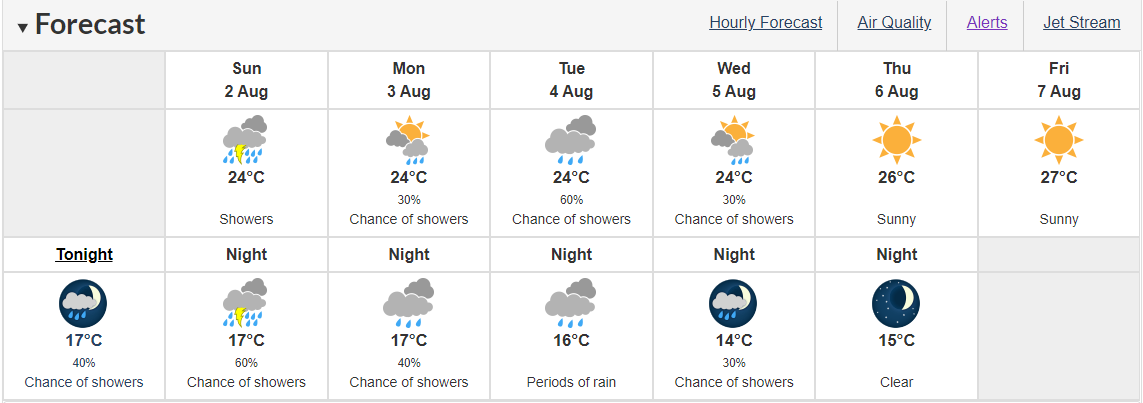
In Ottawa, it may be Cloudy. 40 percent chance of showers early in the morning. Showers beginning in the morning. Risk of a thunderstorm late in the morning and in the afternoon. Local amount 15 to 25 mm. High 24. Humidex 32. UV index 4 or moderate. At night, there might be showers ending in the evening then cloudy with 60 percent chance of showers. Risk of a thunderstorm in the evening. Local amount 5 to 10 mm. Wind becoming southwest 20 km/h gusting to 40 in the evening then becoming northwest 20 overnight. Low 17.
 |
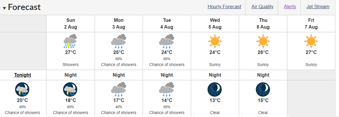
| The weather forecast in Quebec in the next five days Photo: Canadian environment |
In Quebec, it will be mainly sunny. Increasing cloudiness late in the morning then 60 percent chance of showers in the afternoon. High 28. Humidex 35. UV index 7 or high. At night, it is cloudy. Showers beginning in the evening. Wind becoming southwest 20 km/h overnight. Low 19.
 |
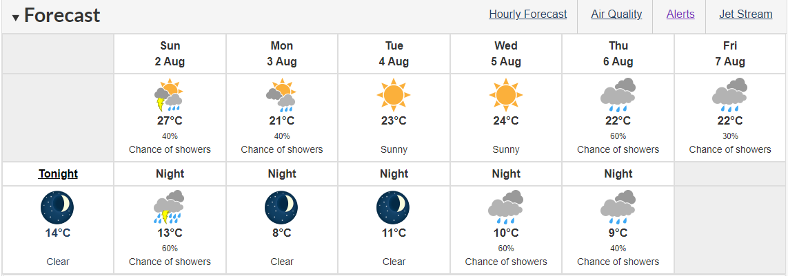
| The weather forecast in Toronto in the next five days Photo: Canadian environment |
In Toronto, it may shower ending early in the afternoon then cloudy with 60 percent chance of showers. Risk of a thunderstorm in the morning and afternoon. Local amount 10 to 15 mm. Wind becoming southwest 20 km/h gusting to 40 in the morning. High 27. Humidex 35. UV index 4 or moderate. At night, it is expected to be partly cloudy with a 60 percent chance of showers. Risk of a thunderstorm early in the evening. Wind southwest 20 km/h gusting to 40 becoming northwest 20 gusting to 40 in the evening then light overnight. Low 18.
 |
| The weather forecast in Prince George in the next five days Photo: Canadian environment Prince George |
 | US and Canada weather forecast July 29: Potential Tropical Cyclone Nine has ominous track US and Canada weather forecast July 29: Isaias- the ninth named storm of 2020 is forecast to form in the Atlantic by the end of ... |
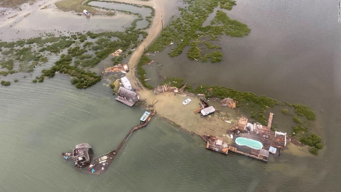 | US and Canada weather forecast, July 27: Hurricane Hanna weakened to a tropical depression while hurricane Douglas threaten parts of U.S. In Canada, severe storm ... |
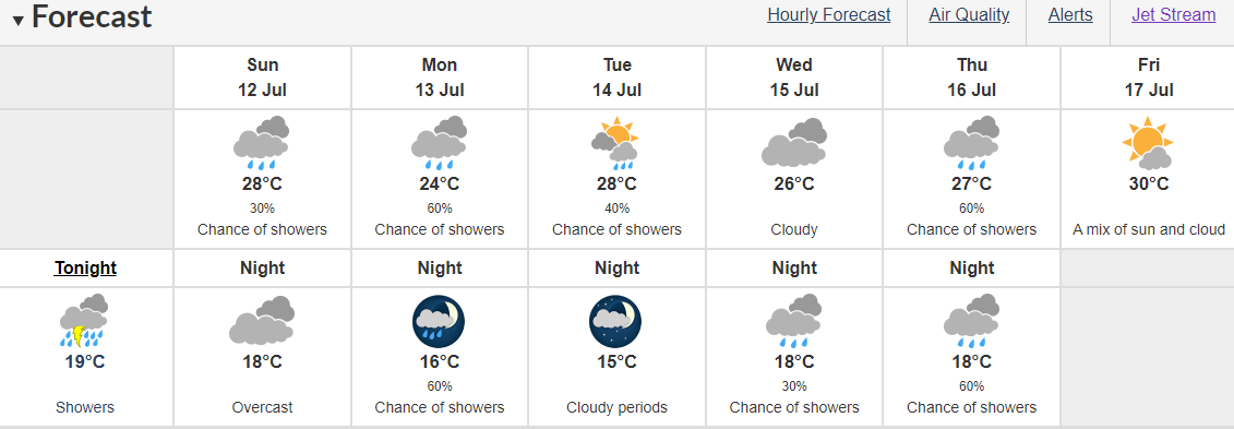 | US and Canada weather forecast today, July 12: Much of the United States, from the Gulf Coast to the desert southwest, is under some form ... |
 World
World
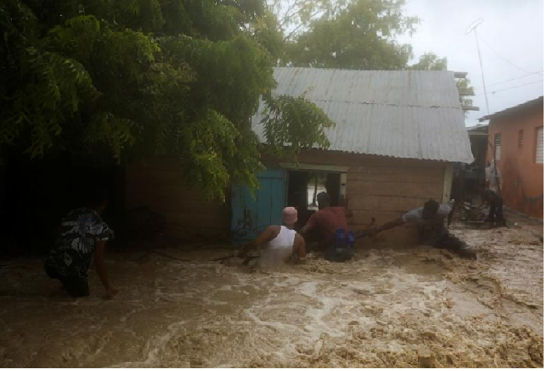
Storm Laura kills 11 in Dominican Republic and Haiti, sets course for US
Recommended
 World
World
Thailand Positions Itself As a Global Wellness Destination
 World
World
Indonesia Accelerates Procedures to Join OECD
 World
World
South Korea elects Lee Jae-myung president
 World
World
22nd Shangri-La Dialogue: Japan, Philippines boost defence cooperation
 World
World
Pakistan NCRC report explores emerging child rights issues
 World
World
"India has right to defend herself against terror," says German Foreign Minister, endorses Op Sindoor
 World
World
‘We stand with India’: Japan, UAE back New Delhi over its global outreach against terror
 World
World

