India weather forecast latest, December 6: Two western disturbances with widespread snowfall set to batter
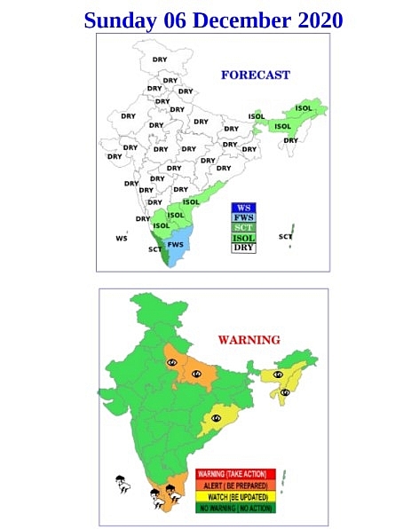
Widespread snowfall is expected in the upper reaches of the Western Himalayas with two western disturbances (WD) impacting the region. The first WD started impacting the region from Friday onwards and brought rain and snow mainly to Jammu & Kashmir. The second WD is likely to be more intense and impact the region from December 7, according to the India Meteorological Department (IMD).
Both maximum and minimum temperatures in most parts of Northwest India are likely to be marginally above normal till December 10 due to clouding and a change in wind direction associated with the WDs. But the temperatures are likely to fall significantly once both WDs pass and icy cold winds from the Himalayas start blowing over northwest India, scientists said.
 |
| Photo: IMD |
“There is a change in wind direction to easterly already due to the WD which is why temperature is also marginally higher. Air pollution levels may go up over the weekend due to a reduction in wind speed. The second WD is likely to be more intense and bring widespread snowfall to Jammu & Kashmir and Himachal Pradesh. Until December 10, we are expecting the minimum temperature to hover around 8 degrees C,” said Kuldeep Shrivastava, who heads the Regional Weather Forecasting Centre.
According to Hindustan Times, the air quality in Delhi and National Capital Region deteriorated on Friday. It is likely to improve marginally but will remain in the “very poor” category on Saturday and Sunday. The Air Quality Index on Friday was 382 in the “very poor” category in Delhi. Ghaziabad, Greater Noida, Kanpur, Lucknow, Meerut, and Noida recorded severe air quality.
 |
| Photo: Weather Online |
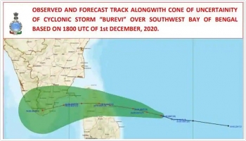
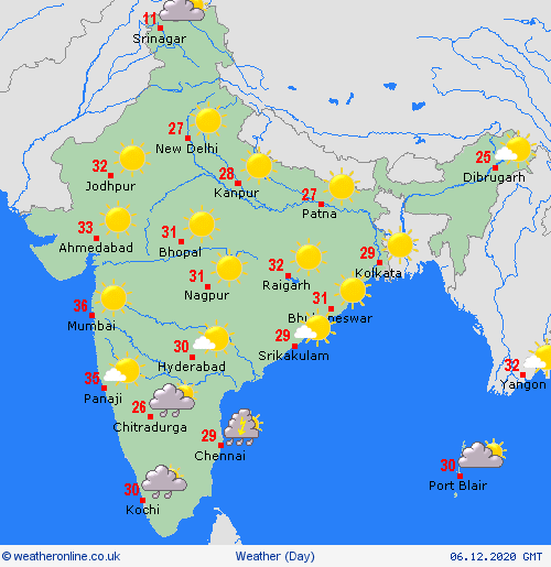
Cyclone Burevi, which weakened to a depression on Thursday close to Ramanathapuram coast, remained stationary for 30 hours till Saturday morning. The associated wind speed is about 40 to 50 km per hour gusting to 60 km per hour. It is likely to remain stationary and weaken further, scientists said. Thereafter it will move west-south-westwards across Ramanathapuram towards Kerala and then weaken into a well-marked low-pressure area.
According to Skymet Weather, a cyclonic circulation over Malay Peninsula is persisting. A fresh Western Disturbance is over North Pakistan and adjoining Jammu and Kashmir. Cyclonic circulation is over East Uttar Pradesh and Bihar.
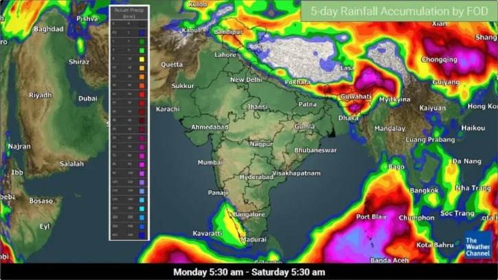
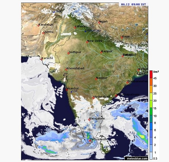
During the next 24 hours, moderate to heavy rains will continue over South coastal Andhra Pradesh, coastal Tamil Nadu and parts of Andaman and Nicobar Islands.
 |
| Photo: Meteoblue |
Light to moderate rain with few heavy spells may occur over interior Tamil Nadu and parts of Kerala. Light rain and shower activities are possible over South interior Karnataka and Lakshadweep. Scattered light to moderate rain and snowfall may occur over Western Himalayas.
“We are expecting the deep depression to degenerate in the Gulf of Mannar because the water is very shallow there. The depression, or low-pressure area, may emerge into the Arabian Sea but its intensification is unlikely. Consecutive cyclones also lead to marginal cooling of seawaters which is why there is no intensification of cyclones which develop later,” said Mahesh Palawat, vice president, climate change and meteorology at Skymet Weather.
 | India weather forecast latest, December 2: A new storm to bring heavy rainfall to south Tamil Nadu and south Kerala The system of a new storm is forecasted to bring extremely heavy rainfall for some parts of India over the next two days. Meanwhile, the ... |
 | India weather forecast latest, December 1: Another storm sets to hit Tamil Nadu and Kerala Less than a week after Cyclone Nivar hit the southern state, India is forecasted to bear another storm leading to heavy rain. |
 | India weather forecast latest, November 30: Air quality remains between moderate and poor range The minimum temperature in India is forecasted to have a slight drop while air quality in Delhi remains between moderate and poor range. |
In topics
 World
World
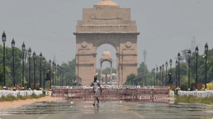
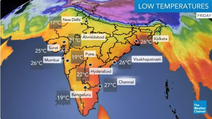
India daily weather forecast latest, April 3: Areas with above maximum temperatures of 40°C to widen northward
 World
World
India daily weather forecast latest, April 2: Heatwave to grip many parts of India as maximum temperatures above normal
Recommended
 World
World
Pakistan NCRC report explores emerging child rights issues
 World
World
"India has right to defend herself against terror," says German Foreign Minister, endorses Op Sindoor
 World
World
‘We stand with India’: Japan, UAE back New Delhi over its global outreach against terror
 World
World
'Action Was Entirely Justifiable': Former US NSA John Bolton Backs India's Right After Pahalgam Attack
Popular article
 World
World
US, China Conclude Trade Talks with Positive Outcome
 World
World
Nifty, Sensex jumped more than 2% in opening as India-Pakistan tensions ease
 World
World
Easing of US-China Tariffs: Markets React Positively, Experts Remain Cautious
 World
World


