Saigon through 300 years in photos
 |
| (Photo: VNE) |
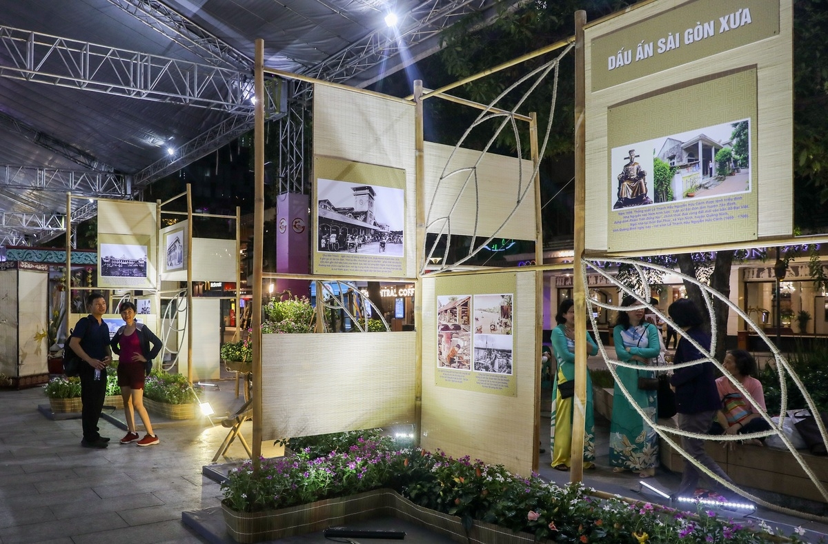
The “Saigon – Ho Chi Minh city over 320 years of culture and history” photo exhibition is being held in Nguyen Hue walking street, Ho Chi Minh city, celebrating the 44th anniversary of Saigon - Gia Dinh were renamed Ho Chi Minh City (July 2, 1976 - July 2, 2020).
The 100 photos on display show the city’s cultural, social, economic and urban development from its inception to the renewal and present period. The photos are categorized into topics such as The ancient Saigon Seal, Saigon Hao - Cho Lon - Gia Dinh, Ho Chi Minh City.
 |
| (Photo: VNE) |
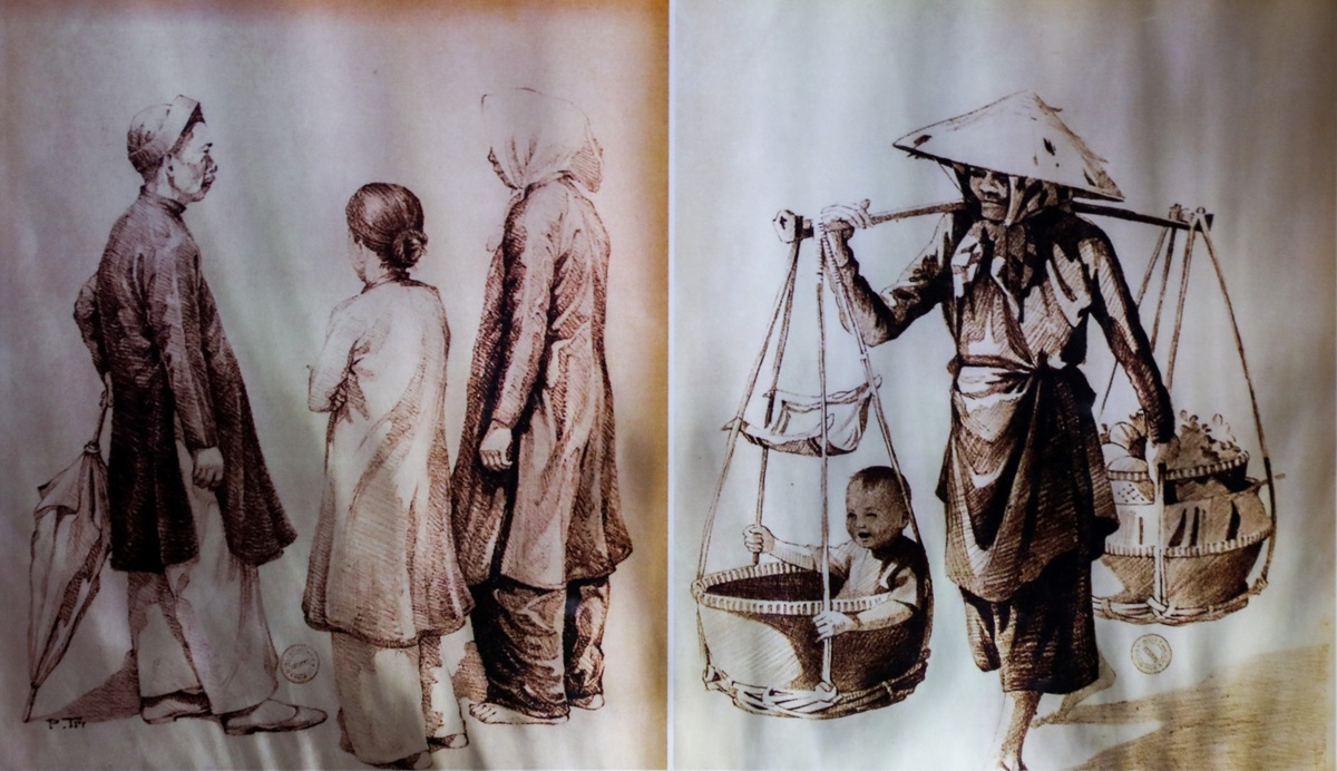
Under the theme of the ancient Saigon Imprint are paintings depicting people, craft villages, and daily life, etc., of the land of Saigon - Gia Dinh in the early period, when the first groups of Vietnamese people came to reclaim the land more than 300 years ago.
In the picture is the painting of the casual costumes of Vietnamese immigrants in the 17th- 18th century, who followed the Nguyen Lord army to reclaim and set up a hamlet in the southern land.
 |
| (Photo: VNE) |
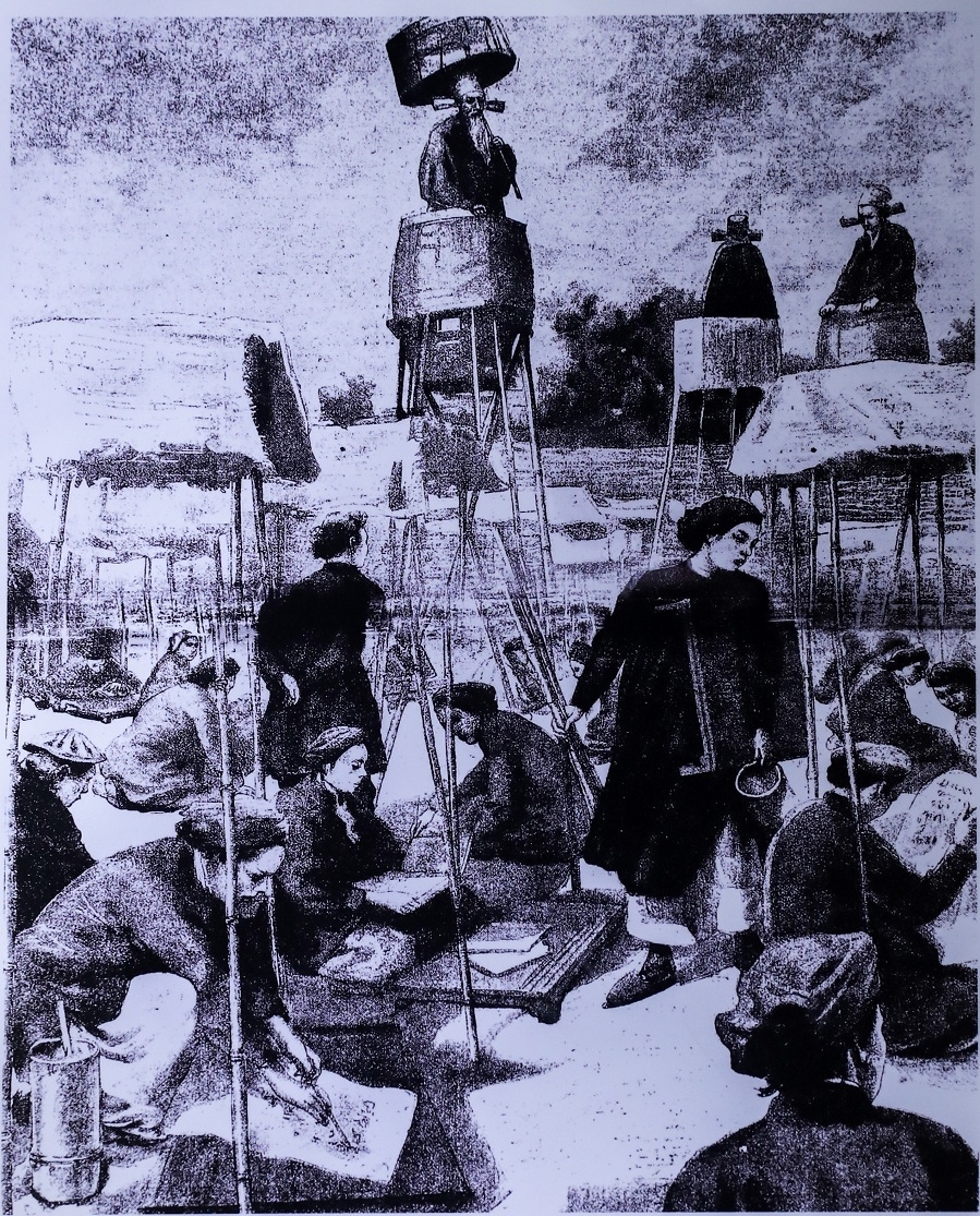
Candidates sitting for exam in the Gia Dinh exam school in the 19th century. This place is now the are of the Youth Cultural House on Pham Ngoc Thach Street (District 1).
 |
| (Photo: VNE) |
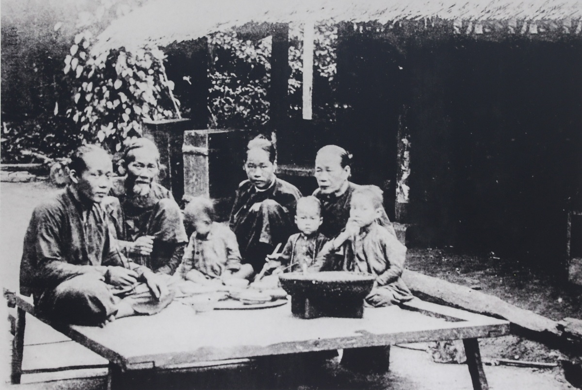
A family meal of Saigon people in the 19th century.
 |
| (Photo: VNE) |
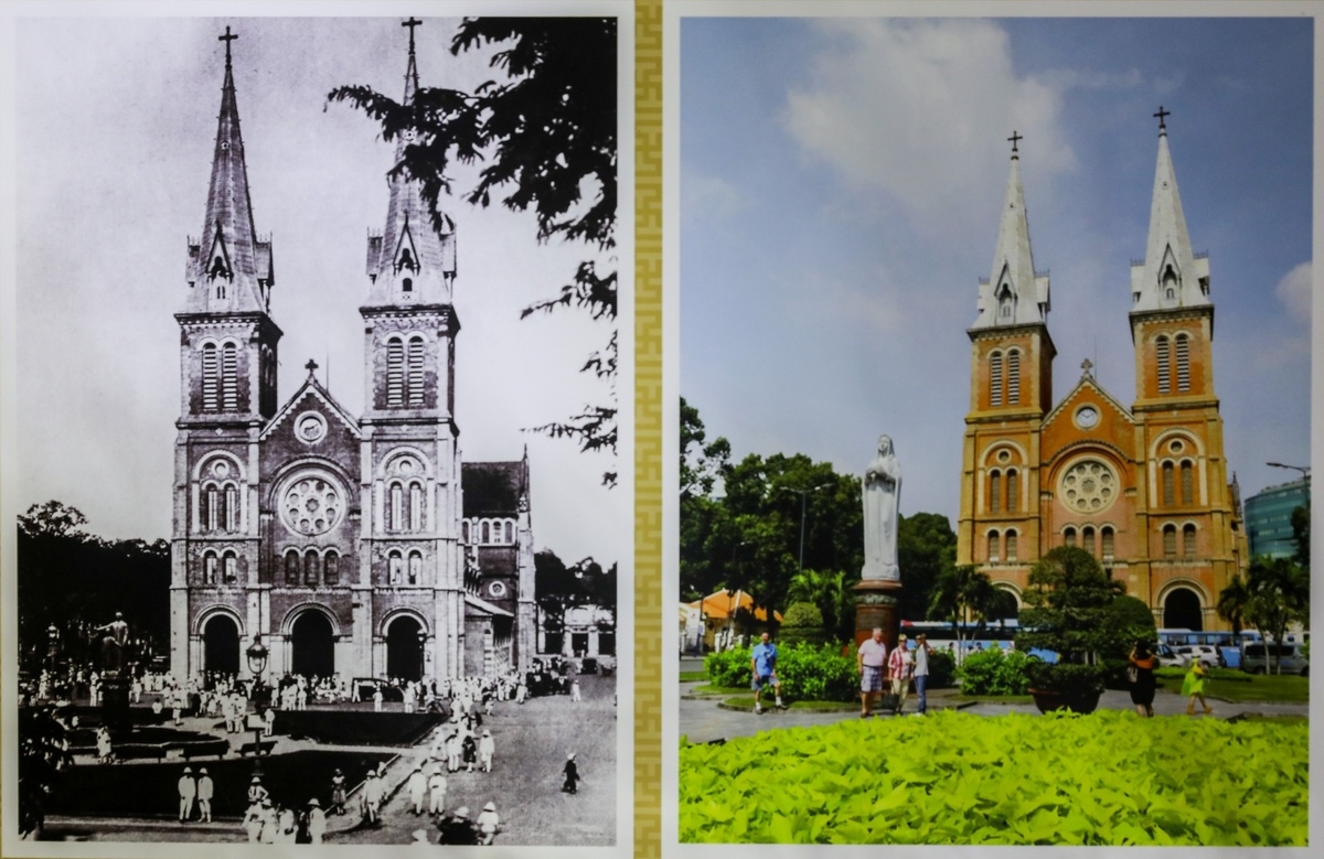
The Notre Dame Cathedral, the outstanding architectural work of Saigon was built by the French in 1877, which attracts many visitors every day. After over two decades of existence, the church remains intact and still retains its own unique beauty.
 |
| (Photo: VNE) |
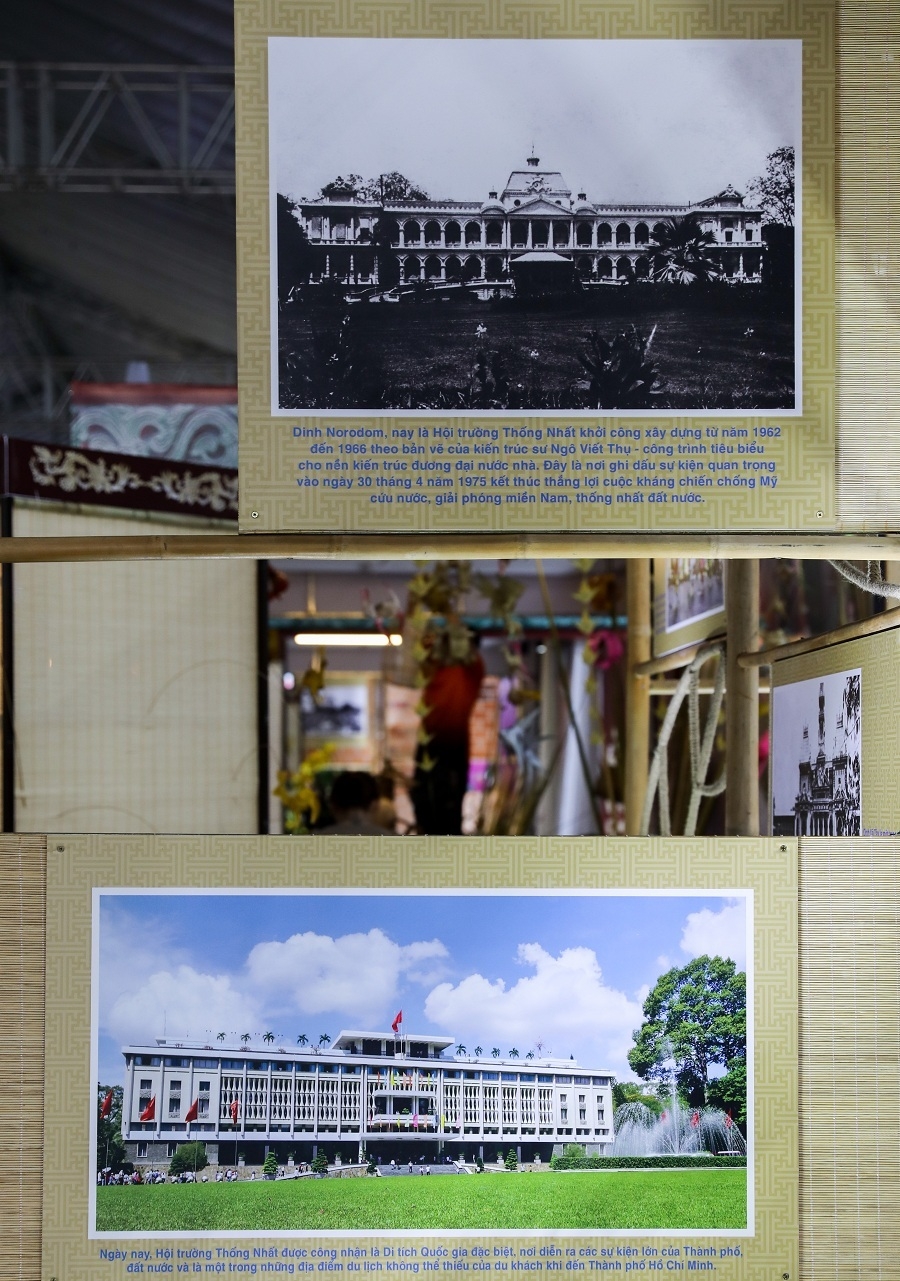
The Norodom Palace built in 1868 no longer existed today after the 1962’s bombing incident. As it could not be restored, the old Norodom Palace was re-designed by architect Ngo Viet Thu and re-erected at the same location and named Independence Palace.
This building is now known as the Unification Hall, which witnessed many historical events of Saigon.
 |
| (Photo: VNE) |
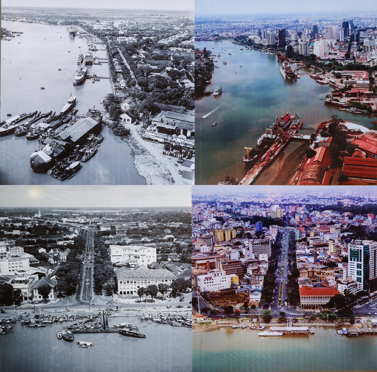
Aerial view of the center of Saigon – Ho Chi Minh city since the French colonial era and today clearly show the development of the city after a century. This area is now the District 1.
 |
| (Photo: VNE) |
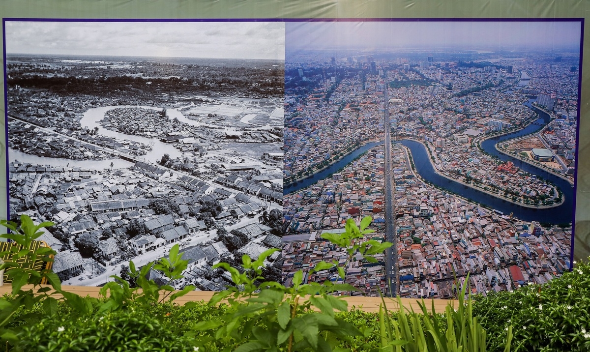
The Nhieu Loc - Thi Nghe Canal flowing through the Kieu Bridge are taken in 1955 and today. The canal is about 10 km long, heavily polluted in the 1980s, with slums lining the two shore. The canal is at present has been renovated, with embankments and parks along the banks and no longer polluted as it used to be.
 |
| (Photo: VNE) |
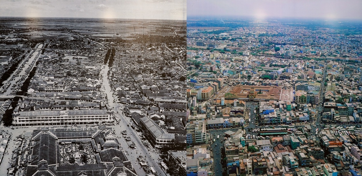
Bird-eye view of Cho Lon market, the left one was taken in 1950 while the right one is taken in 2020. The market was built by the Chinese community, it was once a city next to Saigon. Since its inception, Cho Lon market has been growing busier and busier to this day.
 |
| (Photo: VNE) |
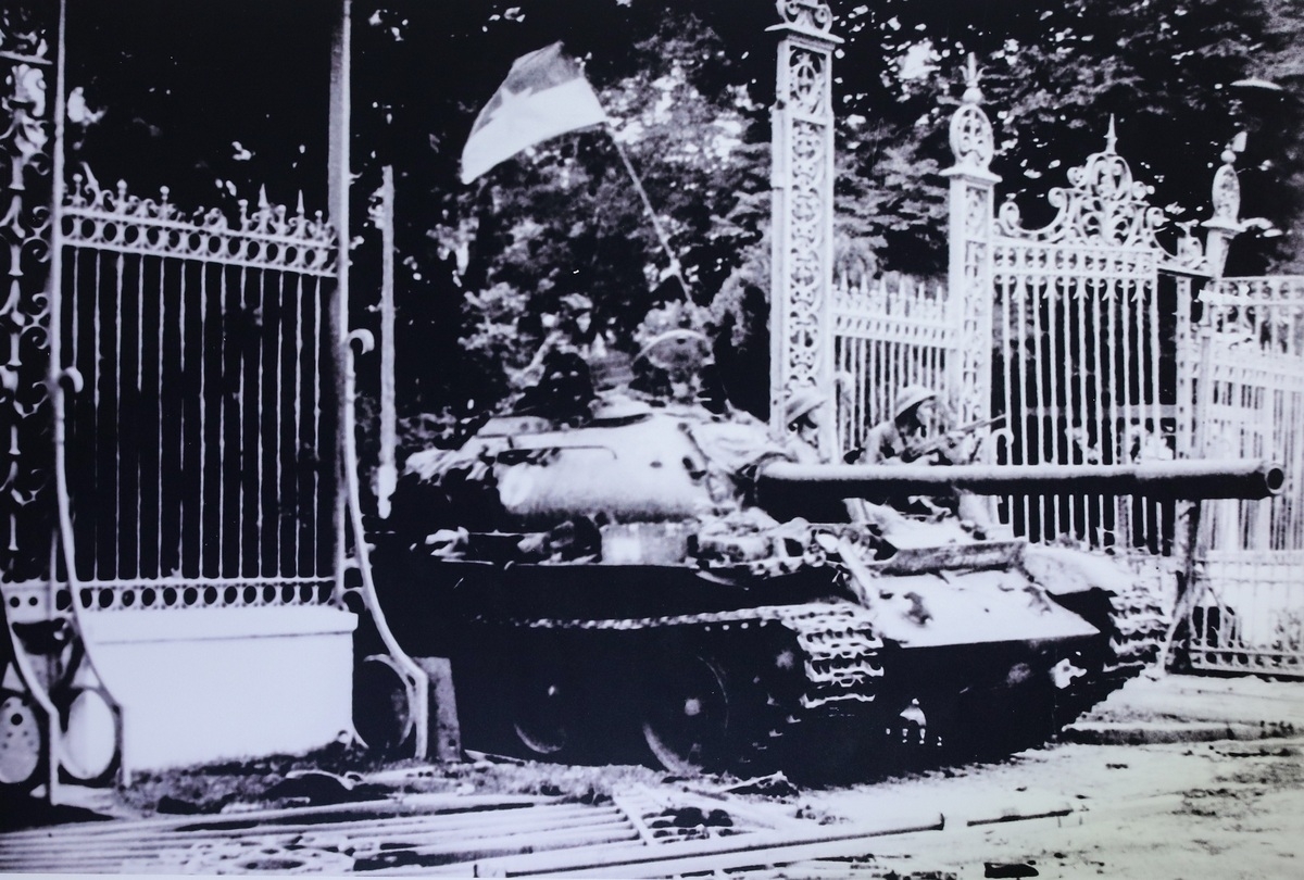
A tank heading to the gate of the Independence Palace on April 30, 1975, marking the end of the war and reuniting the country. Independence Palace on April 30, 1975, marking the end of the war and reuniting the country.
 |
| (Photo: VNE) |
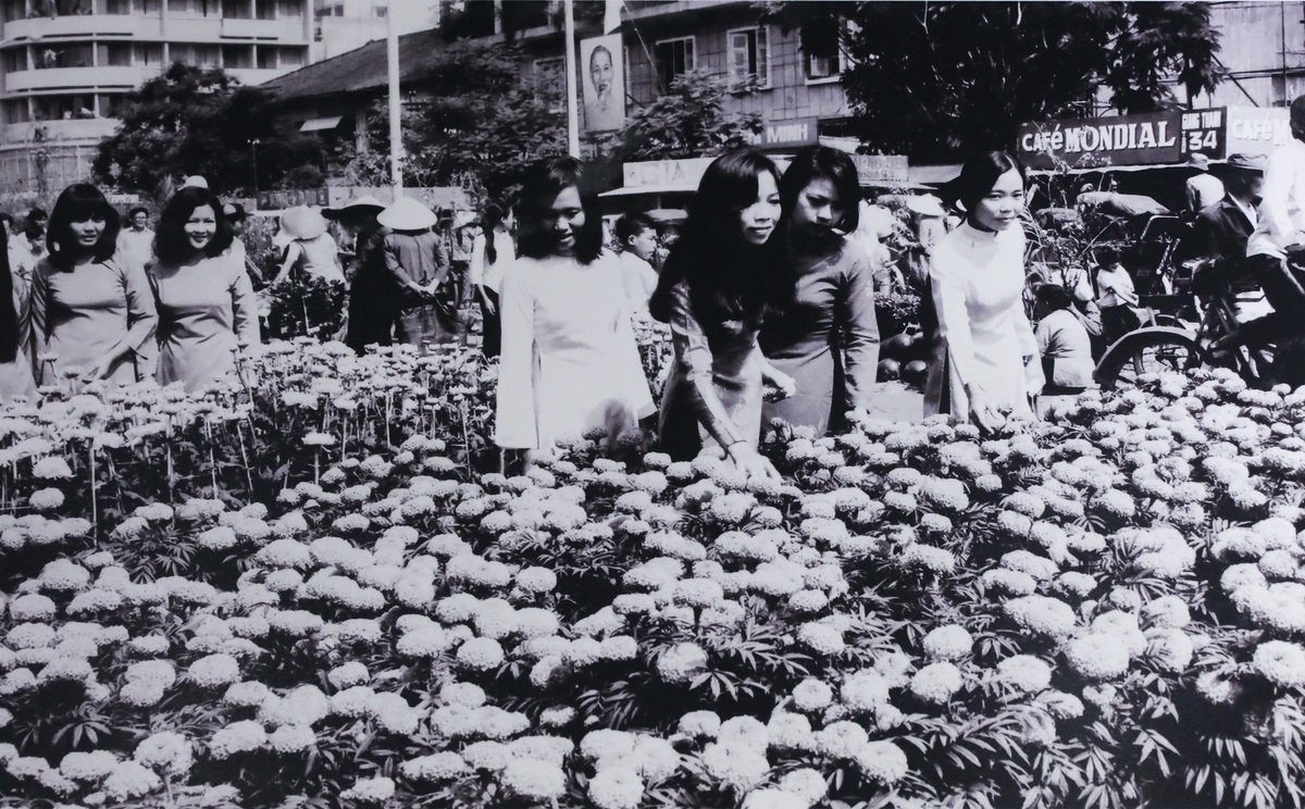
Saigonese visit Nguyen Hue Flower Street which was first organized in 1981 after the country's reunification. Over the years, the flower festival becomes an annual event every Lunar New Year, giving the city one more unique cultural feature.
 |
| (Photo: VNE) |
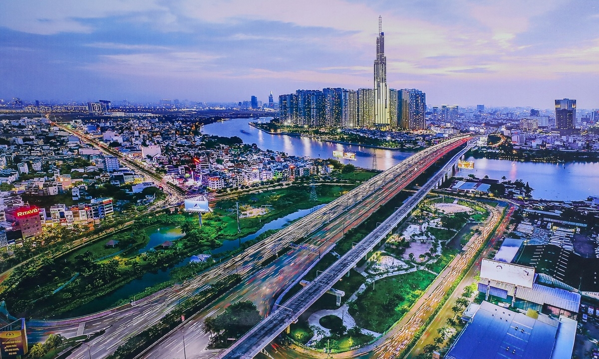
Over the past 45 years, Ho Chi Minh City has gradually developed, playing a pivotal role as the largest city in Vietnam. In the picture is the District 2 and Binh Thanh district, which are separated by the Saigon river.
 | Rare old photos of first water park in Vietnam Saigon Water Park used to be a popular name for generations of people in Ho Chi Minh City and neighboring provinces between 1997-2006. |
 | Rare photos of My Tho in the 1960s under US veteran's lens These photos of My Tho city's outskirts taken by US veteran Lance V. Nix below are first officially published. The series was captured between 1968-1969, depicting ... |
 | Rare photos of Hue’s daily life in early 1990s Under the lens of German photographer Hans-Peter Grumpe, the daily life in the ancient capital of Hue, central Vietnam some 30 years ago, has become ... |
Recommended
 Handbook
Vietnam Moves Up 8 Places In World Happiness Index
 Handbook
Travelling Vietnam Through French Artist's Children Book
 Multimedia
Vietnamese Turmeric Fish among Best Asian Dishes: TasteAtlas
 Handbook
From Lost to Found: German Tourist Thanks Vietnamese Police for Returning His Bag
Popular article
 Handbook
Prediction and Resolution for the Disasters of Humanity
 Handbook
16 French Films To Be Shown For Free During Tet Holiday In Vietnam
 Handbook
Unique Cultural and Religious Activities to Welcome Year of the Snake
 Handbook

