UK and Europe weather forecast latest, January 1: Heavy snow to hit Britain amid biggest winter threat in decade
UK's weather forecast
Accordidng to Express, a ‘severe weather action’ health alert warns the elderly and vulnerable to take care through the coming days with a month-long mega-freeze looming. Sheet ice will turn roads and pavements into deadly skating-rinks while up to four inches of snow will blanket some regions, according to the Met Office. Freezing conditions sweeping in from Russia and Eastern Europe will disrupt rail and air services with power cuts and road delays also possible.
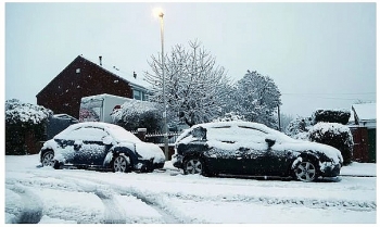
Heavy snow, which has already smothered parts of the UK, will spread widely through the next 24 hours putting swathes of the country including London and the southeast on the hit list.
Jim Dale, meteorologist for British Weather Services, said: “This is the greatest threat posed by the weather at this time of year since the big freeze of 2010/11."
“We are expecting a north-easterly and easterly feed with air coming in from Russia and the surrounding regions. This will bring some very low temperatures and snow, and overall, this is looking like the most notable snow event for a decade."
“So far snow has affected only some regions, but this will change over the next few days with more widespread, and at times heavy, wintry showers expected."
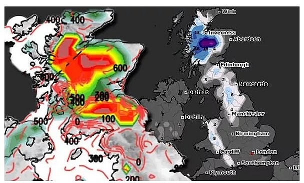 |
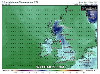
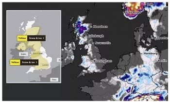
| Snow radar: Where will it snow across the UK in the next 24 hours? (Image: WX CHARTS/NETWEATHER) |
Public Health England (PHE) has issued a level-3 ‘cold weather action’ health alert across northern Britain into the New Year. It warns widespread ice, heavy snow and persistently low temperatures pose a threat to the elderly and vulnerable.
Dr Ishani Kar-Purkayastha, PHE’s public health consultant, said: “Cold weather can be bad for your health.
“Heat your home to at least 18 Celsius if you can, particularly if you have reduced mobility, are 65 and over, or have a health condition such as heart or lung disease.”
Meteorologists are keeping a keen eye on the Baltic region amid growing fears of repeat of the killer 2018 Beast from the East.
High pressure over Greenland will keep milder Atlantic conditions at bay while funnelling Polar air in from Russia and the Baltic region.
Mr Dale said: “The beast is getting closer and at the moment it is stretching its claws across from the east towards Britain."
“While the Atlantic weather is currently being held back by high pressure over Greenland, if this weakens it will allow more moist air into the UK where it will clash with cold air."
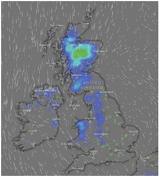 |
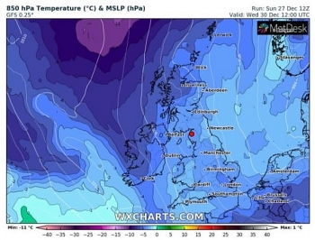
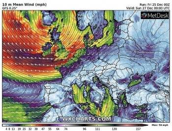
| Snow radar: The Met Office has issued several severe weather warnings for today and tomorrow (Image: WINDY.COM) |
“This is something we will be keeping our eyes on as this could bring the very real risk of a major snow event later in January. This is looking like turning into a lengthy cold spell lasting at least into the middle of January.”
Some forecasters say it could be February before the cold eases its grip with snowstorms and sub-zero temperatures likely through next month.
Exacta Weather’s James Madden said brutal Atlantic storms threaten to whip up major snow events across Britain with persistent extreme cold likely through January.
He said: “January looks set to continue with the cold theme and although snow will be a feature for many, another risk would be ice storms which will develop as stormy weather pushes in off the Atlantic."
“When these clash with cold air across the UK there will be a risk of heavy snow, this will make for hazardous conditions on the roads. January is now looking like it will turn out colder than average.”
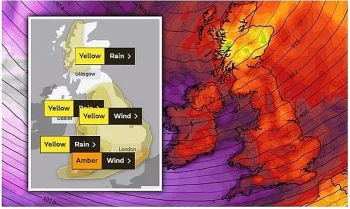
Government weather warnings have been issued widely through the coming days as northerly winds scour Britain. Snow and ice alerts cover much of the Scotland and England through the next three days. Government meteorologists have warned Britons to take care on the roads with icy conditions forecast overnight.
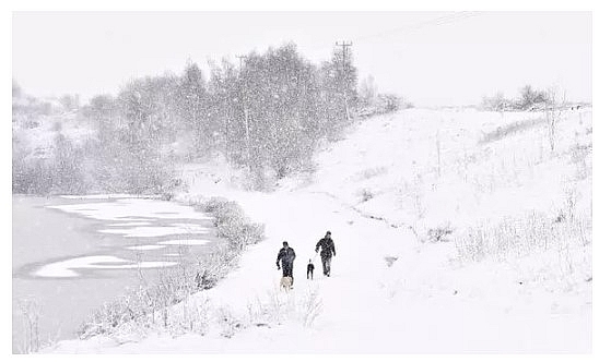 |
| Two people walk their dogs around Silverdale Country Park (Image: Nathan Stirk/Getty Images) |
A Met Office spokesman said: “Services may be delayed or cancelled, with some road closures and longer journey times."
“There is a small chance of travel delays on roads with some stranded vehicles and passengers, along with delayed or cancelled rail and air travel. There is a slight chance that power cuts may occur, with the potential to affect other services, such as mobile phone coverage.”
A spokesman for The Weather Company (IBM) added: “On occasion snow will come down to lower levels bringing several centimetres to even lower levels.
“It looks like colder than average temperatures will continue into early January.”
The AA warned drivers to take extra care on the roads and carry supplies in case of breakdowns.
Spokesman Ben Sheridan said: “Thawing snow, rainfall and freezing temperatures overnight lead to challenging driving conditions, with roads likely to be icy in the morning."
“If you do need to travel, adjust your speed to the conditions and leave plenty of space behind other vehicles to account for greater stopping distances."
“It’s also worth carrying some winter essentials such as warm, waterproof layers, a shovel, a torch, fully charged mobile phone and a flask of hot drink.”
 |
| Photo: Weather Online |
On January 1
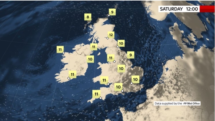
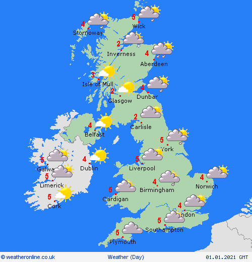
According to Weather Online, staying cold in to the New Year. Areas of wintry showers in places, but particularly across northern Scotland and eastern regions of the UK. A mix of rain, sleet and snow could still be affecting central areas of England heading into southern England and parts of the southwest before pushing into the Channel later in the day. A good amount of dry weather about too with frost. The best of the sun over Ireland and the west of the UK. Local fog patches. Highs at 1 to 5C.
Europe's weather forecast
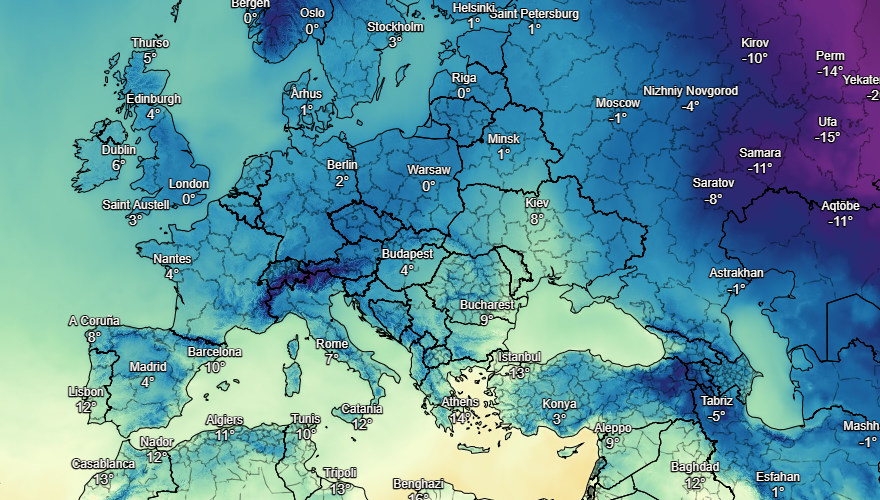
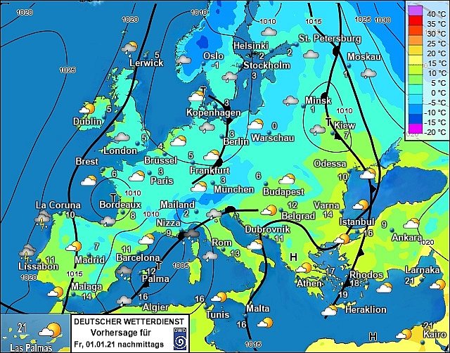
Showery outbreaks of rain spread over Portugal and the northwestern half of Spain on Thursday. These turn wintry over higher ground. Staying dry and fine to the southeast and for the Balearic Islands. Showers, these locally heavy, affect Corsica, Sardinia, Sicily and far southern and northern parts of mainland Italy. Staying dry and bright for central areas. Heavy showers spread across Greece and into western Turkey though much of Turkey stays dry and sunny.
A front brings showery outbreaks of rain, sleet and snow across much of France, the Low Countries and into western Germany. These will be locally very heavy.Some snow showers spread into the far west of Switzerland too but otherwise it's a dry and fine day across the Alps as well as for the Czech Republic, eastern Germany and Poland. Cloudy for Slovakia and Hungary with rain and sleet for far eastern areas.
 |
| Photo: Stirimeteo |
 |
| Photo: Stirimeteo |
Frequent outbreaks of rain, sleet and snow for Denmark, southern Sweden and Finland as low pressure starts to fill up here. Isolated snow showers affect southern Norway as well as central and northern parts of Sweden. An area of wintry precipitation clears north of the Baltic States through Thursday morning leaving a dry afternoon with a few spells of sunshine.
On January 1
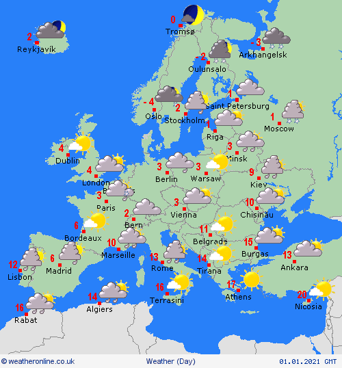
It will be a largely cloudy day across Spain and Portugal with rain, sleet and snow affecting many areas at times, heaviest to the north. An area of low pressure develops over the Mediterranean bringing showers or longer spells of rain to the Balearics, where it could fall wintry over higher ground, as well as northern and western areas of Italy, Corsica and Sardinia. Southern Italy and Sicily will be cloudy but mainly dry. An improving day across Greece with some patchy rain affecting over west Turkey.
 |
| Photo: Weather Online |
Outbreaks of rain will be confined to mainly southern parts of France but with some wintry showers affecting northern areas too. West Switzerland will see some rain and snow with southern part of Austria also seeing some patchy rain and snow showers but drier elsewhere here. Rain affecting western parts of Croatia, Slovenia and Hungary. Drier further east down the Balkans. Largely dry across eastern Europe.
Mostly dry across Norway but with some snow in the far southeast. Sweden will see snow fall in the situh but remain largely dry further north. An area of wintry precipitation pushes acxross the Baltics as the day progresses. Snow fall will soon clear from the south of Finland allowing for an improving day here. Rain, sleet and snow expected across parts of Denmark.
 | UK and Europe weather forecast latest, December 28: Storm Bella heading to Britain as shown by horrifying weather maps Storm Bella is forecasted to sweep across the UK bringing more strong gales and heavy rain as a handful of weather alerts issued. |
 | UK and Europe weather forecast latest, December 27: Widespread disruption, heavy rain bear down the UK as Storm Bella sets to hit The UK is forecasted to cope with a dangerous storm named Bella this weekend and an amber weather warning has been issued to prepare for ... |
 | UK and Europe weather forecast latest, December 26: Amber warning for wind and rain this weekend in light of Storm Bella On this weekend, the UK is forecasted to cope with wind and rain after rare amber warning issued. Meanwhile, wintry showers set to cover in ... |
Recommended
 World
World
Pakistan NCRC report explores emerging child rights issues
 World
World
"India has right to defend herself against terror," says German Foreign Minister, endorses Op Sindoor
 World
World
‘We stand with India’: Japan, UAE back New Delhi over its global outreach against terror
 World
World
'Action Was Entirely Justifiable': Former US NSA John Bolton Backs India's Right After Pahalgam Attack
 World
World
US, China Conclude Trade Talks with Positive Outcome
 World
World
Nifty, Sensex jumped more than 2% in opening as India-Pakistan tensions ease
 World
World
Easing of US-China Tariffs: Markets React Positively, Experts Remain Cautious
 World
World

