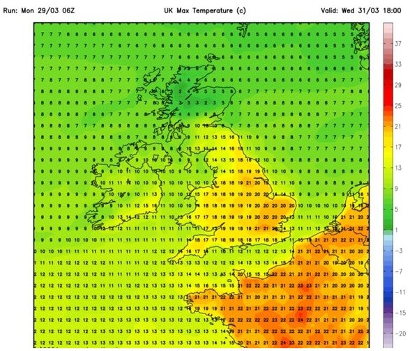
UK and Europe weather forecast latest, August 17: Thunderstorm and floods strike up to 90 mm rain in the UK
UK's weather forecast
The UK has experienced a scorching heatwave over the last week, but it can expect temperatures to plummet as thunderstorms and rain batter the UK, Met Office reported.
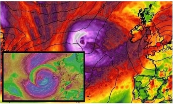
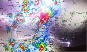
Thunderstorms, lightning and heavy rain will continue to hit parts of Britain this weekend. Forecasters warn up to 90mm of rain could fall today, after heavy rain and thunderstorms caused disruption on Saturday. Yesterday saw roads and railway lines flooded in the south of England. The Met Office issued a yellow warning for thunderstorms across much of England and Wales, stretching across the weekend and into most of Monday.
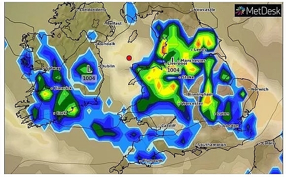 |
| UK weather forecast: Thunderstorms, lightning and heavy rain will continue to hit parts of Britain (Image: WXCHARTS) |
Meteorologist Matthew Box said Saturday's stormy weather broke out in Kent before moving across Essex, where some places saw 40mm of rain in around 40 minutes.
"It may not mean anything to a non-meteorologist maybe, but that is a healthy dose of rain in under an hour," he told the PA news agency."
Mr Box said Sunday was likely to bring large hail and gusty winds as well as rainfall of up to 90mm in places hit by multiple thunderstorms.
"We're going to see essentially some pulses of potentially thundery showers pushing their way up from the channel through the course of the morning affecting southern counties," he said.
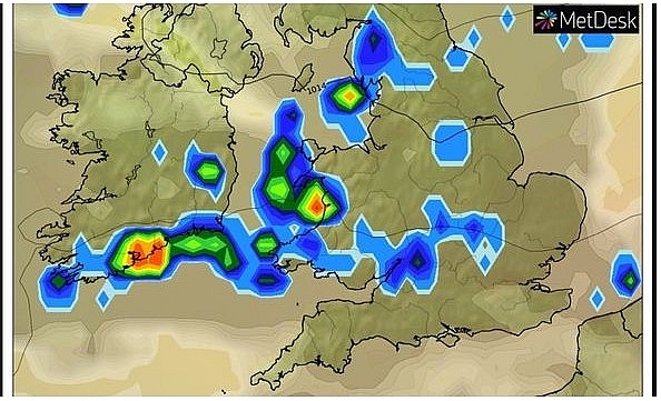 |
| UK weather forecast: Forecasters warn up to 90mm of rain could fall today (Image: WXCHARTS) |
Flooding expected to cause travel chaos - as forecasters warned of an end to the heatwave. The extreme weather may damage buildings and cause power cuts and cancellations to train and bus services.
Flooding is expected to cause roads to close causing issues with travel. Five flood alert warnings have been issued across the West Midlands by the Environment Agency.
Mr Box said: "Saturday will begin mostly cloudy for most areas across the UK but as the day goes on showers will start to break out in the South and South East of England."
"As the day progresses further there's a chance of some rumbles of thunder and potentially some hail and lightning."
"The risk of thunder will start to push further north on Sunday, with central parts of England and Wales facing heavy rain and the chance of flooding."
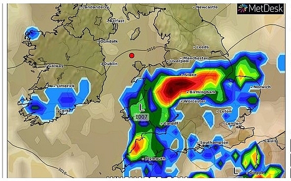 |
| UK weather forecast: The Met Office issued a yellow warning for thunderstorms across much of England and Wales, stretching across the weekend and into most of Monday (Image: WXCHARTS) |
However, areas in Scotland and north-western England and Northern Ireland are forecast to be dry with a few sunny spells after a week of heavy rain.
Mr Box said this was due to winds causing an "East-West" split in northern areas.
Chief Meteorologist Frank Saunders added: "Up until Monday, thunderstorm warnings cover much of England and Wales, with parts of southern England and South Wales seeing the greatest likelihood of impacts."
Due to the continuing hot weather, large parts of the UK will be at risk of thunderstorms, Mr Saunders explained.
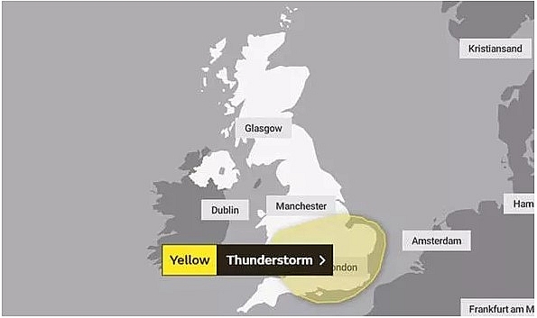 |
| UK weather forecast: The Met Office issued a yellow warning for thunderstorms across much of England and Wales, stretching across the weekend and into most of Monday (Image: WXCHARTS) |
Neil Davies, Flood Duty Manager at the Environment Agency, said: "Isolated thunderstorms could bring sudden surface-water and river flooding, which may lead to flooded properties and severe travel disruption in some areas. Further surface water and river flooding is also a possibility until Sunday."
On August 17
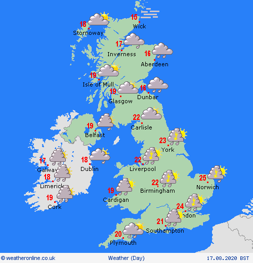
According Weather Online, thundery periods of rain on Monday, many affecting England, Wales and Ireland as well as southern parts of Scotland. The afternoon sees the risk of some potentially torrential showers forming in England, Wales and Ireland. Lower cloud continues to affect eastern Scotland with some mist and fog here. Drier in northern Scotland. Highs at 16 to 24C.
 |
| Photo: Weather Online. |
Europe's weather forecast
Britain has enjoyed some of the hottest temperatures of the year this week, with the mercury regularly surging beyond 30C in large parts of the country. But the latest weather maps from WXCHARTS show a band of cooler air sweeping in across western and central Europe from Monday, with the UK in danger of receiving the back end of this colder blast.
Warmer air will briefly return to blanket much of the continent from Thursday, with the map turning almost entirely blue for almost a week thereafter.
But the weather charts show from Wednesday August 25, scorching air suddenly starts blanketing much of Southern Europe, Express reported.
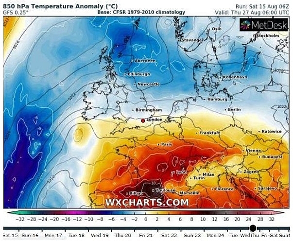 |
| UK hot weather forecast: Warm air makes its way towards Britain in time for the bank holiday weekend (Image: WXCHARTS) |
This will continue making its way through the continent through much of the following day, before blasting Britain in time for the Bank Holiday weekend on Saturday August 29.
The scorching plume of air from Europe will continue to blanket the UK throughout the weekend, before making its way from the continent towards the end of the month.
The long-range weather forecast from the BBC for August 24 until September 6 warns areas of low pressure could track near the north of the UK and as the month progresses, rain and windy spells are likely throughout most of the country.
Northern Ireland and Scotland are likely to be hit by most of this wet weather, while England and Wales "may only see fleeting spells of wet weather as fronts come and go", with Southeast England likely to escape many of the downpours.
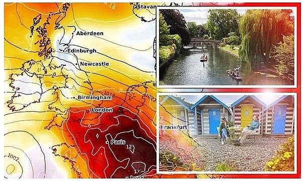 |
| UK hot weather forecast: A wave of warm air will rise through Europe towards Britain (Image: WXCHARTS / GETTY / PA) |
But the forecast continues: "High pressure may ridge in from Europe to give lengthier periods of dry and warm weather over the southeast, whilst fronts may push into the northwest to give frequent wet spells and fluctuating temperatures."
But there is "considerable uncertainty to the forecast around the turn of the month", as one weather type "may dominate over the other for an extended period".
Low pressure may drift further south than expected, which could bring above-average rainfall to that part of the country instead.
However, the BBC forecast also says: "By the same token, high pressure may be more persistent and extensive over the UK, which would bring drier, warmer weather more widely across the country."
"Another complicating matter is that in late August and early September, the Atlantic hurricane season tends to enter its peak of activity, and this can lead to large swings in the weather for the UK."
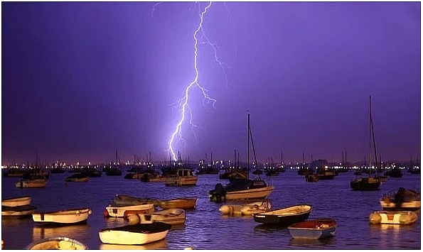 |
| Photo: Getty. |
The long-range forecast from the Met Office from August 18-29 warns this period will likely experience unsettled weather. There could be "longer spells of rain at times" that could become heavy in places."
There is also a chance of thundery weather, but this is most likely to smash into the east and southeast of the UK. Temperatures could start "rather warm for many" at the start of this period, but may cool slightly as winds sweep in across the country.
But the Met Office also offers a more encouraging forecast for the two-week period from Bank Holiday weekend (Saturday August 29).
The Met Office says in this long-range forecast: "Although confidence is low for this period, it is likely that conditions will become more changeable with drier and brighter days interspersed with periods of rain and strengthening winds."
"Temperatures should be around the average for this time of year. Towards the end of this period, there are some tentative signs that high pressure could begin to dominate, especially across the south of the UK, with a return to more settled conditions."
On August 17
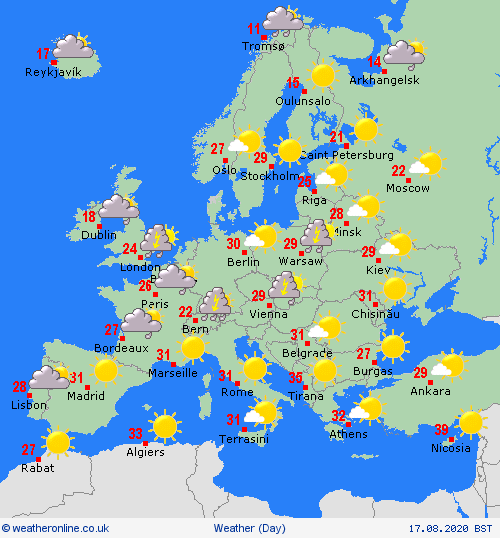
Outbreaks of rain and showers, some heavy, spread into northwest Spain and northern Portugal on Tuesday. Staying dry and sunny to the south and east. Further dry and sunny conditions for the Balearic Islands and Italy though a few thunderstorms could develop over the Alps later. Hot, dry and sunny in Greece and Turkey, Weather Online reported.
 |
| Photo: Weather Online. |
Sunny spells and scattered showers again in France, these mainly focussed to the west. Fair for the Low Countries with isolated showers here. Heavy thunderstorms develop over Germany, Switzerland, Austria, southern Poland, Slovakia and Hungary. Scattered showers for the Czech Republic and dry with some sunny spells for northern Poland.
Another fine day for Denmark though thunderstorms may develop to the southwest later. Dry and fine for the Baltic States. Cloud increases over southern parts of Norway and Sweden with isolated thunderstorms developing over Norway. Dry and sunny for central regions and for much of Finland. Far northern portions of Norway, Sweden and Finland are breezy with scattered outbreaks of rain.
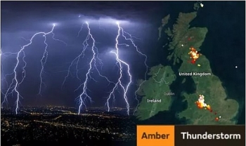 | UK and Europe weather forecast latest, August 13: Upgraded warnings for thunderstorm as 'danger to life' to battle UK Met Office has upgraded warnings for thunderstorm to strike the UK. Meanwhile, Europe is forecasted to go through increasingly unsettled conditions till the end of ... |
 | UK and Europe weather forecast latest, August 12: Thunderstorms to rock many areas cross the UK Thunderstorms are forecasted to rock many areas in the UK and the same weather conditions also sweep Europe before temperatures running into the mid-highs 30s ... |
 | UK and Europe weather forecast latest, August 11: Lightning storms to battle Britain for days Lightning storms is forecasted to smash Britain for days as Europe is to cope with thunderstorms issued with red warnings. |
In topics
 World
World
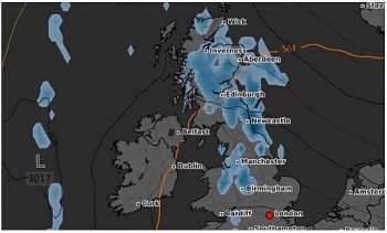
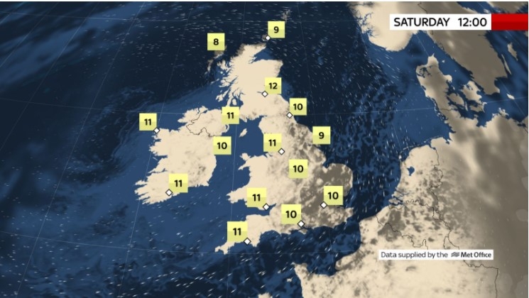
UK and Europe daily weather forecast latest, April 3: Largely settled and dry conditions with plenty of sunshine in the UK
 World
World
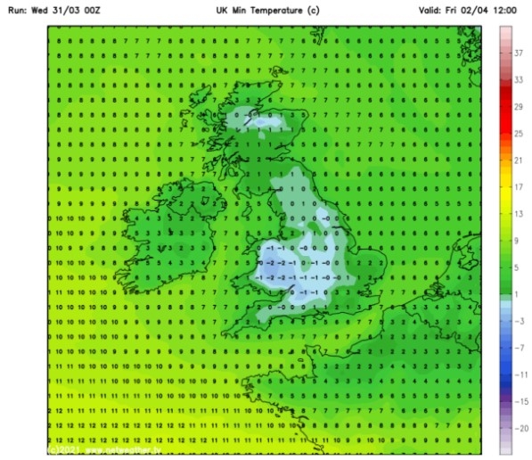
UK and Europe daily weather forecast (April 2): Breezy in the east and feeling cool along the coasts of the UK
Recommended
 World
World
Easing of US-China Tariffs: Markets React Positively, Experts Remain Cautious
 World
World
India strikes back at terrorists with Operation Sindoor
 World
World
India sending Holy Relics of Lord Buddha to Vietnam a special gesture, has generated tremendous spiritual faith: Kiren Rijiju
 World
World
Why the India-US Sonobuoy Co-Production Agreement Matters
Popular article
 World
World
Vietnam’s 50-year Reunification Celebration Garners Argentine Press’s Attention
 World
World
"Will continue offering our full support to Indian govt": US FBI Director after Pahalgam attack
 World
World
"Great Leader": JD Vance Lauds PM Modi During His India Visit
 World
World

